Property Record
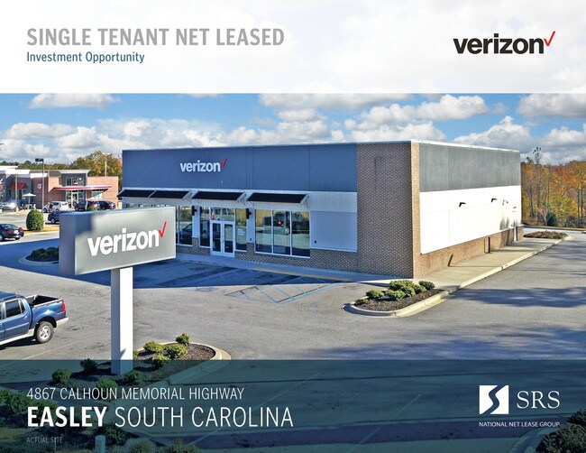
4867 Calhoun Memorial Hwy, Easley, SC 29640


NEARBY LISTINGS FOR SALE OR LEASE
Property Detail
4867 Calhoun Memorial Hwy
Greenville-Anderson-Mauldin, SC
Sc Easley Cmh
5039-19-52-8009
S/SIDE CALHOUN MEM HWY (US HWY #123) LOT 4A PLAT 602/218
Storebuilding
Pickens
X
South Carolina
45007C0035E
4a
2025
1.46 AC
2024
Pickens County
010903
Greenville/Spartanburg
5,402 SF
DEMOGRAPHICS near 4867 Calhoun Memorial Hwy
1 Mile
3 Mile
5 Mile
2024 Total Population
3,604
25,676
61,037
2029 Population
3,713
26,800
64,319
Pop Growth 2024-2029
+ 3.02%
+ 4.38%
+ 5.38%
Average Age
42
42
41
2024 Total Households
1,616
10,571
24,174
HH Growth 2024-2029
+ 3.03%
+ 4.42%
+ 5.41%
Median Household Inc
$57,621
$60,119
$59,387
Avg Household Size
2.20
2.40
2.50
2024 Avg HH Vehicles
2.00
2.00
2.00
Median Home Value
$221,260
$200,157
$202,260
Median Year Built
1991
1991
1990
Nearby Places
Map Layers
Map Styles
 Street
 Aerial
- Restaurants
- Banks
- Shops
- Fitness
- Groceries
PUBLIC TRANSPORTATION
COMMUTER RAIL
DRIVE
WALK
Distance
17 min
9.0 mi
AIRPORT
Greenville Spartanburg International
DRIVE
WALK
Distance
Greenville Spartanburg International
36 min
24.9 mi
SALE & LEASE HISTORY
LISTING DATE
SALE/LEASE

Dec 20, 2019
For Sale
Nearby Properties
Address
Land Use
TOTAL SIZE
Lot Size
Zoning
Address
Land Use
TOTAL SIZE
Lot Size
Zoning
16.29 AC
GENERAL CO
Address
Land Use
TOTAL SIZE
Lot Size
Zoning
10,906 SF
2.59 AC
CORE COMME
Address
Land Use
TOTAL SIZE
Lot Size
Zoning
19,164 SF
3.22 AC
GC
Address
Land Use
TOTAL SIZE
Lot Size
Zoning
13.75 AC
GC
Address
Land Use
TOTAL SIZE
Lot Size
Zoning
24,362 SF
3.84 AC
GENERAL CO
Address
Land Use
TOTAL SIZE
Lot Size
Zoning
3,344 SF
3.04 AC
GR2
Address
Land Use
TOTAL SIZE
Lot Size
Zoning
3.60 AC
CORE COMME
Address
Land Use
TOTAL SIZE
Lot Size
Zoning
49,803 SF
18.36 AC
GC
Address
Land Use
TOTAL SIZE
Lot Size
Zoning
4,200 SF
0.98 AC
GC
Address
Land Use
TOTAL SIZE
Lot Size
Zoning
220,956 SF
16.80 AC
GENERAL CO
Address
Land Use
TOTAL SIZE
Lot Size
Zoning
36.37 AC
Address
Land Use
TOTAL SIZE
Lot Size
Zoning
5,321 SF
3.38 AC
Address
Land Use
TOTAL SIZE
Lot Size
Zoning
5,427 SF
1.34 AC
Address
Land Use
TOTAL SIZE
Lot Size
Zoning
8.96 AC
R 10 ONE F
Address
Land Use
TOTAL SIZE
Lot Size
Zoning
7.30 AC
R 10 ONE F
Address
Land Use
TOTAL SIZE
Lot Size
Zoning
187,150 SF
19.38 AC
GC
Address
Land Use
TOTAL SIZE
Lot Size
Zoning
42.26 AC
OFFICE INS
Address
Land Use
TOTAL SIZE
Lot Size
Zoning
7.09 AC
GC
Address
Land Use
TOTAL SIZE
Lot Size
Zoning
21,258 SF
15 AC
GR2
Address
Land Use
TOTAL SIZE
Lot Size
Zoning
135,439 SF
13.80 AC
GC
Address
Land Use
TOTAL SIZE
Lot Size
Zoning
41.39 AC
Address
Land Use
TOTAL SIZE
Lot Size
Zoning
54.93 AC
GC
Address
Land Use
TOTAL SIZE
Lot Size
Zoning
104,889 SF
10.68 AC
GC
Address
Land Use
TOTAL SIZE
Lot Size
Zoning
140,718 SF
18.32 AC
PUD
Address
Land Use
TOTAL SIZE
Lot Size
Zoning
3.98 AC
NEIGHBORHO
Address
Land Use
TOTAL SIZE
Lot Size
Zoning
3,299 SF
0.32 AC
GENERAL CO
Address
Land Use
TOTAL SIZE
Lot Size
Zoning
16,494 SF
4.66 AC
GR2
Address
Land Use
TOTAL SIZE
Lot Size
Zoning
3,668 SF
6.59 AC
Address
Land Use
TOTAL SIZE
Lot Size
Zoning
1.84 AC
LI
The World's #1 Commercial Real Estate Marketplace
Connect with us
© 2026 CoStar Group
The information above has been obtained from sources believed reliable. While we do not doubt its accuracy we have not verified it and make no guarantee, warranty or representation about it. It is your responsibility to independently confirm its accuracy and completeness. Any projections, opinions, assumptions, or estimates used are for example only and do not represent the current or future performance of the property. The value of this transaction to you depends on tax and other factors which should be evaluated by your tax, financial, and legal advisors. You and your advisors should conduct a careful, independent investigation of the property to determine to your satisfaction the suitability of the property for your needs.