Property Record
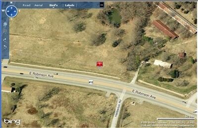
4867 E Robinson Ave, Springdale, AR 72764

Property Detail
4867 E Robinson Ave
Fayetteville-Springdale-Rogers, AR
PT SE NW 14.82 AC FURTHER DESCRIBED FROM 2017-12445 AS: PART OF THE SOUTHEAST QUARTER OF THE NORTHWEST QUARTER OF SECTION 9,
001-14781-001
WASHINGTON
Agriculturalland
Arkansas
B and X Area of moderate flood hazard, usually the area between the limits of the 100-year and 500-year floods.
14.82 AC
2025
Outlying Washington Cnty
2025
Fayetteville/Springdale/Rogers
010307
NEARBY LISTINGS FOR SALE OR LEASE
DEMOGRAPHICS near 4867 E Robinson Ave
1 mile
3 mile
5 mile
2025 Total Population
1,950
32,681
84,340
2030 Population
2,131
35,151
90,351
Pop Growth 2025-2030
+ 9.28%
+ 7.56%
+ 7.13%
Average Age
38
34
35
2025 Total Households
683
10,102
27,890
HH Growth 2025-2030
+ 9.52%
+ 7.81%
+ 7.29%
Median Household Inc
$87,159
$71,173
$67,512
Avg Household Size
2.90
3.10
2.90
2025 Avg HH Vehicles
2.00
2.00
2.00
Median Home Value
$329,856
$276,192
$283,555
Median Year Built
2001
1998
1993
Nearby Places
Map Layers
Map Styles
 Street
 Aerial
Layers
 Traffic
 Biking
Places
Listings with unknown addresses are not visible on the map
- Restaurants
- Banks
- Shops
- Fitness
- Groceries
PUBLIC TRANSPORTATION
AIRPORT
Northwest Arkansas Ntl
Drive
Walk
Distance
Northwest Arkansas Ntl
41 min
19.0 mi
Freight Ports
Tulsa Port of Inola
Drive
Walk
Distance
Tulsa Port of Inola
109 min
90.4 mi
SALE & LEASE HISTORY
LISTING DATE
SALE/LEASE

Sep 24, 2016
For Sale
Jun 23, 2017
For Sale
Nearby Properties
Address
Land Use
TOTAL SIZE
Lot Size
Zoning
Address
Land Use
TOTAL SIZE
Lot Size
Zoning
481,800 SF
40 AC
Address
Land Use
TOTAL SIZE
Lot Size
Zoning
4,941 SF
10.87 AC
Address
Land Use
TOTAL SIZE
Lot Size
Zoning
156,072 SF
12.43 AC
Address
Land Use
TOTAL SIZE
Lot Size
Zoning
178,140 SF
4.39 AC
Address
Land Use
TOTAL SIZE
Lot Size
Zoning
117,196 SF
9.74 AC
Address
Land Use
TOTAL SIZE
Lot Size
Zoning
116,736 SF
10.95 AC
Address
Land Use
TOTAL SIZE
Lot Size
Zoning
74,434 SF
32.25 AC
Address
Land Use
TOTAL SIZE
Lot Size
Zoning
352,195 SF
15 AC
Address
Land Use
TOTAL SIZE
Lot Size
Zoning
107,950 SF
6.68 AC
C2
Address
Land Use
TOTAL SIZE
Lot Size
Zoning
153,968 SF
21 AC
Address
Land Use
TOTAL SIZE
Lot Size
Zoning
364,696 SF
4.49 AC
Address
Land Use
TOTAL SIZE
Lot Size
Zoning
38,594 SF
6.04 AC
Address
Land Use
TOTAL SIZE
Lot Size
Zoning
38,058 SF
9.13 AC
Address
Land Use
TOTAL SIZE
Lot Size
Zoning
102,190 SF
14 AC
I2
Address
Land Use
TOTAL SIZE
Lot Size
Zoning
50,154 SF
4.09 AC
C2
Address
Land Use
TOTAL SIZE
Lot Size
Zoning
81,600 SF
6.98 AC
Address
Land Use
TOTAL SIZE
Lot Size
Zoning
59,760 SF
1.77 AC
Address
Land Use
TOTAL SIZE
Lot Size
Zoning
16,800 SF
6.26 AC
Address
Land Use
TOTAL SIZE
Lot Size
Zoning
118,220 SF
3.27 AC
I1
Address
Land Use
TOTAL SIZE
Lot Size
Zoning
55,900 SF
3.42 AC
C2
Address
Land Use
TOTAL SIZE
Lot Size
Zoning
79,453 SF
7.04 AC
Address
Land Use
TOTAL SIZE
Lot Size
Zoning
39,916 SF
5.24 AC
Address
Land Use
TOTAL SIZE
Lot Size
Zoning
32,705 SF
5.66 AC
Address
Land Use
TOTAL SIZE
Lot Size
Zoning
32,032 SF
1.66 AC
C2
Address
Land Use
TOTAL SIZE
Lot Size
Zoning
79,272 SF
10.72 AC
Address
Land Use
TOTAL SIZE
Lot Size
Zoning
9,112 SF
9 AC
C2
Address
Land Use
TOTAL SIZE
Lot Size
Zoning
48,650 SF
2.74 AC
Address
Land Use
TOTAL SIZE
Lot Size
Zoning
39,064 SF
2.99 AC
Address
Land Use
TOTAL SIZE
Lot Size
Zoning
87,722 SF
2.41 AC
Address
Land Use
TOTAL SIZE
Lot Size
Zoning
55,362 SF
3.50 AC
The World's #1 Commercial Real Estate Marketplace
Connect with us
© 2026 CoStar Group
The information above has been obtained from sources believed reliable. While we do not doubt its accuracy we have not verified it and make no guarantee, warranty or representation about it. It is your responsibility to independently confirm its accuracy and completeness. Any projections, opinions, assumptions, or estimates used are for example only and do not represent the current or future performance of the property. The value of this transaction to you depends on tax and other factors which should be evaluated by your tax, financial, and legal advisors. You and your advisors should conduct a careful, independent investigation of the property to determine to your satisfaction the suitability of the property for your needs.