Property Record
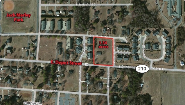
487 E Depot St, Angier, NC 27501

NEARBY LISTINGS FOR SALE OR LEASE
Property Detail
487 E Depot St
04067420050036
Roscoe Ragland
Sfr
1.504 AC SMITHFIELD ST
X
Harnett
3720068200J
North Carolina
2025
1.50 AC
2025
North Carolina Southeast Area
070901
Other Market Areas
1,188 SF
Anderson Creek, NC
DEMOGRAPHICS near 487 E Depot St
1 mile
3 mile
5 mile
2024 Total Population
4,442
13,475
31,553
2029 Population
4,871
14,845
35,041
Pop Growth 2024-2029
+ 9.66%
+ 10.17%
+ 11.05%
Average Age
40
39
39
2024 Total Households
1,697
4,993
11,458
HH Growth 2024-2029
+ 9.90%
+ 10.33%
+ 11.18%
Median Household Inc
$63,366
$64,882
$72,088
Avg Household Size
2.60
2.70
2.70
2024 Avg HH Vehicles
2.00
2.00
2.00
Median Home Value
$191,634
$228,555
$275,592
Median Year Built
1993
1997
2000
Nearby Places
Map Layers
Map Styles
 Street
 Aerial
Transit
 Traffic
 Biking
Places
Listings with unknown addresses are not visible on the map
- Restaurants
- Banks
- Shops
- Fitness
- Groceries
PUBLIC TRANSPORTATION
AIRPORT
Raleigh-Durham International
Drive
Walk
Distance
Raleigh-Durham International
52 min
33.3 mi
Freight Ports
Port of Wilmington
Drive
Walk
Distance
Port of Wilmington
141 min
119.8 mi
Nearby Properties
Address
Land Use
TOTAL SIZE
Lot Size
Zoning
Address
Land Use
TOTAL SIZE
Lot Size
Zoning
38,728 SF
9.99 AC
RA-30
Address
Land Use
TOTAL SIZE
Lot Size
Zoning
76.04 AC
R-6
Address
Land Use
TOTAL SIZE
Lot Size
Zoning
47,048 SF
12.46 AC
Address
Land Use
TOTAL SIZE
Lot Size
Zoning
52.31 AC
R-6
Address
Land Use
TOTAL SIZE
Lot Size
Zoning
33.10 AC
R-6
Address
Land Use
TOTAL SIZE
Lot Size
Zoning
2,922 SF
0.14 AC
Address
Land Use
TOTAL SIZE
Lot Size
Zoning
2,922 SF
0.14 AC
Address
Land Use
TOTAL SIZE
Lot Size
Zoning
4,501 SF
56.30 AC
R-30
Address
Land Use
TOTAL SIZE
Lot Size
Zoning
48.89 AC
R-20
Address
Land Use
TOTAL SIZE
Lot Size
Zoning
14,416 SF
1.61 AC
GC
Address
Land Use
TOTAL SIZE
Lot Size
Zoning
14,480 SF
5.10 AC
O&I
Address
Land Use
TOTAL SIZE
Lot Size
Zoning
7,760 SF
8 AC
R-30
Address
Land Use
TOTAL SIZE
Lot Size
Zoning
96,923 SF
18.97 AC
Address
Land Use
TOTAL SIZE
Lot Size
Zoning
1,112 SF
123.37 AC
R-30
Address
Land Use
TOTAL SIZE
Lot Size
Zoning
1,040 SF
2.24 AC
R10
Address
Land Use
TOTAL SIZE
Lot Size
Zoning
22,364 SF
2 AC
R10
Address
Land Use
TOTAL SIZE
Lot Size
Zoning
3,000 SF
3.04 AC
COL
Address
Land Use
TOTAL SIZE
Lot Size
Zoning
9,935 SF
0.76 AC
GC
Address
Land Use
TOTAL SIZE
Lot Size
Zoning
640 SF
27.02 AC
AD-2
Address
Land Use
TOTAL SIZE
Lot Size
Zoning
4,410 SF
1.18 AC
GC
Address
Land Use
TOTAL SIZE
Lot Size
Zoning
12,069 SF
24.50 AC
R-30
Address
Land Use
TOTAL SIZE
Lot Size
Zoning
6,712 SF
31.34 AC
R-30
Address
Land Use
TOTAL SIZE
Lot Size
Zoning
25,156 SF
5.17 AC
RA30
Address
Land Use
TOTAL SIZE
Lot Size
Zoning
9,217 SF
1.44 AC
GC
Address
Land Use
TOTAL SIZE
Lot Size
Zoning
4,310 SF
11.27 AC
R-30
Address
Land Use
TOTAL SIZE
Lot Size
Zoning
9,674 SF
7.65 AC
RA30
Address
Land Use
TOTAL SIZE
Lot Size
Zoning
1,125 SF
23.74 AC
RA30
Address
Land Use
TOTAL SIZE
Lot Size
Zoning
24.36 AC
RA30
Address
Land Use
TOTAL SIZE
Lot Size
Zoning
8,546 SF
1.43 AC
Address
Land Use
TOTAL SIZE
Lot Size
Zoning
19.63 AC
O&I
The World's #1 Commercial Real Estate Marketplace
Connect with us
© 2026 CoStar Group
The information above has been obtained from sources believed reliable. While we do not doubt its accuracy we have not verified it and make no guarantee, warranty or representation about it. It is your responsibility to independently confirm its accuracy and completeness. Any projections, opinions, assumptions, or estimates used are for example only and do not represent the current or future performance of the property. The value of this transaction to you depends on tax and other factors which should be evaluated by your tax, financial, and legal advisors. You and your advisors should conduct a careful, independent investigation of the property to determine to your satisfaction the suitability of the property for your needs.