Property Record
487 Groton Rd, Westford, MA 01886


Save to a Folder
{{folder.Name}}
{{folder.ListingIds.length}} Properties
{{folder.ListingIds.length}} Property
Create a New Folder
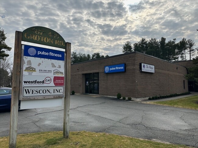
Property Detail
487 Groton Rd
Industrialgeneral
Middlesex
IA
Massachusetts
B and X Area of moderate flood hazard, usually the area between the limits of the 100-year and 500-year floods.
0.98 AC
2025
Groton/Townsend
2025
Boston
318100
Boston-Cambridge-Newton, MA-NH
11,744 SF
WFOR-000046-000021
NEARBY LISTINGS FOR SALE OR LEASE
DEMOGRAPHICS near 487 Groton Rd
1 mile
3 mile
5 mile
2025 Total Population
3,839
35,776
113,173
2030 Population
4,012
37,324
117,272
Pop Growth 2025-2030
+ 4.51%
+ 4.33%
+ 3.62%
Average Age
42
43
41
2025 Total Households
1,354
13,167
40,836
HH Growth 2025-2030
+ 4.51%
+ 4.37%
+ 3.75%
Median Household Inc
$160,416
$150,523
$120,169
Avg Household Size
2.80
2.70
2.70
2025 Avg HH Vehicles
2.00
2.00
2.00
Median Home Value
$710,508
$669,460
$615,170
Median Year Built
1968
1980
1973
Nearby Places
Map Layers
Map Styles
 Street
 Aerial
Layers
 Traffic
 Biking
Places
Listings with unknown addresses are not visible on the map
- Restaurants
- Banks
- Shops
- Fitness
- Groceries
PUBLIC TRANSPORTATION
COMMUTER RAIL
Lowell (Lowell Line - Massachusetts Bay Transportation Authority Commuter Rail (Purple Line))
Drive
Walk
Distance
Lowell (Lowell Line - Massachusetts Bay Transportation Authority Commuter Rail (Purple Line))
11 min
7.2 mi
North Billerica (Lowell Line - Massachusetts Bay Transportation Authority Commuter Rail (Purple Line))
Drive
Walk
Distance
North Billerica (Lowell Line - Massachusetts Bay Transportation Authority Commuter Rail (Purple Line))
15 min
9.6 mi
AIRPORT
Manchester Boston Regional
Drive
Walk
Distance
Manchester Boston Regional
39 min
26.3 mi
General Edward Lawrence Logan International
Drive
Walk
Distance
General Edward Lawrence Logan International
53 min
39.3 mi
Worcester Regional
Drive
Walk
Distance
Worcester Regional
60 min
42.2 mi
SALE & LEASE HISTORY
LISTING DATE
SALE/LEASE

Sep 17, 2020
For Sale
Oct 11, 2019
For Sale
Mar 21, 2024
For Sale
Jun 09, 2021
For Lease
Jan 02, 2019
For Lease
Nearby Properties
Address
Land Use
TOTAL SIZE
Lot Size
Zoning
Address
Land Use
TOTAL SIZE
Lot Size
Zoning
23,251 SF
18.20 AC
SMF
Address
Land Use
TOTAL SIZE
Lot Size
Zoning
269,952 SF
18.11 AC
P
Address
Land Use
TOTAL SIZE
Lot Size
Zoning
68.15 AC
R1
Address
Land Use
TOTAL SIZE
Lot Size
Zoning
38.26 AC
P
Address
Land Use
TOTAL SIZE
Lot Size
Zoning
44.39 AC
SMU
Address
Land Use
TOTAL SIZE
Lot Size
Zoning
119,130 SF
22.36 AC
RA
Address
Land Use
TOTAL SIZE
Lot Size
Zoning
85,450 SF
32.07 AC
RA
Address
Land Use
TOTAL SIZE
Lot Size
Zoning
4.67 AC
IA
Address
Land Use
TOTAL SIZE
Lot Size
Zoning
8.30 AC
B3
Address
Land Use
TOTAL SIZE
Lot Size
Zoning
135,324 SF
70.07 AC
R1
Address
Land Use
TOTAL SIZE
Lot Size
Zoning
90,463 SF
8.56 AC
RA
Address
Land Use
TOTAL SIZE
Lot Size
Zoning
177.27 AC
R1
Address
Land Use
TOTAL SIZE
Lot Size
Zoning
12.26 AC
P
Address
Land Use
TOTAL SIZE
Lot Size
Zoning
82,182 SF
13.86 AC
P
Address
Land Use
TOTAL SIZE
Lot Size
Zoning
31.92 AC
RB
Address
Land Use
TOTAL SIZE
Lot Size
Zoning
58,766 SF
21.98 AC
RA
Address
Land Use
TOTAL SIZE
Lot Size
Zoning
50,000 SF
33.40 AC
IA
Address
Land Use
TOTAL SIZE
Lot Size
Zoning
27.80 AC
P
Address
Land Use
TOTAL SIZE
Lot Size
Zoning
43,200 SF
2.82 AC
IA
Address
Land Use
TOTAL SIZE
Lot Size
Zoning
Address
Land Use
TOTAL SIZE
Lot Size
Zoning
41,635 SF
5.33 AC
RA
Address
Land Use
TOTAL SIZE
Lot Size
Zoning
17.86 AC
I1
Address
Land Use
TOTAL SIZE
Lot Size
Zoning
28,478 SF
16.60 AC
RB
Address
Land Use
TOTAL SIZE
Lot Size
Zoning
83,000 SF
2.78 AC
R1
Address
Land Use
TOTAL SIZE
Lot Size
Zoning
4.62 AC
RC
Address
Land Use
TOTAL SIZE
Lot Size
Zoning
1.91 AC
RC
Address
Land Use
TOTAL SIZE
Lot Size
Zoning
69,619 SF
2.85 AC
CB
Address
Land Use
TOTAL SIZE
Lot Size
Zoning
2.59 AC
I1
Address
Land Use
TOTAL SIZE
Lot Size
Zoning
30,317 SF
3.63 AC
CB
Address
Land Use
TOTAL SIZE
Lot Size
Zoning
177.88 AC
R1
The World's #1 Commercial Real Estate Marketplace
Connect with us
© 2026 CoStar Group
The information above has been obtained from sources believed reliable. While we do not doubt its accuracy we have not verified it and make no guarantee, warranty or representation about it. It is your responsibility to independently confirm its accuracy and completeness. Any projections, opinions, assumptions, or estimates used are for example only and do not represent the current or future performance of the property. The value of this transaction to you depends on tax and other factors which should be evaluated by your tax, financial, and legal advisors. You and your advisors should conduct a careful, independent investigation of the property to determine to your satisfaction the suitability of the property for your needs.