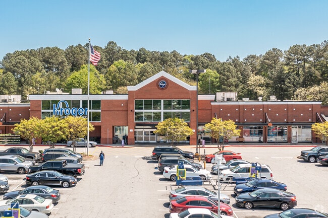
Property Record
4875 Floyd Rd Sw, Mableton, GA 30126

Save to a Folder
{{folder.Name}}
{{folder.ListingIds.length}} Properties
{{folder.ListingIds.length}} Property
Create a New Folder
Property Detail
4875 Floyd Rd Sw
17-0042-0-023-0
COBB
Regionalshoppingcenterormallwithanchorstore
Georgia
NRC
11
B and X Area of moderate flood hazard, usually the area between the limits of the 100-year and 500-year floods.
10.60 AC
2025
Powder Spring/Austell
2025
Atlanta
031325
Atlanta-Sandy Springs-Roswell, GA
89,686 SF
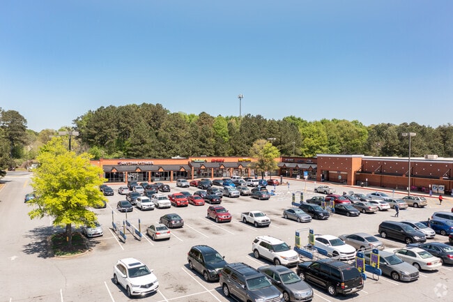
NEARBY LISTINGS FOR SALE OR LEASE
DEMOGRAPHICS near 4875 Floyd Rd Sw
1 mile
3 mile
5 mile
2025 Total Population
6,966
65,695
193,443
2030 Population
7,275
67,761
199,386
Pop Growth 2025-2030
+ 4.44%
+ 3.14%
+ 3.07%
Average Age
42
40
38
2025 Total Households
2,616
24,452
73,997
HH Growth 2025-2030
+ 4.40%
+ 3.14%
+ 3.07%
Median Household Inc
$95,555
$92,220
$85,957
Avg Household Size
2.50
2.60
2.50
2025 Avg HH Vehicles
2.00
2.00
2.00
Median Home Value
$389,680
$395,860
$384,591
Median Year Built
1981
1984
1988
Nearby Places
Map Layers
Map Styles
 Street
 Aerial
Layers
 Traffic
 Biking
Places
Listings with unknown addresses are not visible on the map
- Restaurants
- Banks
- Shops
- Fitness
- Groceries
SALE & LEASE HISTORY
LISTING DATE
SALE/LEASE

Sep 24, 2016
For Lease
Feb 01, 2021
For Lease
Dec 14, 2016
For Lease
Nearby Properties
Address
Land Use
TOTAL SIZE
Lot Size
Zoning
Address
Land Use
TOTAL SIZE
Lot Size
Zoning
494,972 SF
25.60 AC
CF
Address
Land Use
TOTAL SIZE
Lot Size
Zoning
403,898 SF
37.53 AC
RM-12
Address
Land Use
TOTAL SIZE
Lot Size
Zoning
370,201 SF
28.35 AC
RM-12
Address
Land Use
TOTAL SIZE
Lot Size
Zoning
25,956 SF
12.78 AC
PVC
Address
Land Use
TOTAL SIZE
Lot Size
Zoning
272,170 SF
26.40 AC
RM-12
Address
Land Use
TOTAL SIZE
Lot Size
Zoning
238,984 SF
17.51 AC
RM-12
Address
Land Use
TOTAL SIZE
Lot Size
Zoning
219,402 SF
10.33 AC
RM-12
Address
Land Use
TOTAL SIZE
Lot Size
Zoning
151,436 SF
11.42 AC
RM-12
Address
Land Use
TOTAL SIZE
Lot Size
Zoning
179,048 SF
25.97 AC
RM-12
Address
Land Use
TOTAL SIZE
Lot Size
Zoning
377,059 SF
32.20 AC
LI
Address
Land Use
TOTAL SIZE
Lot Size
Zoning
250,482 SF
16.74 AC
RM-12
Address
Land Use
TOTAL SIZE
Lot Size
Zoning
118,069 SF
0.38 AC
OI
Address
Land Use
TOTAL SIZE
Lot Size
Zoning
188,988 SF
15.30 AC
OI
Address
Land Use
TOTAL SIZE
Lot Size
Zoning
3.46 AC
RM-12
Address
Land Use
TOTAL SIZE
Lot Size
Zoning
198,052 SF
24.52 AC
NRC/CRC
Address
Land Use
TOTAL SIZE
Lot Size
Zoning
109,072 SF
15.23 AC
NRC
Address
Land Use
TOTAL SIZE
Lot Size
Zoning
92,468 SF
13.69 AC
RM-8
Address
Land Use
TOTAL SIZE
Lot Size
Zoning
83,314 SF
15.74 AC
NRC
Address
Land Use
TOTAL SIZE
Lot Size
Zoning
98,574 SF
10.27 AC
CRC
Address
Land Use
TOTAL SIZE
Lot Size
Zoning
117,715 SF
7.88 AC
RM-12
Address
Land Use
TOTAL SIZE
Lot Size
Zoning
63,424 SF
10.67 AC
RM-12
Address
Land Use
TOTAL SIZE
Lot Size
Zoning
2.76 AC
NRC
Address
Land Use
TOTAL SIZE
Lot Size
Zoning
134,592 SF
13.43 AC
CBD
Address
Land Use
TOTAL SIZE
Lot Size
Zoning
2,636 SF
2.97 AC
NRC
Address
Land Use
TOTAL SIZE
Lot Size
Zoning
52,250 SF
7.41 AC
OS/WS
Address
Land Use
TOTAL SIZE
Lot Size
Zoning
104,538 SF
9.18 AC
RM-12
Address
Land Use
TOTAL SIZE
Lot Size
Zoning
44,097 SF
3.45 AC
OI
Address
Land Use
TOTAL SIZE
Lot Size
Zoning
175,923 SF
12.75 AC
GC
Address
Land Use
TOTAL SIZE
Lot Size
Zoning
94,074 SF
5 AC
PSC
The World's #1 Commercial Real Estate Marketplace
Connect with us
© 2026 CoStar Group
The information above has been obtained from sources believed reliable. While we do not doubt its accuracy we have not verified it and make no guarantee, warranty or representation about it. It is your responsibility to independently confirm its accuracy and completeness. Any projections, opinions, assumptions, or estimates used are for example only and do not represent the current or future performance of the property. The value of this transaction to you depends on tax and other factors which should be evaluated by your tax, financial, and legal advisors. You and your advisors should conduct a careful, independent investigation of the property to determine to your satisfaction the suitability of the property for your needs.