Property Record
488 Valley Rd, Gillette, NJ 07933


Property Detail
488 Valley Rd
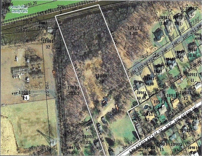
30-11001-0000-00022
MORRIS
Apartment
New Jersey
C
22
2024
8.60 AC
2025
Morristown Region
044102
Northern New Jersey
2,360 SF
Newark, NJ
NEARBY LISTINGS FOR SALE OR LEASE
DEMOGRAPHICS near 488 Valley Rd
1 mile
3 mile
5 mile
2025 Total Population
5,804
34,530
156,836
2030 Population
6,064
36,277
163,755
Pop Growth 2025-2030
+ 4.48%
+ 5.06%
+ 4.41%
Average Age
43
43
41
2025 Total Households
2,010
11,942
53,587
HH Growth 2025-2030
+ 4.48%
+ 5.07%
+ 4.54%
Median Household Inc
$167,596
$179,604
$133,540
Avg Household Size
2.90
2.80
2.80
2025 Avg HH Vehicles
2.00
2.00
2.00
Median Home Value
$757,263
$783,763
$707,660
Median Year Built
1964
1967
1962
Nearby Places
Map Layers
Map Styles
 Street
 Aerial
Layers
 Traffic
 Biking
Places
Listings with unknown addresses are not visible on the map
- Restaurants
- Banks
- Shops
- Fitness
- Groceries
PUBLIC TRANSPORTATION
COMMUTER RAIL
Gillette (Morris & Essex Gladstone Branch - NJ Transit Commuter Rail (NJ Transit))
Drive
Walk
Distance
Gillette (Morris & Essex Gladstone Branch - NJ Transit Commuter Rail (NJ Transit))
2 min
13 min
0.7 mi
Berkeley Heights (Morris & Essex Gladstone Branch - NJ Transit Commuter Rail (NJ Transit))
Drive
Walk
Distance
Berkeley Heights (Morris & Essex Gladstone Branch - NJ Transit Commuter Rail (NJ Transit))
2 min
1.2 mi
AIRPORT
Newark Liberty International
Drive
Walk
Distance
Newark Liberty International
28 min
21.4 mi
Freight Ports
New York Container Terminal
Drive
Walk
Distance
New York Container Terminal
38 min
24.4 mi
SALE & LEASE HISTORY
LISTING DATE
SALE/LEASE

May 08, 2017
For Sale
Nearby Properties
Address
Land Use
TOTAL SIZE
Lot Size
Zoning
Address
Land Use
TOTAL SIZE
Lot Size
Zoning
47.69 AC
MU
Address
Land Use
TOTAL SIZE
Lot Size
Zoning
34.60 AC
MU
Address
Land Use
TOTAL SIZE
Lot Size
Zoning
67.22 AC
R65
Address
Land Use
TOTAL SIZE
Lot Size
Zoning
140,732 SF
42.73 AC
OR
Address
Land Use
TOTAL SIZE
Lot Size
Zoning
23.93 AC
B2
Address
Land Use
TOTAL SIZE
Lot Size
Zoning
24.92 AC
MU
Address
Land Use
TOTAL SIZE
Lot Size
Zoning
61,912 SF
16 AC
OR
Address
Land Use
TOTAL SIZE
Lot Size
Zoning
8.09 AC
B3
Address
Land Use
TOTAL SIZE
Lot Size
Zoning
6.76 AC
MU
Address
Land Use
TOTAL SIZE
Lot Size
Zoning
16.30 AC
OR
Address
Land Use
TOTAL SIZE
Lot Size
Zoning
218,207 SF
15.28 AC
Address
Land Use
TOTAL SIZE
Lot Size
Zoning
35.20 AC
OL
Address
Land Use
TOTAL SIZE
Lot Size
Zoning
9.53 AC
DD
Address
Land Use
TOTAL SIZE
Lot Size
Zoning
16.32 AC
R2
Address
Land Use
TOTAL SIZE
Lot Size
Zoning
11.16 AC
R-3
Address
Land Use
TOTAL SIZE
Lot Size
Zoning
7.46 AC
BR80
Address
Land Use
TOTAL SIZE
Lot Size
Zoning
27.24 AC
A-H
Address
Land Use
TOTAL SIZE
Lot Size
Zoning
30.26 AC
C
Address
Land Use
TOTAL SIZE
Lot Size
Zoning
21.30 AC
OL
Address
Land Use
TOTAL SIZE
Lot Size
Zoning
9.80 AC
OL
Address
Land Use
TOTAL SIZE
Lot Size
Zoning
4.42 AC
C
Address
Land Use
TOTAL SIZE
Lot Size
Zoning
55.80 AC
OL
Address
Land Use
TOTAL SIZE
Lot Size
Zoning
14.22 AC
B3
Address
Land Use
TOTAL SIZE
Lot Size
Zoning
2.30 AC
RMF3
Address
Land Use
TOTAL SIZE
Lot Size
Zoning
2.13 AC
RMF3
Address
Land Use
TOTAL SIZE
Lot Size
Zoning
Address
Land Use
TOTAL SIZE
Lot Size
Zoning
89,794 SF
10.19 AC
LI
Address
Land Use
TOTAL SIZE
Lot Size
Zoning
2.83 AC
NB
Address
Land Use
TOTAL SIZE
Lot Size
Zoning
51,000 SF
1.70 AC
LI
Address
Land Use
TOTAL SIZE
Lot Size
Zoning
8.98 AC
NB
The World's #1 Commercial Real Estate Marketplace
Connect with us
© 2026 CoStar Group
The information above has been obtained from sources believed reliable. While we do not doubt its accuracy we have not verified it and make no guarantee, warranty or representation about it. It is your responsibility to independently confirm its accuracy and completeness. Any projections, opinions, assumptions, or estimates used are for example only and do not represent the current or future performance of the property. The value of this transaction to you depends on tax and other factors which should be evaluated by your tax, financial, and legal advisors. You and your advisors should conduct a careful, independent investigation of the property to determine to your satisfaction the suitability of the property for your needs.