Property Record
488 W Victory Rd, Henderson, NV 89015


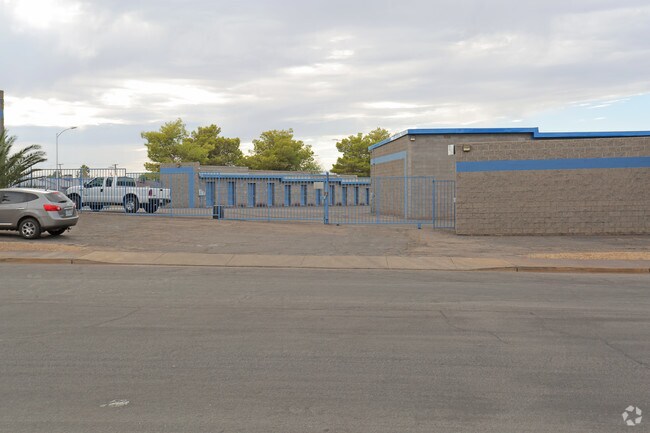
Property Detail
488 W Victory Rd
178-13-702-004
PT N2 SE4 SEC 13-22-62
Publicstorage
Clark
IP
Nevada
B and X Area of moderate flood hazard, usually the area between the limits of the 100-year and 500-year floods.
3.91 AC
2026
SE Las Vegas/Henderson
2026
Las Vegas
005200
Las Vegas-Henderson-North Las Vegas, NV
62,788 SF
NEARBY LISTINGS FOR SALE OR LEASE
-
-
View all Henderson listings for sale on LoopNet.com
DEMOGRAPHICS near 488 W Victory Rd
1 mile
3 mile
5 mile
2025 Total Population
9,647
110,149
235,373
2030 Population
10,141
117,042
248,651
Pop Growth 2025-2030
+ 5.12%
+ 6.26%
+ 5.64%
Average Age
42
41
41
2025 Total Households
3,838
42,440
91,122
HH Growth 2025-2030
+ 5.13%
+ 6.31%
+ 5.69%
Median Household Inc
$79,711
$88,417
$88,883
Avg Household Size
2.40
2.50
2.50
2025 Avg HH Vehicles
2.00
2.00
2.00
Median Home Value
$401,742
$450,333
$457,825
Median Year Built
1993
1999
1998
Nearby Places
Map Layers
Map Styles
 Street
 Aerial
Layers
 Traffic
 Biking
Places
Listings with unknown addresses are not visible on the map
- Restaurants
- Banks
- Shops
- Fitness
- Groceries
PUBLIC TRANSPORTATION
AIRPORT
Harry Reid International
Drive
Walk
Distance
Harry Reid International
17 min
12.2 mi
Boulder City Municipal
Drive
Walk
Distance
Boulder City Municipal
20 min
12.3 mi
Nearby Properties
Address
Land Use
TOTAL SIZE
Lot Size
Zoning
Address
Land Use
TOTAL SIZE
Lot Size
Zoning
8,536 SF
24.93 AC
Address
Land Use
TOTAL SIZE
Lot Size
Zoning
62,258 SF
59.95 AC
Address
Land Use
TOTAL SIZE
Lot Size
Zoning
Address
Land Use
TOTAL SIZE
Lot Size
Zoning
31,463 SF
191.46 AC
PS
Address
Land Use
TOTAL SIZE
Lot Size
Zoning
502,625 SF
45.92 AC
Address
Land Use
TOTAL SIZE
Lot Size
Zoning
9,493 SF
15.37 AC
Address
Land Use
TOTAL SIZE
Lot Size
Zoning
7,825 SF
15.41 AC
Address
Land Use
TOTAL SIZE
Lot Size
Zoning
46.75 AC
PS
Address
Land Use
TOTAL SIZE
Lot Size
Zoning
10.50 AC
Address
Land Use
TOTAL SIZE
Lot Size
Zoning
5,658 SF
16.18 AC
RH24
Address
Land Use
TOTAL SIZE
Lot Size
Zoning
81,485 SF
160.06 AC
PS
Address
Land Use
TOTAL SIZE
Lot Size
Zoning
387,990 SF
22.04 AC
Address
Land Use
TOTAL SIZE
Lot Size
Zoning
1,500 SF
25.08 AC
Address
Land Use
TOTAL SIZE
Lot Size
Zoning
9,000 SF
96.81 AC
RE
Address
Land Use
TOTAL SIZE
Lot Size
Zoning
4,446 SF
15.81 AC
CC
Address
Land Use
TOTAL SIZE
Lot Size
Zoning
40,031 SF
21.25 AC
Address
Land Use
TOTAL SIZE
Lot Size
Zoning
78,760 SF
1.23 AC
Address
Land Use
TOTAL SIZE
Lot Size
Zoning
222,167 SF
6.99 AC
Address
Land Use
TOTAL SIZE
Lot Size
Zoning
4,578 SF
13.23 AC
H:RH-24-MP
Address
Land Use
TOTAL SIZE
Lot Size
Zoning
23,087 SF
71.36 AC
PS
Address
Land Use
TOTAL SIZE
Lot Size
Zoning
4,496 SF
15.59 AC
H:RH-24-MP
Address
Land Use
TOTAL SIZE
Lot Size
Zoning
239,288 SF
14.10 AC
Address
Land Use
TOTAL SIZE
Lot Size
Zoning
250,076 SF
24.61 AC
Address
Land Use
TOTAL SIZE
Lot Size
Zoning
295,238 SF
23.49 AC
IP
Address
Land Use
TOTAL SIZE
Lot Size
Zoning
3,126 SF
17.69 AC
RM16
Address
Land Use
TOTAL SIZE
Lot Size
Zoning
4,280 SF
18.25 AC
H:RM-16-MP
Address
Land Use
TOTAL SIZE
Lot Size
Zoning
71,133 SF
7.56 AC
DP
Address
Land Use
TOTAL SIZE
Lot Size
Zoning
19,753 SF
10.21 AC
DP
Address
Land Use
TOTAL SIZE
Lot Size
Zoning
2,860 SF
15.43 AC
RM16
The World's #1 Commercial Real Estate Marketplace
Connect with us
© 2026 CoStar Group
The information above has been obtained from sources believed reliable. While we do not doubt its accuracy we have not verified it and make no guarantee, warranty or representation about it. It is your responsibility to independently confirm its accuracy and completeness. Any projections, opinions, assumptions, or estimates used are for example only and do not represent the current or future performance of the property. The value of this transaction to you depends on tax and other factors which should be evaluated by your tax, financial, and legal advisors. You and your advisors should conduct a careful, independent investigation of the property to determine to your satisfaction the suitability of the property for your needs.