Property Record
489 Central Tpke, Sutton, MA 01590
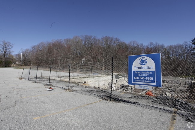

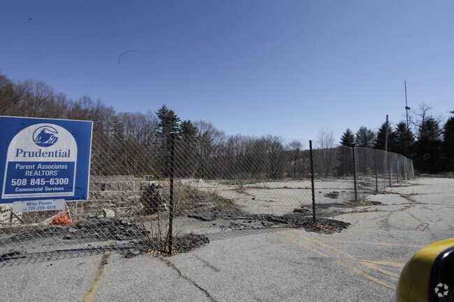
Property Detail
489 Central Tpke
Governmentalpublicusegeneral
Worcester
R1
Massachusetts
B and X Area of moderate flood hazard, usually the area between the limits of the 100-year and 500-year floods.
2.52 AC
0
Outlying Worcester
2025
Boston
751101
Worcester, MA
6,230 SF
SUTT-000030-000000-000038
NEARBY LISTINGS FOR SALE OR LEASE
-
-
View all Sutton listings for sale on LoopNet.com
DEMOGRAPHICS near 489 Central Tpke
1 mile
3 mile
5 mile
2025 Total Population
709
6,188
31,312
2030 Population
740
6,434
32,153
Pop Growth 2025-2030
+ 4.37%
+ 3.98%
+ 2.69%
Average Age
44
45
43
2025 Total Households
258
2,341
12,401
HH Growth 2025-2030
+ 4.65%
+ 4.10%
+ 2.77%
Median Household Inc
$168,382
$143,604
$124,509
Avg Household Size
2.70
2.60
2.50
2025 Avg HH Vehicles
2.00
2.00
2.00
Median Home Value
$653,448
$630,766
$477,102
Median Year Built
1981
1979
1973
Nearby Places
Map Layers
Map Styles
 Street
 Aerial
Transit
 Traffic
 Biking
Places
Listings with unknown addresses are not visible on the map
- Restaurants
- Banks
- Shops
- Fitness
- Groceries
PUBLIC TRANSPORTATION
AIRPORT
Worcester Regional
Drive
Walk
Distance
Worcester Regional
29 min
17.5 mi
Rhode Island Tf Green International
Drive
Walk
Distance
Rhode Island Tf Green International
56 min
41.1 mi
Freight Ports
Port of Boston
Drive
Walk
Distance
Port of Boston
70 min
52.1 mi
Nearby Properties
Address
Land Use
TOTAL SIZE
Lot Size
Zoning
Address
Land Use
TOTAL SIZE
Lot Size
Zoning
200,557 SF
13.09 AC
R1
Address
Land Use
TOTAL SIZE
Lot Size
Zoning
42.92 AC
R1
Address
Land Use
TOTAL SIZE
Lot Size
Zoning
136.75 AC
R1
Address
Land Use
TOTAL SIZE
Lot Size
Zoning
255.31 AC
R1
Address
Land Use
TOTAL SIZE
Lot Size
Zoning
3.50 AC
R1
Address
Land Use
TOTAL SIZE
Lot Size
Zoning
32,618 SF
4.36 AC
B2
Address
Land Use
TOTAL SIZE
Lot Size
Zoning
11.22 AC
V
Address
Land Use
TOTAL SIZE
Lot Size
Zoning
116.25 AC
R1
Address
Land Use
TOTAL SIZE
Lot Size
Zoning
4.41 AC
R1
Address
Land Use
TOTAL SIZE
Lot Size
Zoning
6.75 AC
B2
Address
Land Use
TOTAL SIZE
Lot Size
Zoning
854 SF
72.35 AC
RA
Address
Land Use
TOTAL SIZE
Lot Size
Zoning
13,812 SF
1.82 AC
R1
Address
Land Use
TOTAL SIZE
Lot Size
Zoning
3,296 SF
2.90 AC
B2
Address
Land Use
TOTAL SIZE
Lot Size
Zoning
2,380 SF
4.12 AC
R1
Address
Land Use
TOTAL SIZE
Lot Size
Zoning
9.39 AC
R1
Address
Land Use
TOTAL SIZE
Lot Size
Zoning
6,268 SF
4.90 AC
V
Address
Land Use
TOTAL SIZE
Lot Size
Zoning
13.32 AC
R1
Address
Land Use
TOTAL SIZE
Lot Size
Zoning
25.48 AC
R1
Address
Land Use
TOTAL SIZE
Lot Size
Zoning
44.79 AC
R1
Address
Land Use
TOTAL SIZE
Lot Size
Zoning
34.75 AC
B2
Address
Land Use
TOTAL SIZE
Lot Size
Zoning
127.14 AC
R1
Address
Land Use
TOTAL SIZE
Lot Size
Zoning
7,646 SF
1.48 AC
B2
Address
Land Use
TOTAL SIZE
Lot Size
Zoning
2,396 SF
0.44 AC
RA
Address
Land Use
TOTAL SIZE
Lot Size
Zoning
7,087 SF
1 AC
B2
Address
Land Use
TOTAL SIZE
Lot Size
Zoning
6,355 SF
1.66 AC
V
Address
Land Use
TOTAL SIZE
Lot Size
Zoning
4,290 SF
0.30 AC
V
Address
Land Use
TOTAL SIZE
Lot Size
Zoning
3.97 AC
R1
Address
Land Use
TOTAL SIZE
Lot Size
Zoning
128.86 AC
R1
Address
Land Use
TOTAL SIZE
Lot Size
Zoning
7,648 SF
0.98 AC
B2
The World's #1 Commercial Real Estate Marketplace
Connect with us
© 2026 CoStar Group
The information above has been obtained from sources believed reliable. While we do not doubt its accuracy we have not verified it and make no guarantee, warranty or representation about it. It is your responsibility to independently confirm its accuracy and completeness. Any projections, opinions, assumptions, or estimates used are for example only and do not represent the current or future performance of the property. The value of this transaction to you depends on tax and other factors which should be evaluated by your tax, financial, and legal advisors. You and your advisors should conduct a careful, independent investigation of the property to determine to your satisfaction the suitability of the property for your needs.