Property Record
489 S Rivershore Ln, Eagle, ID 83616

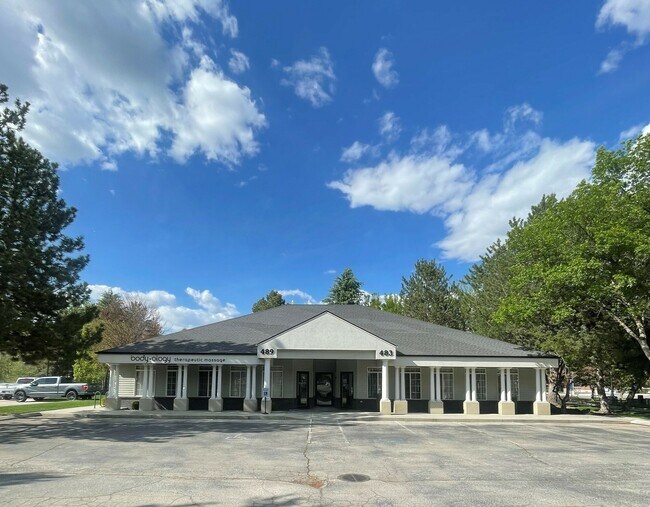
Property Detail
489 S Rivershore Ln
R5341100020
UNIT 1 LOYA CONDO
Officebuilding
ADA
C-1
Idaho
C and X Area of minimal flood hazard, usually depicted on FIRMs as above the 500-year flood level.
0.04 AC
2024
Eagle
2025
Boise City/Nampa
010233
Boise City, ID
1,643 SF
NEARBY LISTINGS FOR SALE OR LEASE
DEMOGRAPHICS near 489 S Rivershore Ln
1 mile
3 mile
5 mile
2024 Total Population
7,888
49,235
150,897
2029 Population
8,402
51,876
158,395
Pop Growth 2024-2029
+ 6.52%
+ 5.36%
+ 4.97%
Average Age
46
44
42
2024 Total Households
3,238
18,201
55,306
HH Growth 2024-2029
+ 6.98%
+ 5.85%
+ 5.40%
Median Household Inc
$90,857
$111,464
$100,844
Avg Household Size
2.40
2.70
2.70
2024 Avg HH Vehicles
2.00
2.00
2.00
Median Home Value
$731,003
$733,584
$605,327
Median Year Built
2003
2002
2002
Nearby Places
Map Layers
Map Styles
 Street
 Aerial
Transit
 Traffic
 Biking
Places
Listings with unknown addresses are not visible on the map
- Restaurants
- Banks
- Shops
- Fitness
- Groceries
PUBLIC TRANSPORTATION
AIRPORT
Boise Air Trml/Gowen Field
Drive
Walk
Distance
Boise Air Trml/Gowen Field
36 min
18.9 mi
Freight Ports
Port of Portland
Drive
Walk
Distance
Port of Portland
472 min
424.5 mi
SALE & LEASE HISTORY
LISTING DATE
SALE/LEASE

Sep 25, 2016
For Lease
Nov 22, 2024
For Lease
Mar 03, 2025
For Sale
Mar 03, 2023
For Lease
Jul 30, 2025
For Sale
Nearby Properties
Address
Land Use
TOTAL SIZE
Lot Size
Zoning
Address
Land Use
TOTAL SIZE
Lot Size
Zoning
301,800 SF
12.70 AC
R-3D
Address
Land Use
TOTAL SIZE
Lot Size
Zoning
239,991 SF
8.09 AC
MU-DA
Address
Land Use
TOTAL SIZE
Lot Size
Zoning
203,635 SF
4.76 AC
L-OD
Address
Land Use
TOTAL SIZE
Lot Size
Zoning
98,738 SF
4.25 AC
CBD
Address
Land Use
TOTAL SIZE
Lot Size
Zoning
151,365 SF
12.03 AC
T-1D
Address
Land Use
TOTAL SIZE
Lot Size
Zoning
129,827 SF
3.08 AC
MU-DA
Address
Land Use
TOTAL SIZE
Lot Size
Zoning
152,123 SF
6 AC
MU-DA
Address
Land Use
TOTAL SIZE
Lot Size
Zoning
69,546 SF
4.26 AC
MU-DA
Address
Land Use
TOTAL SIZE
Lot Size
Zoning
65,034 SF
4.44 AC
MU-DA
Address
Land Use
TOTAL SIZE
Lot Size
Zoning
98,612 SF
5.38 AC
MU-DA
Address
Land Use
TOTAL SIZE
Lot Size
Zoning
97,655 SF
7.74 AC
T-1D
Address
Land Use
TOTAL SIZE
Lot Size
Zoning
36,454 SF
3.18 AC
MU
Address
Land Use
TOTAL SIZE
Lot Size
Zoning
81,591 SF
2.88 AC
MU-DA
Address
Land Use
TOTAL SIZE
Lot Size
Zoning
165,295 SF
7.01 AC
MU-DA
Address
Land Use
TOTAL SIZE
Lot Size
Zoning
66,322 SF
3.61 AC
T-1D
Address
Land Use
TOTAL SIZE
Lot Size
Zoning
59,778 SF
3.68 AC
C-3-DA
Address
Land Use
TOTAL SIZE
Lot Size
Zoning
125,400 SF
12.68 AC
C-4D
Address
Land Use
TOTAL SIZE
Lot Size
Zoning
68,707 SF
2.83 AC
C-3-DA
Address
Land Use
TOTAL SIZE
Lot Size
Zoning
105,312 SF
3.85 AC
L-OD/DA
Address
Land Use
TOTAL SIZE
Lot Size
Zoning
74,296 SF
4.86 AC
CBD
Address
Land Use
TOTAL SIZE
Lot Size
Zoning
102,094 SF
7.15 AC
C-2
Address
Land Use
TOTAL SIZE
Lot Size
Zoning
72,258 SF
4.30 AC
R-3D
Address
Land Use
TOTAL SIZE
Lot Size
Zoning
112,281 SF
9.72 AC
C-3
Address
Land Use
TOTAL SIZE
Lot Size
Zoning
104,886 SF
12.51 AC
C-3
Address
Land Use
TOTAL SIZE
Lot Size
Zoning
12.71 AC
C-3
Address
Land Use
TOTAL SIZE
Lot Size
Zoning
34,602 SF
2.61 AC
MU-DA
Address
Land Use
TOTAL SIZE
Lot Size
Zoning
211,576 SF
21.86 AC
M1
Address
Land Use
TOTAL SIZE
Lot Size
Zoning
56,809 SF
5.95 AC
C-1-DA
Address
Land Use
TOTAL SIZE
Lot Size
Zoning
93,791 SF
6.41 AC
MU-DA
Address
Land Use
TOTAL SIZE
Lot Size
Zoning
56,382 SF
3.94 AC
C-C
The World's #1 Commercial Real Estate Marketplace
Connect with us
© 2026 CoStar Group
The information above has been obtained from sources believed reliable. While we do not doubt its accuracy we have not verified it and make no guarantee, warranty or representation about it. It is your responsibility to independently confirm its accuracy and completeness. Any projections, opinions, assumptions, or estimates used are for example only and do not represent the current or future performance of the property. The value of this transaction to you depends on tax and other factors which should be evaluated by your tax, financial, and legal advisors. You and your advisors should conduct a careful, independent investigation of the property to determine to your satisfaction the suitability of the property for your needs.