Property Record
1414 50Th St N, Birmingham, AL 35212


NEARBY LISTINGS FOR SALE OR LEASE
Property Detail
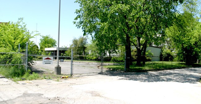
1414 50Th St N
Birmingham-Hoover, AL
50Th St Indu Sub 23-17-3
23-00-17-4-000-003.002
LOT 4 50TH STREET INDUSTRIAL SUB PB 160 PG 52
Vacantlandnec
Jefferson
AE
Alabama
01073C0392H
4
2023
27 AC
2024
Center Point
0005004001
Birmingham
28,200 SF
DEMOGRAPHICS near 1414 50Th St N
1 Mile
3 Mile
5 Mile
2024 Total Population
5,295
53,990
135,638
2029 Population
5,436
54,019
134,996
Pop Growth 2024-2029
+ 2.66%
+ 0.05%
(0.47%)
Average Age
37
38
39
2024 Total Households
2,101
23,051
58,807
HH Growth 2024-2029
+ 2.76%
(0.20%)
(0.44%)
Median Household Inc
$21,438
$38,279
$47,425
Avg Household Size
2.30
2.20
2.10
2024 Avg HH Vehicles
1.00
1.00
2.00
Median Home Value
$69,254
$170,814
$205,156
Median Year Built
1966
1961
1965
Nearby Places
Map Layers
Map Styles
 Street
 Aerial
- Restaurants
- Banks
- Shops
- Fitness
- Groceries
PUBLIC TRANSPORTATION
COMMUTER RAIL
Birmingham (Crescent - Amtrak)
DRIVE
WALK
Distance
Birmingham (Crescent - Amtrak)
11 min
4.6 mi
AIRPORT
Birmingham-Shuttlesworth International
DRIVE
WALK
Distance
Birmingham-Shuttlesworth International
6 min
2.1 mi
Freight Ports
Port of Mobile
DRIVE
WALK
Distance
Port of Mobile
290 min
261.9 mi
Nearby Properties
Address
Land Use
TOTAL SIZE
Lot Size
Zoning
Address
Land Use
TOTAL SIZE
Lot Size
Zoning
145,865 SF
142 AC
M1-M
Address
Land Use
TOTAL SIZE
Lot Size
Zoning
94,958 SF
4.47 AC
M1
Address
Land Use
TOTAL SIZE
Lot Size
Zoning
298,966 SF
73 AC
M1
Address
Land Use
TOTAL SIZE
Lot Size
Zoning
166,863 SF
21 AC
CB2
Address
Land Use
TOTAL SIZE
Lot Size
Zoning
155,160 SF
14.20 AC
B6
Address
Land Use
TOTAL SIZE
Lot Size
Zoning
2.20 AC
M1
Address
Land Use
TOTAL SIZE
Lot Size
Zoning
144,135 SF
31.95 AC
CR5
Address
Land Use
TOTAL SIZE
Lot Size
Zoning
237,826 SF
12 AC
B3
Address
Land Use
TOTAL SIZE
Lot Size
Zoning
249,627 SF
5.29 AC
B4-M
Address
Land Use
TOTAL SIZE
Lot Size
Zoning
Address
Land Use
TOTAL SIZE
Lot Size
Zoning
297,391 SF
27.10 AC
CR5
Address
Land Use
TOTAL SIZE
Lot Size
Zoning
225,000 SF
14 AC
B-2
Address
Land Use
TOTAL SIZE
Lot Size
Zoning
345,035 SF
39 AC
M1
Address
Land Use
TOTAL SIZE
Lot Size
Zoning
50,794 SF
2.02 AC
R6
Address
Land Use
TOTAL SIZE
Lot Size
Zoning
50,794 SF
1.62 AC
R6
Address
Land Use
TOTAL SIZE
Lot Size
Zoning
131,319 SF
13.28 AC
CB2
Address
Land Use
TOTAL SIZE
Lot Size
Zoning
50,808 SF
1.31 AC
M1
Address
Land Use
TOTAL SIZE
Lot Size
Zoning
83,931 SF
5.90 AC
O&I
Address
Land Use
TOTAL SIZE
Lot Size
Zoning
456,619 SF
27.30 AC
M2
Address
Land Use
TOTAL SIZE
Lot Size
Zoning
63,934 SF
0.87 AC
B3
Address
Land Use
TOTAL SIZE
Lot Size
Zoning
78,730 SF
1.05 AC
R3
Address
Land Use
TOTAL SIZE
Lot Size
Zoning
62,372 SF
1.29 AC
M1
Address
Land Use
TOTAL SIZE
Lot Size
Zoning
52,407 SF
25.71 AC
R2
Address
Land Use
TOTAL SIZE
Lot Size
Zoning
83,776 SF
3.79 AC
B6
Address
Land Use
TOTAL SIZE
Lot Size
Zoning
22 AC
CB2
Address
Land Use
TOTAL SIZE
Lot Size
Zoning
127,131 SF
22.40 AC
QR7
Address
Land Use
TOTAL SIZE
Lot Size
Zoning
210,920 SF
22.41 AC
CB2
Address
Land Use
TOTAL SIZE
Lot Size
Zoning
222,082 SF
46 AC
R3
Address
Land Use
TOTAL SIZE
Lot Size
Zoning
84,906 SF
2.73 AC
B2
Address
Land Use
TOTAL SIZE
Lot Size
Zoning
102,748 SF
8.50 AC
CB2
The World's #1 Commercial Real Estate Marketplace
Connect with us
© 2025 CoStar Group
The information above has been obtained from sources believed reliable. While we do not doubt its accuracy we have not verified it and make no guarantee, warranty or representation about it. It is your responsibility to independently confirm its accuracy and completeness. Any projections, opinions, assumptions, or estimates used are for example only and do not represent the current or future performance of the property. The value of this transaction to you depends on tax and other factors which should be evaluated by your tax, financial, and legal advisors. You and your advisors should conduct a careful, independent investigation of the property to determine to your satisfaction the suitability of the property for your needs.