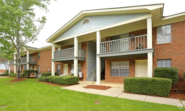
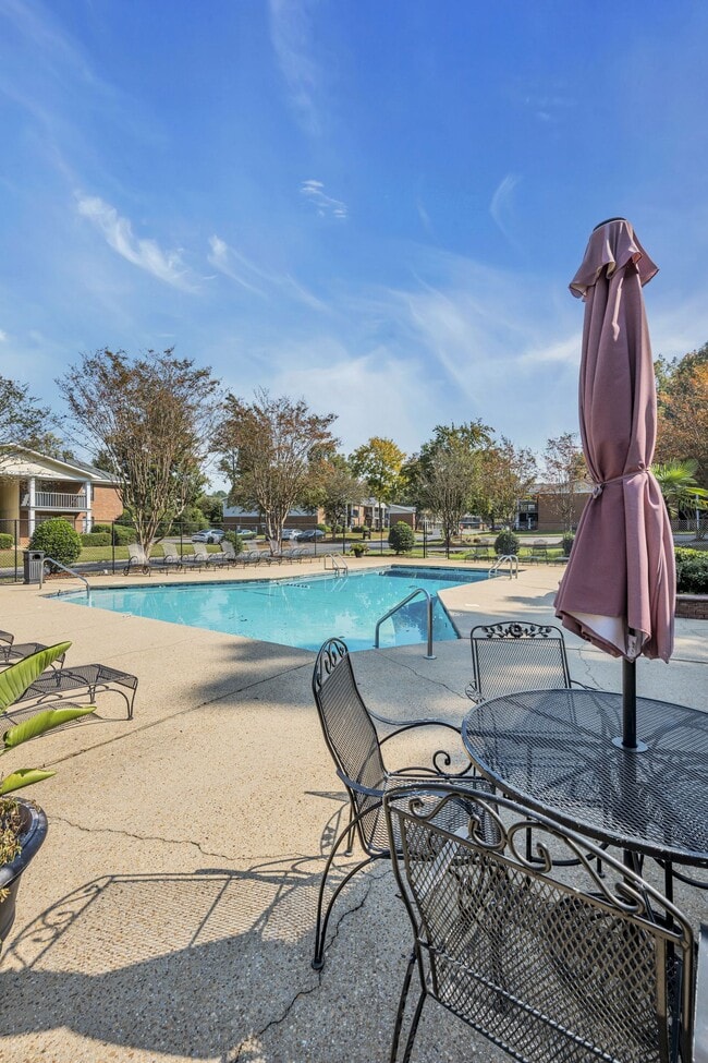
Property Record
48Th St E, , AL
Save to a Folder
{{folder.Name}}
{{folder.ListingIds.length}} Properties
{{folder.ListingIds.length}} Property
Create a New Folder
Property Detail
48Th St E
37-03-06-1-001-027.002
COM SE COR LT 5 RES LTS 4 & 5 TIMBERLANE NO.2 IN SW1/4-NW1/4 S5 T22S R9W; TH NW 225.5 TO POB; TH NW 30; SW 191.1; SE 153.9; N
Apartment
TUSCALOOSA
R4
Alabama
B and X Area of moderate flood hazard, usually the area between the limits of the 100-year and 500-year floods.
4-5
2025
8.20 AC
2025
Skyland-McFarland
012304
Birmingham
9,216 SF
Tuscaloosa, AL
NEARBY LISTINGS FOR SALE OR LEASE
DEMOGRAPHICS near 48Th St E
1 mile
3 mile
5 mile
2025 Total Population
5,595
45,498
120,770
2030 Population
5,568
45,994
122,951
Pop Growth 2025-2030
(0.48%)
+ 1.09%
+ 1.81%
Average Age
35
36
34
2025 Total Households
2,708
20,469
45,094
HH Growth 2025-2030
(0.59%)
+ 1.07%
+ 1.89%
Median Household Inc
$42,138
$46,686
$44,959
Avg Household Size
2.00
2.10
2.20
2025 Avg HH Vehicles
1.00
2.00
2.00
Median Home Value
$206,698
$218,589
$218,266
Median Year Built
1991
1991
1992
Nearby Places
Map Layers
Map Styles
 Street
 Aerial
Layers
 Traffic
 Biking
Places
Listings with unknown addresses are not visible on the map
- Restaurants
- Banks
- Shops
- Fitness
- Groceries
PUBLIC TRANSPORTATION
COMMUTER RAIL
Tuscaloosa Amtrak Station (Crescent - Amtrak)
Drive
Walk
Distance
Tuscaloosa Amtrak Station (Crescent - Amtrak)
10 min
4.6 mi
Freight Ports
Port of Mobile
Drive
Walk
Distance
Port of Mobile
241 min
200.6 mi
Nearby Properties
Address
Land Use
TOTAL SIZE
Lot Size
Zoning
Address
Land Use
TOTAL SIZE
Lot Size
Zoning
318,383 SF
44 SF
BN
Address
Land Use
TOTAL SIZE
Lot Size
Zoning
9,258 SF
19 AC
R4
Address
Land Use
TOTAL SIZE
Lot Size
Zoning
11,278 SF
145 AC
R3
Address
Land Use
TOTAL SIZE
Lot Size
Zoning
279,917 SF
4.01 AC
MX3
Address
Land Use
TOTAL SIZE
Lot Size
Zoning
8,760 SF
23 AC
R4
Address
Land Use
TOTAL SIZE
Lot Size
Zoning
22,925 SF
13.45 AC
R4
Address
Land Use
TOTAL SIZE
Lot Size
Zoning
231,339 SF
4.20 AC
MX5
Address
Land Use
TOTAL SIZE
Lot Size
Zoning
25,920 SF
16 AC
RMF1
Address
Land Use
TOTAL SIZE
Lot Size
Zoning
24,165 SF
28 AC
BN
Address
Land Use
TOTAL SIZE
Lot Size
Zoning
5,377 SF
22 AC
RMF1
Address
Land Use
TOTAL SIZE
Lot Size
Zoning
196,378 SF
1.46 AC
MX5
Address
Land Use
TOTAL SIZE
Lot Size
Zoning
9,328 SF
19 AC
RMF1
Address
Land Use
TOTAL SIZE
Lot Size
Zoning
1,088 SF
17 AC
R4
Address
Land Use
TOTAL SIZE
Lot Size
Zoning
5,568 SF
50 AC
Address
Land Use
TOTAL SIZE
Lot Size
Zoning
25,155 SF
6 AC
R4
Address
Land Use
TOTAL SIZE
Lot Size
Zoning
82,284 SF
1.87 AC
MX5
Address
Land Use
TOTAL SIZE
Lot Size
Zoning
15,912 SF
22 AC
Address
Land Use
TOTAL SIZE
Lot Size
Zoning
25,422 SF
8.90 AC
RMF1
Address
Land Use
TOTAL SIZE
Lot Size
Zoning
32,616 SF
11 AC
Address
Land Use
TOTAL SIZE
Lot Size
Zoning
68,796 SF
11.30 AC
MG
Address
Land Use
TOTAL SIZE
Lot Size
Zoning
9,796 SF
14 AC
RMF1
Address
Land Use
TOTAL SIZE
Lot Size
Zoning
16,536 SF
15.96 AC
R4
Address
Land Use
TOTAL SIZE
Lot Size
Zoning
2,442 SF
10.85 AC
R4
Address
Land Use
TOTAL SIZE
Lot Size
Zoning
8,960 SF
19 AC
R4
Address
Land Use
TOTAL SIZE
Lot Size
Zoning
12 AC
R1
Address
Land Use
TOTAL SIZE
Lot Size
Zoning
13,110 SF
7.33 AC
RMF1
Address
Land Use
TOTAL SIZE
Lot Size
Zoning
193,154 SF
20 AC
BN
Address
Land Use
TOTAL SIZE
Lot Size
Zoning
18,828 SF
5 AC
R2
Address
Land Use
TOTAL SIZE
Lot Size
Zoning
55,010 SF
2.12 AC
MX3
Address
Land Use
TOTAL SIZE
Lot Size
Zoning
7,536 SF
11 AC
R4
The World's #1 Commercial Real Estate Marketplace
Connect with us
© 2026 CoStar Group
The information above has been obtained from sources believed reliable. While we do not doubt its accuracy we have not verified it and make no guarantee, warranty or representation about it. It is your responsibility to independently confirm its accuracy and completeness. Any projections, opinions, assumptions, or estimates used are for example only and do not represent the current or future performance of the property. The value of this transaction to you depends on tax and other factors which should be evaluated by your tax, financial, and legal advisors. You and your advisors should conduct a careful, independent investigation of the property to determine to your satisfaction the suitability of the property for your needs.