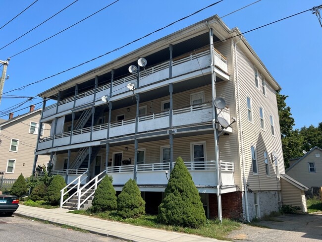
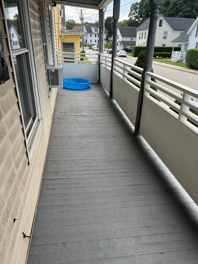
Property Record
49 Brook St, Willimantic, CT 06226

Property Detail
49 Brook St
WIND-001403-000123-000015
Southeastern Ct
Commercialbuilding
Connecticut
NPR2
15
2025
0.18 AC
2025
Windham County
800600
Hartford
5,040 SF
Willimantic, CT
NEARBY LISTINGS FOR SALE OR LEASE
-
-
View all Willimantic listings for sale on LoopNet.com
DEMOGRAPHICS near 49 Brook St
1 mile
3 mile
5 mile
2025 Total Population
11,689
26,718
35,664
2030 Population
11,899
27,081
36,164
Pop Growth 2025-2030
+ 1.80%
+ 1.36%
+ 1.40%
Average Age
37
37
39
2025 Total Households
4,560
9,882
13,446
HH Growth 2025-2030
+ 1.62%
+ 1.43%
+ 1.45%
Median Household Inc
$47,357
$52,048
$62,671
Avg Household Size
2.30
2.30
2.40
2025 Avg HH Vehicles
1.00
2.00
2.00
Median Home Value
$196,961
$226,613
$260,894
Median Year Built
1950
1962
1965
Nearby Places
Map Layers
Map Styles
 Street
 Aerial
Transit
 Traffic
 Biking
Places
Listings with unknown addresses are not visible on the map
- Restaurants
- Banks
- Shops
- Fitness
- Groceries
PUBLIC TRANSPORTATION
AIRPORT
Bradley International
Drive
Walk
Distance
Bradley International
69 min
43.5 mi
Freight Ports
Port of New Haven
Drive
Walk
Distance
Port of New Haven
82 min
57.9 mi
SALE & LEASE HISTORY
LISTING DATE
SALE/LEASE

Nov 02, 2023
For Sale
Nearby Properties
Address
Land Use
TOTAL SIZE
Lot Size
Zoning
Address
Land Use
TOTAL SIZE
Lot Size
Zoning
14.62 AC
B4
Address
Land Use
TOTAL SIZE
Lot Size
Zoning
33,366 SF
R6
Address
Land Use
TOTAL SIZE
Lot Size
Zoning
145,144 SF
R6
Address
Land Use
TOTAL SIZE
Lot Size
Zoning
127,472 SF
R6
Address
Land Use
TOTAL SIZE
Lot Size
Zoning
14.50 AC
R20
Address
Land Use
TOTAL SIZE
Lot Size
Zoning
111,757 SF
6.74 AC
RL
Address
Land Use
TOTAL SIZE
Lot Size
Zoning
90,450 SF
R6
Address
Land Use
TOTAL SIZE
Lot Size
Zoning
73,691 SF
R6
Address
Land Use
TOTAL SIZE
Lot Size
Zoning
99,139 SF
R6
Address
Land Use
TOTAL SIZE
Lot Size
Zoning
86,899 SF
18.27 AC
R3
Address
Land Use
TOTAL SIZE
Lot Size
Zoning
68,508 SF
R6
Address
Land Use
TOTAL SIZE
Lot Size
Zoning
316,812 SF
39.88 AC
R4
Address
Land Use
TOTAL SIZE
Lot Size
Zoning
57,648 SF
R6
Address
Land Use
TOTAL SIZE
Lot Size
Zoning
22.30 AC
RL
Address
Land Use
TOTAL SIZE
Lot Size
Zoning
28,231 SF
R6
Address
Land Use
TOTAL SIZE
Lot Size
Zoning
158,766 SF
3.91 AC
R6
Address
Land Use
TOTAL SIZE
Lot Size
Zoning
24,313 SF
R6
Address
Land Use
TOTAL SIZE
Lot Size
Zoning
275,230 SF
27.63 AC
PB1
Address
Land Use
TOTAL SIZE
Lot Size
Zoning
200 AC
R2 - 1
Address
Land Use
TOTAL SIZE
Lot Size
Zoning
63,224 SF
2.68 AC
R6
Address
Land Use
TOTAL SIZE
Lot Size
Zoning
231.54 AC
C2A
Address
Land Use
TOTAL SIZE
Lot Size
Zoning
300,483 SF
R6
Address
Land Use
TOTAL SIZE
Lot Size
Zoning
57,350 SF
R6
Address
Land Use
TOTAL SIZE
Lot Size
Zoning
44,000 SF
R6
Address
Land Use
TOTAL SIZE
Lot Size
Zoning
1,552 SF
10.06 AC
DMR
Address
Land Use
TOTAL SIZE
Lot Size
Zoning
90.58 AC
M1
Address
Land Use
TOTAL SIZE
Lot Size
Zoning
3.50 AC
R6
Address
Land Use
TOTAL SIZE
Lot Size
Zoning
131 SF
M1 - 1
Address
Land Use
TOTAL SIZE
Lot Size
Zoning
67,532 SF
R6
Address
Land Use
TOTAL SIZE
Lot Size
Zoning
168,728 SF
24.40 AC
C4
The World's #1 Commercial Real Estate Marketplace
Connect with us
© 2026 CoStar Group
The information above has been obtained from sources believed reliable. While we do not doubt its accuracy we have not verified it and make no guarantee, warranty or representation about it. It is your responsibility to independently confirm its accuracy and completeness. Any projections, opinions, assumptions, or estimates used are for example only and do not represent the current or future performance of the property. The value of this transaction to you depends on tax and other factors which should be evaluated by your tax, financial, and legal advisors. You and your advisors should conduct a careful, independent investigation of the property to determine to your satisfaction the suitability of the property for your needs.