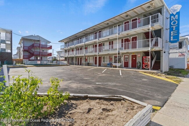
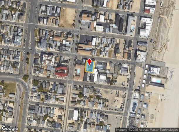
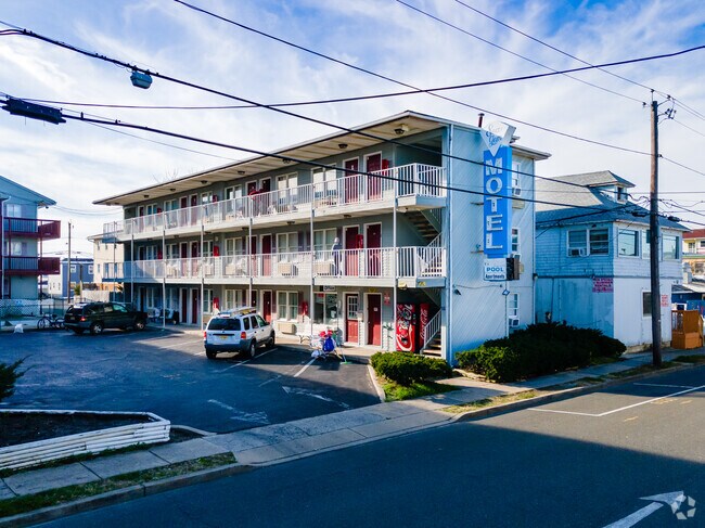
Property Record
49 Dupont Ave, Seaside Heights, NJ 08751
NEARBY LISTINGS FOR SALE OR LEASE
Property Detail
49 Dupont Ave
27-00001-0000-00049
80 X 110
Commercialnec
Ocean
AE
New Jersey
34029C0329F
49
2024
0.20 AC
2025
North Shore
728004
Northern New Jersey
6,480 SF
New York-Jersey City-White Plains, NY-NJ
DEMOGRAPHICS near 49 Dupont Ave
1 Mile
3 Mile
5 Mile
2024 Total Population
7,849
23,751
64,451
2029 Population
9,097
27,489
71,947
Pop Growth 2024-2029
+ 15.90%
+ 15.74%
+ 11.63%
Average Age
44
49
45
2024 Total Households
3,746
11,295
27,576
HH Growth 2024-2029
+ 15.67%
+ 15.74%
+ 12.27%
Median Household Inc
$53,972
$73,825
$79,449
Avg Household Size
2.00
2.00
2.20
2024 Avg HH Vehicles
1.00
2.00
2.00
Median Home Value
$513,495
$609,540
$433,941
Median Year Built
1966
1969
1972
Nearby Places
Map Layers
Map Styles
 Street
 Aerial
- Restaurants
- Banks
- Shops
- Fitness
- Groceries
PUBLIC TRANSPORTATION
COMMUTER RAIL
Bay Head (North Jersey Coast Line - NJ Transit Commuter Rail (NJ Transit))
DRIVE
WALK
Distance
Bay Head (North Jersey Coast Line - NJ Transit Commuter Rail (NJ Transit))
22 min
9.9 mi
SALE & LEASE HISTORY
LISTING DATE
SALE/LEASE

Nov 08, 2023
For Sale
Nearby Properties
Address
Land Use
TOTAL SIZE
Lot Size
Zoning
Address
Land Use
TOTAL SIZE
Lot Size
Zoning
1.27 AC
P
Address
Land Use
TOTAL SIZE
Lot Size
Zoning
744 SF
0.69 AC
RB
Address
Land Use
TOTAL SIZE
Lot Size
Zoning
44,768 SF
0.62 AC
RRA
Address
Land Use
TOTAL SIZE
Lot Size
Zoning
Address
Land Use
TOTAL SIZE
Lot Size
Zoning
2,636 SF
2.90 AC
RRA
Address
Land Use
TOTAL SIZE
Lot Size
Zoning
12,520 SF
1.81 AC
RB
Address
Land Use
TOTAL SIZE
Lot Size
Zoning
39,331 SF
0.52 AC
RR
Address
Land Use
TOTAL SIZE
Lot Size
Zoning
4,563 SF
2.50 AC
RR
Address
Land Use
TOTAL SIZE
Lot Size
Zoning
1.19 AC
RB
Address
Land Use
TOTAL SIZE
Lot Size
Zoning
0.97 AC
RB
Address
Land Use
TOTAL SIZE
Lot Size
Zoning
12.70 AC
PUB
Address
Land Use
TOTAL SIZE
Lot Size
Zoning
0.82 AC
RB
Address
Land Use
TOTAL SIZE
Lot Size
Zoning
1.37 AC
RRS
Address
Land Use
TOTAL SIZE
Lot Size
Zoning
6.16 AC
MF16
Address
Land Use
TOTAL SIZE
Lot Size
Zoning
1.30 AC
RR
Address
Land Use
TOTAL SIZE
Lot Size
Zoning
0.75 AC
RR
Address
Land Use
TOTAL SIZE
Lot Size
Zoning
20,271 SF
0.96 AC
PUB
Address
Land Use
TOTAL SIZE
Lot Size
Zoning
3,209 SF
7.40 AC
GB
Address
Land Use
TOTAL SIZE
Lot Size
Zoning
1.36 AC
PUB
Address
Land Use
TOTAL SIZE
Lot Size
Zoning
8.78 AC
P
Address
Land Use
TOTAL SIZE
Lot Size
Zoning
Address
Land Use
TOTAL SIZE
Lot Size
Zoning
2.50 AC
RR
Address
Land Use
TOTAL SIZE
Lot Size
Zoning
1,344 SF
0.20 AC
RR
Address
Land Use
TOTAL SIZE
Lot Size
Zoning
8.19 AC
P
Address
Land Use
TOTAL SIZE
Lot Size
Zoning
12,008 SF
0.53 AC
RB
Address
Land Use
TOTAL SIZE
Lot Size
Zoning
29,422 SF
1.30 AC
Address
Land Use
TOTAL SIZE
Lot Size
Zoning
1.29 AC
Address
Land Use
TOTAL SIZE
Lot Size
Zoning
2.04 AC
LDR
Address
Land Use
TOTAL SIZE
Lot Size
Zoning
12.01 AC
P
Address
Land Use
TOTAL SIZE
Lot Size
Zoning
1,736 SF
0.37 AC
RR
The World's #1 Commercial Real Estate Marketplace
Connect with us
© 2025 CoStar Group
The information above has been obtained from sources believed reliable. While we do not doubt its accuracy we have not verified it and make no guarantee, warranty or representation about it. It is your responsibility to independently confirm its accuracy and completeness. Any projections, opinions, assumptions, or estimates used are for example only and do not represent the current or future performance of the property. The value of this transaction to you depends on tax and other factors which should be evaluated by your tax, financial, and legal advisors. You and your advisors should conduct a careful, independent investigation of the property to determine to your satisfaction the suitability of the property for your needs.