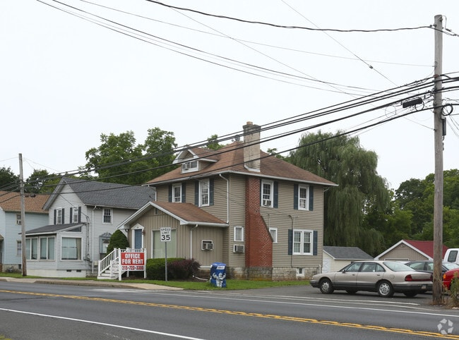
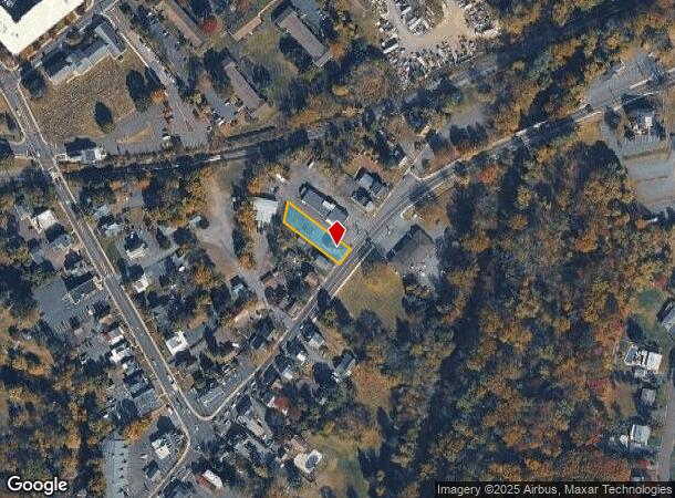
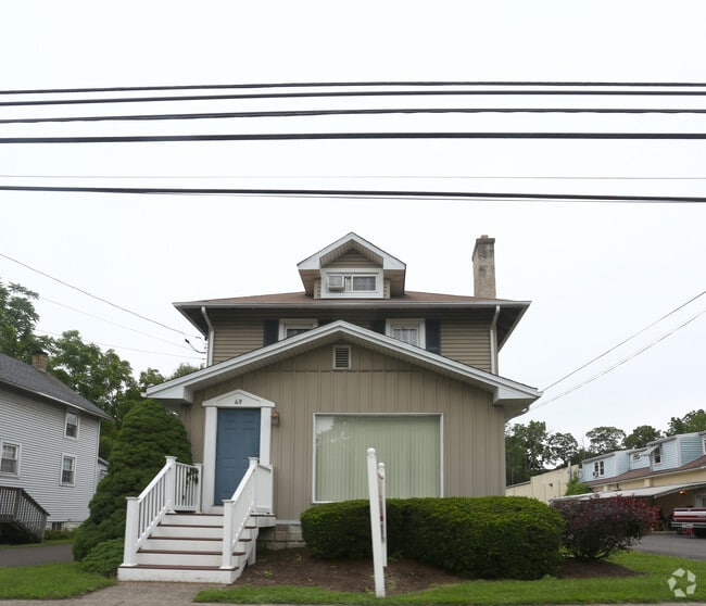
Property Record
49 E Butler Ave, Chalfont, PA 18914
NEARBY LISTINGS FOR SALE OR LEASE
Property Detail
49 E Butler Ave
07-006-114
LOT N S US202 516 FT E SR 152 50X207
Storemultistory
Bucks
AE
Pennsylvania
42017C0287K
n
2024
0.24 AC
2025
Upper Bucks County
101900
Philadelphia
1,324 SF
Philadelphia-Camden-Wilmington, PA-NJ-DE-MD
DEMOGRAPHICS near 49 E Butler Ave
1 Mile
3 Mile
5 Mile
2024 Total Population
6,895
37,059
118,520
2029 Population
6,875
37,075
119,654
Pop Growth 2024-2029
(0.29%)
+ 0.04%
+ 0.96%
Average Age
42
42
43
2024 Total Households
2,556
12,969
43,829
HH Growth 2024-2029
(0.20%)
+ 0.02%
+ 0.97%
Median Household Inc
$123,157
$129,835
$112,416
Avg Household Size
2.60
2.70
2.60
2024 Avg HH Vehicles
2.00
2.00
2.00
Median Home Value
$417,457
$442,919
$439,520
Median Year Built
1973
1983
1983
Nearby Places
Map Layers
Map Styles
 Street
 Aerial
- Restaurants
- Banks
- Shops
- Fitness
- Groceries
PUBLIC TRANSPORTATION
TRANSIT/SUBWAY
Chalfont (R5 - Southeastern Pennsylvania Transportation Authority Regional Rail (SEPTA Regional Rail))
DRIVE
WALK
Distance
Chalfont (R5 - Southeastern Pennsylvania Transportation Authority Regional Rail (SEPTA Regional Rail))
1 min
8 min
0.4 mi
COMMUTER RAIL
Chalfont (R5 - Southeastern Pennsylvania Transportation Authority Regional Rail (SEPTA Regional Rail))
DRIVE
WALK
Distance
Chalfont (R5 - Southeastern Pennsylvania Transportation Authority Regional Rail (SEPTA Regional Rail))
1 min
7 min
0.4 mi
New Britain (R5 - Southeastern Pennsylvania Transportation Authority Regional Rail (SEPTA Regional Rail))
DRIVE
WALK
Distance
New Britain (R5 - Southeastern Pennsylvania Transportation Authority Regional Rail (SEPTA Regional Rail))
4 min
1.7 mi
AIRPORT
Trenton Mercer
DRIVE
WALK
Distance
Trenton Mercer
46 min
27.6 mi
Lehigh Valley International
DRIVE
WALK
Distance
Lehigh Valley International
57 min
34.6 mi
Philadelphia International
DRIVE
WALK
Distance
Philadelphia International
65 min
37.7 mi
SALE & LEASE HISTORY
LISTING DATE
SALE/LEASE

Aug 02, 2017
For Lease
Nearby Properties
Address
Land Use
TOTAL SIZE
Lot Size
Zoning
Address
Land Use
TOTAL SIZE
Lot Size
Zoning
89,349 SF
18.11 AC
R1
Address
Land Use
TOTAL SIZE
Lot Size
Zoning
88,060 SF
20.74 AC
R1
Address
Land Use
TOTAL SIZE
Lot Size
Zoning
380,875 SF
40.10 AC
LI
Address
Land Use
TOTAL SIZE
Lot Size
Zoning
72,937 SF
42.19 AC
CR
Address
Land Use
TOTAL SIZE
Lot Size
Zoning
79,335 SF
11.50 AC
LI
Address
Land Use
TOTAL SIZE
Lot Size
Zoning
361,858 SF
27.82 AC
LI
Address
Land Use
TOTAL SIZE
Lot Size
Zoning
86,930 SF
1.76 AC
LI
Address
Land Use
TOTAL SIZE
Lot Size
Zoning
5,856 SF
2.37 AC
LI
Address
Land Use
TOTAL SIZE
Lot Size
Zoning
65,000 SF
6.08 AC
LI
Address
Land Use
TOTAL SIZE
Lot Size
Zoning
26,024 SF
3.29 AC
LI
Address
Land Use
TOTAL SIZE
Lot Size
Zoning
76,560 SF
11.51 AC
LI
Address
Land Use
TOTAL SIZE
Lot Size
Zoning
26,650 SF
3.66 AC
LI
Address
Land Use
TOTAL SIZE
Lot Size
Zoning
33,337 SF
14.88 AC
C3
Address
Land Use
TOTAL SIZE
Lot Size
Zoning
32,964 SF
9.65 AC
BP
Address
Land Use
TOTAL SIZE
Lot Size
Zoning
45,759 SF
4.20 AC
LI
Address
Land Use
TOTAL SIZE
Lot Size
Zoning
144,419 SF
21.13 AC
C2
Address
Land Use
TOTAL SIZE
Lot Size
Zoning
344,604 SF
6.95 AC
LI
Address
Land Use
TOTAL SIZE
Lot Size
Zoning
23,500 SF
7.65 AC
R1
Address
Land Use
TOTAL SIZE
Lot Size
Zoning
20,365 SF
5.65 AC
C
Address
Land Use
TOTAL SIZE
Lot Size
Zoning
53,730 SF
2.82 AC
C
Address
Land Use
TOTAL SIZE
Lot Size
Zoning
35,660 SF
5 AC
BP
Address
Land Use
TOTAL SIZE
Lot Size
Zoning
52,500 SF
4.15 AC
LI
Address
Land Use
TOTAL SIZE
Lot Size
Zoning
68,450 SF
4.18 AC
C
Address
Land Use
TOTAL SIZE
Lot Size
Zoning
12,150 SF
5.60 AC
C
Address
Land Use
TOTAL SIZE
Lot Size
Zoning
31,254 SF
3 AC
LI
Address
Land Use
TOTAL SIZE
Lot Size
Zoning
39,696 SF
2.50 AC
C
Address
Land Use
TOTAL SIZE
Lot Size
Zoning
3,105 SF
1.96 AC
C
Address
Land Use
TOTAL SIZE
Lot Size
Zoning
20,800 SF
2.34 AC
LI
Address
Land Use
TOTAL SIZE
Lot Size
Zoning
25,372 SF
32 AC
R6
Address
Land Use
TOTAL SIZE
Lot Size
Zoning
55,805 SF
2.11 AC
RA1
The World's #1 Commercial Real Estate Marketplace
Connect with us
© 2026 CoStar Group
The information above has been obtained from sources believed reliable. While we do not doubt its accuracy we have not verified it and make no guarantee, warranty or representation about it. It is your responsibility to independently confirm its accuracy and completeness. Any projections, opinions, assumptions, or estimates used are for example only and do not represent the current or future performance of the property. The value of this transaction to you depends on tax and other factors which should be evaluated by your tax, financial, and legal advisors. You and your advisors should conduct a careful, independent investigation of the property to determine to your satisfaction the suitability of the property for your needs.