Property Record
49 E Monroe St, Franklin, IN 46131
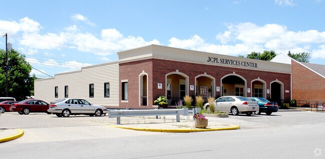


Property Detail
49 E Monroe St
Indianapolis-Carmel-Greenwood, IN
O P FRANKLIN LOT 66 MP FRANKLIN COMMUNI
41-08-14-043-120.000-009
Johnson
Officebuilding
Indiana
B and X Area of moderate flood hazard, usually the area between the limits of the 100-year and 500-year floods.
66
0
0.24 AC
2025
Far South Johnson Cty
611000
Indianapolis
7,576 SF
NEARBY LISTINGS FOR SALE OR LEASE
DEMOGRAPHICS near 49 E Monroe St
1 mile
3 mile
5 mile
2025 Total Population
8,380
27,314
36,326
2030 Population
8,843
28,696
38,183
Pop Growth 2025-2030
+ 5.53%
+ 5.06%
+ 5.11%
Average Age
41
40
40
2025 Total Households
3,108
10,187
13,454
HH Growth 2025-2030
+ 6.08%
+ 5.31%
+ 5.34%
Median Household Inc
$77,328
$85,593
$87,259
Avg Household Size
2.30
2.50
2.50
2025 Avg HH Vehicles
2.00
2.00
2.00
Median Home Value
$229,287
$256,395
$250,229
Median Year Built
1966
1991
1992
Nearby Places
Map Layers
Map Styles
 Street
 Aerial
Transit
 Traffic
 Biking
Places
Listings with unknown addresses are not visible on the map
- Restaurants
- Banks
- Shops
- Fitness
- Groceries
PUBLIC TRANSPORTATION
AIRPORT
Indianapolis International
Drive
Walk
Distance
Indianapolis International
49 min
30.4 mi
Freight Ports
Port of Toledo
Drive
Walk
Distance
Port of Toledo
295 min
247.3 mi
Nearby Properties
Address
Land Use
TOTAL SIZE
Lot Size
Zoning
Address
Land Use
TOTAL SIZE
Lot Size
Zoning
2,908 SF
1.31 AC
Address
Land Use
TOTAL SIZE
Lot Size
Zoning
954,880 SF
42.36 AC
Address
Land Use
TOTAL SIZE
Lot Size
Zoning
35,382 SF
42.11 AC
Address
Land Use
TOTAL SIZE
Lot Size
Zoning
153,589 SF
160.27 AC
Address
Land Use
TOTAL SIZE
Lot Size
Zoning
933,504 SF
42.07 AC
Address
Land Use
TOTAL SIZE
Lot Size
Zoning
806,916 SF
42.56 AC
Address
Land Use
TOTAL SIZE
Lot Size
Zoning
519,376 SF
53.98 AC
Address
Land Use
TOTAL SIZE
Lot Size
Zoning
553,152 SF
35.86 AC
Address
Land Use
TOTAL SIZE
Lot Size
Zoning
160.96 AC
PUD
Address
Land Use
TOTAL SIZE
Lot Size
Zoning
3,668 SF
18.95 AC
Address
Land Use
TOTAL SIZE
Lot Size
Zoning
1,792 SF
66.50 AC
Address
Land Use
TOTAL SIZE
Lot Size
Zoning
146,505 SF
30.71 AC
Address
Land Use
TOTAL SIZE
Lot Size
Zoning
232,709 SF
51.30 AC
Address
Land Use
TOTAL SIZE
Lot Size
Zoning
8,504 SF
31.42 AC
Address
Land Use
TOTAL SIZE
Lot Size
Zoning
193,378 SF
20.55 AC
Address
Land Use
TOTAL SIZE
Lot Size
Zoning
7,304 SF
15.32 AC
Address
Land Use
TOTAL SIZE
Lot Size
Zoning
119,499 SF
11.54 AC
Address
Land Use
TOTAL SIZE
Lot Size
Zoning
54,436 SF
18.83 AC
Address
Land Use
TOTAL SIZE
Lot Size
Zoning
207,310 SF
17.20 AC
Address
Land Use
TOTAL SIZE
Lot Size
Zoning
60,000 SF
20.19 AC
Address
Land Use
TOTAL SIZE
Lot Size
Zoning
86,082 SF
8.14 AC
Address
Land Use
TOTAL SIZE
Lot Size
Zoning
193,690 SF
47 AC
Address
Land Use
TOTAL SIZE
Lot Size
Zoning
2,516 SF
7.87 AC
Address
Land Use
TOTAL SIZE
Lot Size
Zoning
2,304 SF
14.05 AC
Address
Land Use
TOTAL SIZE
Lot Size
Zoning
66,906 SF
2.92 AC
Address
Land Use
TOTAL SIZE
Lot Size
Zoning
26,208 SF
3.74 AC
PUD
Address
Land Use
TOTAL SIZE
Lot Size
Zoning
539,190 SF
33.27 AC
Address
Land Use
TOTAL SIZE
Lot Size
Zoning
39.94 AC
PUD
Address
Land Use
TOTAL SIZE
Lot Size
Zoning
140,328 SF
20 AC
Address
Land Use
TOTAL SIZE
Lot Size
Zoning
290,449 SF
22.82 AC
The World's #1 Commercial Real Estate Marketplace
Connect with us
© 2026 CoStar Group
The information above has been obtained from sources believed reliable. While we do not doubt its accuracy we have not verified it and make no guarantee, warranty or representation about it. It is your responsibility to independently confirm its accuracy and completeness. Any projections, opinions, assumptions, or estimates used are for example only and do not represent the current or future performance of the property. The value of this transaction to you depends on tax and other factors which should be evaluated by your tax, financial, and legal advisors. You and your advisors should conduct a careful, independent investigation of the property to determine to your satisfaction the suitability of the property for your needs.