Property Record
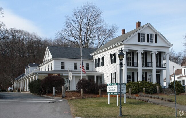
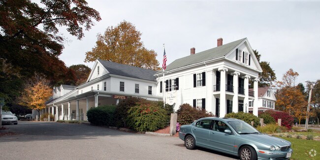
49 Eliot St, Natick, MA 01760

Property Detail
49 Eliot St
Storebuilding
Middlesex
RSB
Massachusetts
B and X Area of moderate flood hazard, usually the area between the limits of the 100-year and 500-year floods.
0.81 AC
2025
Framingham/Natick
2025
Boston
382300
Boston-Cambridge-Newton, MA-NH
8,886 SF
NATI-000063-000000-000062
NEARBY LISTINGS FOR SALE OR LEASE
DEMOGRAPHICS near 49 Eliot St
1 mile
3 mile
5 mile
2025 Total Population
2,778
46,449
132,807
2030 Population
2,906
47,952
137,619
Pop Growth 2025-2030
+ 4.61%
+ 3.24%
+ 3.62%
Average Age
44
41
41
2025 Total Households
980
15,821
46,985
HH Growth 2025-2030
+ 4.69%
+ 3.50%
+ 3.79%
Median Household Inc
$203,213
$196,093
$168,713
Avg Household Size
2.70
2.70
2.70
2025 Avg HH Vehicles
2.00
2.00
2.00
Median Home Value
$959,566
$1,027,313
$1,021,537
Median Year Built
1967
1959
1963
Nearby Places
Map Layers
Map Styles
 Street
 Aerial
Layers
 Traffic
 Biking
Places
Listings with unknown addresses are not visible on the map
- Restaurants
- Banks
- Shops
- Fitness
- Groceries
PUBLIC TRANSPORTATION
COMMUTER RAIL
Natick (Framingham/Worcester Line - Massachusetts Bay Transportation Authority Commuter Rail (Purple Line))
Drive
Walk
Distance
Natick (Framingham/Worcester Line - Massachusetts Bay Transportation Authority Commuter Rail (Purple Line))
5 min
2.1 mi
Wellesley Square (Framingham/Worcester Line - Massachusetts Bay Transportation Authority Commuter Rail (Purple Line))
Drive
Walk
Distance
Wellesley Square (Framingham/Worcester Line - Massachusetts Bay Transportation Authority Commuter Rail (Purple Line))
5 min
2.5 mi
AIRPORT
General Edward Lawrence Logan International
Drive
Walk
Distance
General Edward Lawrence Logan International
32 min
19.9 mi
Worcester Regional
Drive
Walk
Distance
Worcester Regional
55 min
31.7 mi
Freight Ports
Port of Boston
Drive
Walk
Distance
Port of Boston
31 min
18.3 mi
SALE & LEASE HISTORY
LISTING DATE
SALE/LEASE

Sep 25, 2016
For Lease
May 14, 2019
For Lease
Jan 02, 2025
For Lease
Nearby Properties
Address
Land Use
TOTAL SIZE
Lot Size
Zoning
Address
Land Use
TOTAL SIZE
Lot Size
Zoning
10.87 AC
SRD 10
Address
Land Use
TOTAL SIZE
Lot Size
Zoning
188,746 SF
46.90 AC
RSA
Address
Land Use
TOTAL SIZE
Lot Size
Zoning
15,974 SF
2.45 AC
ED
Address
Land Use
TOTAL SIZE
Lot Size
Zoning
6.33 AC
SR10
Address
Land Use
TOTAL SIZE
Lot Size
Zoning
165,382 SF
12.46 AC
HPU
Address
Land Use
TOTAL SIZE
Lot Size
Zoning
15.08 AC
SR10
Address
Land Use
TOTAL SIZE
Lot Size
Zoning
1,683 SF
46.10 AC
SR15
Address
Land Use
TOTAL SIZE
Lot Size
Zoning
122,748 SF
16.90 AC
HPU
Address
Land Use
TOTAL SIZE
Lot Size
Zoning
79.30 AC
RSA
Address
Land Use
TOTAL SIZE
Lot Size
Zoning
3.80 AC
Address
Land Use
TOTAL SIZE
Lot Size
Zoning
25.70 AC
SR10
Address
Land Use
TOTAL SIZE
Lot Size
Zoning
80.85 AC
SR40
Address
Land Use
TOTAL SIZE
Lot Size
Zoning
13,244 SF
12.72 AC
SR10
Address
Land Use
TOTAL SIZE
Lot Size
Zoning
29,022 SF
4.89 AC
RG
Address
Land Use
TOTAL SIZE
Lot Size
Zoning
7.15 AC
Address
Land Use
TOTAL SIZE
Lot Size
Zoning
1,592 SF
10.65 AC
ED
Address
Land Use
TOTAL SIZE
Lot Size
Zoning
7.85 AC
SR10
Address
Land Use
TOTAL SIZE
Lot Size
Zoning
1.43 AC
Address
Land Use
TOTAL SIZE
Lot Size
Zoning
455 SF
18.97 AC
SR10
Address
Land Use
TOTAL SIZE
Lot Size
Zoning
182.10 AC
O
Address
Land Use
TOTAL SIZE
Lot Size
Zoning
28.45 AC
Address
Land Use
TOTAL SIZE
Lot Size
Zoning
119,139 SF
6.86 AC
RSA
Address
Land Use
TOTAL SIZE
Lot Size
Zoning
184,086 SF
7.96 AC
RM
Address
Land Use
TOTAL SIZE
Lot Size
Zoning
9.04 AC
SR15
Address
Land Use
TOTAL SIZE
Lot Size
Zoning
81,685 SF
5.53 AC
RSC
Address
Land Use
TOTAL SIZE
Lot Size
Zoning
147,999 SF
7.73 AC
HM-II
Address
Land Use
TOTAL SIZE
Lot Size
Zoning
1.55 AC
Address
Land Use
TOTAL SIZE
Lot Size
Zoning
25,846 SF
16.67 AC
RSC
Address
Land Use
TOTAL SIZE
Lot Size
Zoning
64,225 SF
5.19 AC
RSC
Address
Land Use
TOTAL SIZE
Lot Size
Zoning
4,508 SF
87.96 AC
SR20
The World's #1 Commercial Real Estate Marketplace
Connect with us
© 2026 CoStar Group
The information above has been obtained from sources believed reliable. While we do not doubt its accuracy we have not verified it and make no guarantee, warranty or representation about it. It is your responsibility to independently confirm its accuracy and completeness. Any projections, opinions, assumptions, or estimates used are for example only and do not represent the current or future performance of the property. The value of this transaction to you depends on tax and other factors which should be evaluated by your tax, financial, and legal advisors. You and your advisors should conduct a careful, independent investigation of the property to determine to your satisfaction the suitability of the property for your needs.