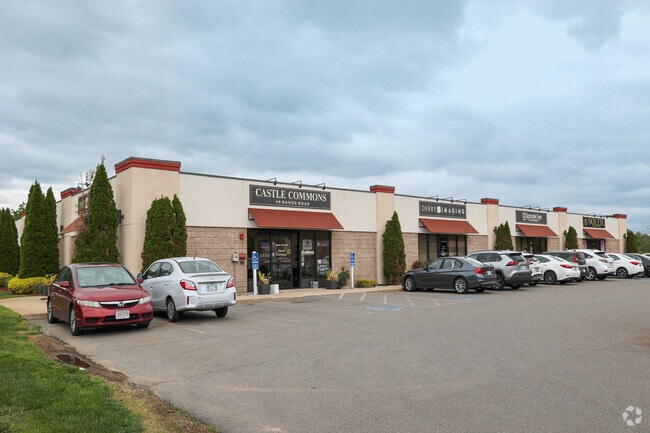
Property Record
49 Range Rd, Windham, NH 03087

Property Detail
49 Range Rd
WNDM-000018-L000000-000400
Rockingham
Commercialbuilding
New Hampshire
MZ
400
B and X Area of moderate flood hazard, usually the area between the limits of the 100-year and 500-year floods.
12.47 AC
2024
Rockingham
2024
Boston
106102
Boston-Cambridge-Newton, MA-NH
23,964 SF
NEARBY LISTINGS FOR SALE OR LEASE
DEMOGRAPHICS near 49 Range Rd
1 mile
3 mile
5 mile
2025 Total Population
1,974
23,533
60,675
2030 Population
2,020
24,058
61,503
Pop Growth 2025-2030
+ 2.33%
+ 2.23%
+ 1.36%
Average Age
44
44
44
2025 Total Households
714
8,952
22,647
HH Growth 2025-2030
+ 2.38%
+ 2.37%
+ 1.39%
Median Household Inc
$152,055
$125,050
$127,624
Avg Household Size
2.70
2.60
2.60
2025 Avg HH Vehicles
2.00
2.00
2.00
Median Home Value
$717,460
$620,609
$577,819
Median Year Built
1985
1982
1982
Nearby Places
Map Layers
Map Styles
 Street
 Aerial
Transit
 Traffic
 Biking
Places
Listings with unknown addresses are not visible on the map
- Restaurants
- Banks
- Shops
- Fitness
- Groceries
PUBLIC TRANSPORTATION
AIRPORT
Manchester Boston Regional
Drive
Walk
Distance
Manchester Boston Regional
30 min
16.8 mi
General Edward Lawrence Logan International
Drive
Walk
Distance
General Edward Lawrence Logan International
52 min
38.0 mi
Portsmouth International at Pease
Drive
Walk
Distance
Portsmouth International at Pease
60 min
40.5 mi
Nearby Properties
Address
Land Use
TOTAL SIZE
Lot Size
Zoning
Address
Land Use
TOTAL SIZE
Lot Size
Zoning
306,500 SF
8.31 AC
CIC
Address
Land Use
TOTAL SIZE
Lot Size
Zoning
8.37 AC
CIC
Address
Land Use
TOTAL SIZE
Lot Size
Zoning
273,035 SF
7.70 AC
CIC
Address
Land Use
TOTAL SIZE
Lot Size
Zoning
75.16 AC
CIB
Address
Land Use
TOTAL SIZE
Lot Size
Zoning
137,886 SF
26.65 AC
CIC
Address
Land Use
TOTAL SIZE
Lot Size
Zoning
72.18 AC
CIB
Address
Land Use
TOTAL SIZE
Lot Size
Zoning
225,000 SF
1.62 AC
CIC
Address
Land Use
TOTAL SIZE
Lot Size
Zoning
7.99 AC
CIB
Address
Land Use
TOTAL SIZE
Lot Size
Zoning
215,338 SF
66.52 AC
CIB
Address
Land Use
TOTAL SIZE
Lot Size
Zoning
173,760 SF
16.48 AC
CIC
Address
Land Use
TOTAL SIZE
Lot Size
Zoning
137,420 SF
15 AC
TCD
Address
Land Use
TOTAL SIZE
Lot Size
Zoning
50,048 SF
8.81 AC
CIB
Address
Land Use
TOTAL SIZE
Lot Size
Zoning
13,158 SF
52.40 AC
VCD
Address
Land Use
TOTAL SIZE
Lot Size
Zoning
113,388 SF
16.28 AC
CIB
Address
Land Use
TOTAL SIZE
Lot Size
Zoning
Address
Land Use
TOTAL SIZE
Lot Size
Zoning
21.88 AC
CIC
Address
Land Use
TOTAL SIZE
Lot Size
Zoning
Address
Land Use
TOTAL SIZE
Lot Size
Zoning
66,543 SF
6.74 AC
CIB
Address
Land Use
TOTAL SIZE
Lot Size
Zoning
71,854 SF
26 AC
RD
Address
Land Use
TOTAL SIZE
Lot Size
Zoning
21.56 AC
CIB
Address
Land Use
TOTAL SIZE
Lot Size
Zoning
155,040 SF
16.36 AC
IND
Address
Land Use
TOTAL SIZE
Lot Size
Zoning
38,168 SF
5 AC
CIC
Address
Land Use
TOTAL SIZE
Lot Size
Zoning
21,433 SF
7.54 AC
LID
Address
Land Use
TOTAL SIZE
Lot Size
Zoning
63,628 SF
34.21 AC
CDA
Address
Land Use
TOTAL SIZE
Lot Size
Zoning
11.49 AC
CIB
Address
Land Use
TOTAL SIZE
Lot Size
Zoning
59,565 SF
41.20 AC
RD
Address
Land Use
TOTAL SIZE
Lot Size
Zoning
55,980 SF
2.08 AC
TCD
Address
Land Use
TOTAL SIZE
Lot Size
Zoning
46,991 SF
5.68 AC
CIB
Address
Land Use
TOTAL SIZE
Lot Size
Zoning
46,389 SF
8.06 AC
B1
Address
Land Use
TOTAL SIZE
Lot Size
Zoning
19,920 SF
15 AC
PBT
The World's #1 Commercial Real Estate Marketplace
Connect with us
© 2026 CoStar Group
The information above has been obtained from sources believed reliable. While we do not doubt its accuracy we have not verified it and make no guarantee, warranty or representation about it. It is your responsibility to independently confirm its accuracy and completeness. Any projections, opinions, assumptions, or estimates used are for example only and do not represent the current or future performance of the property. The value of this transaction to you depends on tax and other factors which should be evaluated by your tax, financial, and legal advisors. You and your advisors should conduct a careful, independent investigation of the property to determine to your satisfaction the suitability of the property for your needs.