Property Record
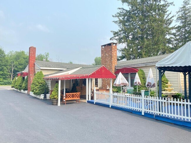
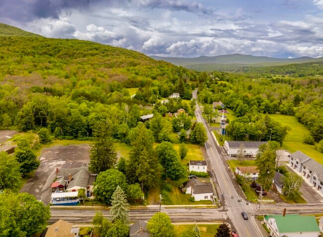
49 Route 65 Rd, Windham, NY 12496

NEARBY LISTINGS FOR SALE OR LEASE
Property Detail
49 Route 65 Rd
Restaurantbuilding
Greene
X
New York
36039C0212F
25.000
2025
1.20 AC
2024
Greene County
080301
Albany/Schenectady/Troy
4,032 SF
194600-096-014-0003-025-000-0000
DEMOGRAPHICS near 49 Route 65 Rd
1 Mile
3 Mile
5 Mile
2024 Total Population
409
1,462
2,572
2029 Population
411
1,483
2,623
Pop Growth 2024-2029
+ 0.49%
+ 1.44%
+ 1.98%
Average Age
47
48
48
2024 Total Households
185
672
1,207
HH Growth 2024-2029
0.00%
+ 1.19%
+ 1.91%
Median Household Inc
$62,727
$58,695
$56,811
Avg Household Size
2.20
2.10
2.10
2024 Avg HH Vehicles
2.00
2.00
2.00
Median Home Value
$259,999
$271,379
$276,908
Median Year Built
1983
1982
1982
Nearby Places
Map Layers
Map Styles
 Street
 Aerial
- Restaurants
- Banks
- Shops
- Fitness
- Groceries
SALE & LEASE HISTORY
LISTING DATE
SALE/LEASE

Sep 29, 2017
For Sale
Oct 03, 2017
For Sale
Jun 05, 2023
For Sale
Jun 02, 2023
For Sale
Jul 26, 2021
For Sale
Jul 18, 2023
For Sale
Jul 17, 2024
For Sale
Jan 05, 2024
For Sale
Feb 26, 2024
For Sale
Apr 25, 2017
For Sale
Nearby Properties
Address
Land Use
TOTAL SIZE
Lot Size
Zoning
Address
Land Use
TOTAL SIZE
Lot Size
Zoning
74,525 SF
556.50 AC
01 - NOT Z
Address
Land Use
TOTAL SIZE
Lot Size
Zoning
459.49 AC
01 - NOT Z
Address
Land Use
TOTAL SIZE
Lot Size
Zoning
61,956 SF
8.30 AC
01 - NOT Z
Address
Land Use
TOTAL SIZE
Lot Size
Zoning
20,880 SF
11.60 AC
01 - NOT Z
Address
Land Use
TOTAL SIZE
Lot Size
Zoning
17,229 SF
19.62 AC
01 - NOT Z
Address
Land Use
TOTAL SIZE
Lot Size
Zoning
8.07 AC
01 - NOT Z
Address
Land Use
TOTAL SIZE
Lot Size
Zoning
8,600 SF
0.96 AC
01 - NOT Z
Address
Land Use
TOTAL SIZE
Lot Size
Zoning
8,049 SF
2.46 AC
01 - NOT Z
Address
Land Use
TOTAL SIZE
Lot Size
Zoning
12,700 SF
119.28 AC
01 - NOT Z
Address
Land Use
TOTAL SIZE
Lot Size
Zoning
14,800 SF
17.02 AC
01 - NOT Z
Address
Land Use
TOTAL SIZE
Lot Size
Zoning
Address
Land Use
TOTAL SIZE
Lot Size
Zoning
Address
Land Use
TOTAL SIZE
Lot Size
Zoning
9,869 SF
3.80 AC
01 - NOT Z
Address
Land Use
TOTAL SIZE
Lot Size
Zoning
4,244 SF
29.90 AC
RC
Address
Land Use
TOTAL SIZE
Lot Size
Zoning
21,504 SF
8.58 AC
01 - NOT Z
Address
Land Use
TOTAL SIZE
Lot Size
Zoning
9,129 SF
2.10 AC
01 - NOT Z
Address
Land Use
TOTAL SIZE
Lot Size
Zoning
128.27 AC
RC
Address
Land Use
TOTAL SIZE
Lot Size
Zoning
10,516 SF
10.23 AC
01 - NOT Z
Address
Land Use
TOTAL SIZE
Lot Size
Zoning
3,748 SF
2 AC
01 - NOT Z
Address
Land Use
TOTAL SIZE
Lot Size
Zoning
2,070 SF
31.78 AC
01 - NOT Z
Address
Land Use
TOTAL SIZE
Lot Size
Zoning
8,554 SF
1.10 AC
01 - NOT Z
Address
Land Use
TOTAL SIZE
Lot Size
Zoning
6,996 SF
3.10 AC
01 - NOT Z
Address
Land Use
TOTAL SIZE
Lot Size
Zoning
2,501 SF
4.77 AC
01 - NOT Z
Address
Land Use
TOTAL SIZE
Lot Size
Zoning
4,480 SF
0.31 AC
01 - NOT Z
Address
Land Use
TOTAL SIZE
Lot Size
Zoning
90.60 AC
RR
Address
Land Use
TOTAL SIZE
Lot Size
Zoning
7,263 SF
1.03 AC
01 - NOT Z
Address
Land Use
TOTAL SIZE
Lot Size
Zoning
2,440 SF
1.60 AC
01 - NOT Z
Address
Land Use
TOTAL SIZE
Lot Size
Zoning
2,040 SF
14.40 AC
01 - NOT Z
Address
Land Use
TOTAL SIZE
Lot Size
Zoning
0.01 AC
01 - NOT Z
Address
Land Use
TOTAL SIZE
Lot Size
Zoning
2,632 SF
24.64 AC
01 - NOT Z
The World's #1 Commercial Real Estate Marketplace
Connect with us
© 2026 CoStar Group
The information above has been obtained from sources believed reliable. While we do not doubt its accuracy we have not verified it and make no guarantee, warranty or representation about it. It is your responsibility to independently confirm its accuracy and completeness. Any projections, opinions, assumptions, or estimates used are for example only and do not represent the current or future performance of the property. The value of this transaction to you depends on tax and other factors which should be evaluated by your tax, financial, and legal advisors. You and your advisors should conduct a careful, independent investigation of the property to determine to your satisfaction the suitability of the property for your needs.