Property Record
49 Tt Hwy, Noel, MO 64854


NEARBY LISTINGS FOR SALE OR LEASE
-
-
View all Noel listings for sale on LoopNet.com
Property Detail
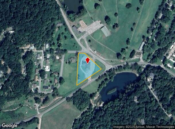
49 Tt Hwy
17-5.0-16-004-002-002.003
BEG 225' E OF INTER S LN HILL TOP RD & E LN HART C IR TH S TO HWY 90 NE 230' N 85' NW 220' TO POB
Restaurantbuilding
Mcdonald
X
Missouri
40041C0225F
1.19 AC
2024
McDonald County
2025
Fayetteville/Springdale/Rogers
070300
Fayetteville-Springdale-Rogers, AR-MO
3,755 SF
DEMOGRAPHICS near 49 Tt Hwy
1 Mile
3 Mile
5 Mile
2024 Total Population
489
3,233
5,363
2029 Population
485
3,237
5,445
Pop Growth 2024-2029
(0.82%)
+ 0.12%
+ 1.53%
Average Age
34
35
36
2024 Total Households
163
1,072
1,846
HH Growth 2024-2029
(0.61%)
0.00%
+ 1.52%
Median Household Inc
$42,307
$36,479
$38,994
Avg Household Size
2.90
2.90
2.80
2024 Avg HH Vehicles
2.00
2.00
2.00
Median Home Value
$140,322
$96,081
$96,064
Median Year Built
1971
1974
1976
Nearby Places
Map Layers
Map Styles
 Street
 Aerial
- Restaurants
- Banks
- Shops
- Fitness
- Groceries
PUBLIC TRANSPORTATION
AIRPORT
Northwest Arkansas Ntl
DRIVE
WALK
Distance
Northwest Arkansas Ntl
55 min
31.7 mi
Freight Ports
Tulsa Port of Inola
DRIVE
WALK
Distance
Tulsa Port of Inola
111 min
93.4 mi
SALE & LEASE HISTORY
LISTING DATE
SALE/LEASE

Jan 02, 2020
For Sale
Nearby Properties
Address
Land Use
TOTAL SIZE
Lot Size
Zoning
Address
Land Use
TOTAL SIZE
Lot Size
Zoning
27,648 SF
61.71 AC
Address
Land Use
TOTAL SIZE
Lot Size
Zoning
1,498 SF
3.19 AC
Address
Land Use
TOTAL SIZE
Lot Size
Zoning
1,680 SF
9.50 AC
Address
Land Use
TOTAL SIZE
Lot Size
Zoning
12,667 SF
2.10 AC
Address
Land Use
TOTAL SIZE
Lot Size
Zoning
3,700 SF
7.18 AC
Address
Land Use
TOTAL SIZE
Lot Size
Zoning
10,532 SF
1.27 AC
Address
Land Use
TOTAL SIZE
Lot Size
Zoning
10,454 SF
18.60 AC
Address
Land Use
TOTAL SIZE
Lot Size
Zoning
3,499 SF
15.89 AC
Address
Land Use
TOTAL SIZE
Lot Size
Zoning
9,321 SF
0.71 AC
Address
Land Use
TOTAL SIZE
Lot Size
Zoning
6,058 SF
1.42 AC
Address
Land Use
TOTAL SIZE
Lot Size
Zoning
Address
Land Use
TOTAL SIZE
Lot Size
Zoning
3,360 SF
6.82 AC
Address
Land Use
TOTAL SIZE
Lot Size
Zoning
12,319 SF
1.60 AC
Address
Land Use
TOTAL SIZE
Lot Size
Zoning
2,784 SF
0.52 AC
Address
Land Use
TOTAL SIZE
Lot Size
Zoning
8,443 SF
0.38 AC
Address
Land Use
TOTAL SIZE
Lot Size
Zoning
1,248 SF
2.21 AC
Address
Land Use
TOTAL SIZE
Lot Size
Zoning
6,684 SF
0.41 AC
Address
Land Use
TOTAL SIZE
Lot Size
Zoning
6,058 SF
2.10 AC
Address
Land Use
TOTAL SIZE
Lot Size
Zoning
11,188 SF
1.58 AC
Address
Land Use
TOTAL SIZE
Lot Size
Zoning
6,020 SF
0.55 AC
Address
Land Use
TOTAL SIZE
Lot Size
Zoning
4,704 SF
69.09 AC
Address
Land Use
TOTAL SIZE
Lot Size
Zoning
4,608 SF
1.11 AC
Address
Land Use
TOTAL SIZE
Lot Size
Zoning
Address
Land Use
TOTAL SIZE
Lot Size
Zoning
3,650 SF
1 AC
Address
Land Use
TOTAL SIZE
Lot Size
Zoning
7,500 SF
0.85 AC
Address
Land Use
TOTAL SIZE
Lot Size
Zoning
5,917 SF
0.14 AC
Address
Land Use
TOTAL SIZE
Lot Size
Zoning
3,942 SF
1.87 AC
Address
Land Use
TOTAL SIZE
Lot Size
Zoning
5,164 SF
0.59 AC
Address
Land Use
TOTAL SIZE
Lot Size
Zoning
2,645 SF
64.80 AC
The World's #1 Commercial Real Estate Marketplace
Connect with us
© 2026 CoStar Group
The information above has been obtained from sources believed reliable. While we do not doubt its accuracy we have not verified it and make no guarantee, warranty or representation about it. It is your responsibility to independently confirm its accuracy and completeness. Any projections, opinions, assumptions, or estimates used are for example only and do not represent the current or future performance of the property. The value of this transaction to you depends on tax and other factors which should be evaluated by your tax, financial, and legal advisors. You and your advisors should conduct a careful, independent investigation of the property to determine to your satisfaction the suitability of the property for your needs.