Property Record
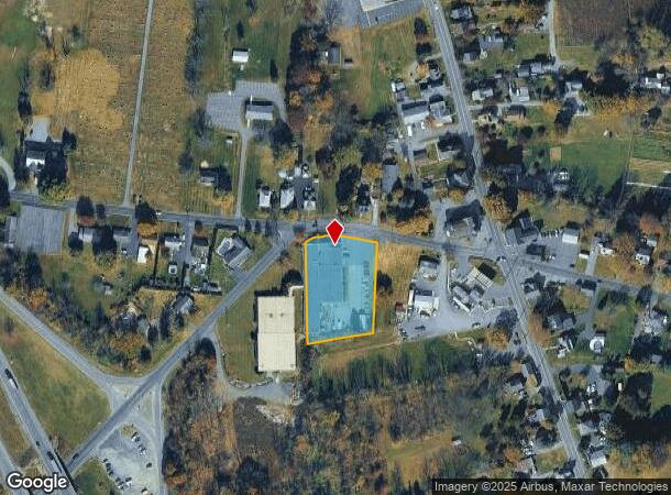
490 Belfast Rd, Nazareth, PA 18064


NEARBY LISTINGS FOR SALE OR LEASE
Property Detail
490 Belfast Rd
H8NW3 4 1 0626
Northampton
Industrialacreage
Pennsylvania
X
1.35 AC
42095C0144E
Lehigh Valley
2025
Philadelphia
2025
Allentown-Bethlehem-Easton, PA-NJ
015500
DEMOGRAPHICS near 490 Belfast Rd
1 Mile
3 Mile
5 Mile
2024 Total Population
1,602
14,065
46,474
2029 Population
1,576
14,116
46,764
Pop Growth 2024-2029
(1.62%)
+ 0.36%
+ 0.62%
Average Age
46
44
44
2024 Total Households
640
5,379
17,804
HH Growth 2024-2029
(1.56%)
+ 0.45%
+ 0.58%
Median Household Inc
$89,964
$94,442
$90,551
Avg Household Size
2.40
2.60
2.50
2024 Avg HH Vehicles
3.00
2.00
2.00
Median Home Value
$267,574
$309,114
$292,561
Median Year Built
1971
1978
1984
Nearby Places
Map Layers
Map Styles
 Street
 Aerial
- Restaurants
- Banks
- Shops
- Fitness
- Groceries
PUBLIC TRANSPORTATION
AIRPORT
Lehigh Valley International
DRIVE
WALK
Distance
Lehigh Valley International
25 min
16.8 mi
Freight Ports
Port of Philadelphia
DRIVE
WALK
Distance
Port of Philadelphia
104 min
66.7 mi
SALE & LEASE HISTORY
LISTING DATE
SALE/LEASE

Sep 23, 2016
For Sale
Oct 17, 2016
For Sale
Nearby Properties
Address
Land Use
TOTAL SIZE
Lot Size
Zoning
Address
Land Use
TOTAL SIZE
Lot Size
Zoning
1,107,596 SF
62.46 AC
RA
Address
Land Use
TOTAL SIZE
Lot Size
Zoning
1,020,930 SF
73.10 AC
RA
Address
Land Use
TOTAL SIZE
Lot Size
Zoning
654,480 SF
43.28 AC
RA
Address
Land Use
TOTAL SIZE
Lot Size
Zoning
130,145 SF
21.19 AC
R3
Address
Land Use
TOTAL SIZE
Lot Size
Zoning
407,685 SF
35.05 AC
RA
Address
Land Use
TOTAL SIZE
Lot Size
Zoning
159,194 SF
42.07 AC
I1
Address
Land Use
TOTAL SIZE
Lot Size
Zoning
160,000 SF
38.72 AC
GI
Address
Land Use
TOTAL SIZE
Lot Size
Zoning
342,820 SF
26.20 AC
RA
Address
Land Use
TOTAL SIZE
Lot Size
Zoning
93,785 SF
76.54 AC
RR
Address
Land Use
TOTAL SIZE
Lot Size
Zoning
130,433 SF
31 AC
RR
Address
Land Use
TOTAL SIZE
Lot Size
Zoning
193,460 SF
18.26 AC
IBP
Address
Land Use
TOTAL SIZE
Lot Size
Zoning
77,799 SF
13.40 AC
11
Address
Land Use
TOTAL SIZE
Lot Size
Zoning
11,355 SF
55.12 AC
I1
Address
Land Use
TOTAL SIZE
Lot Size
Zoning
82,626 SF
18.96 AC
MDR
Address
Land Use
TOTAL SIZE
Lot Size
Zoning
29,666 SF
11.17 AC
FF
Address
Land Use
TOTAL SIZE
Lot Size
Zoning
163,823 SF
10.76 AC
R2
Address
Land Use
TOTAL SIZE
Lot Size
Zoning
55,980 SF
8.48 AC
R10
Address
Land Use
TOTAL SIZE
Lot Size
Zoning
15,100 SF
13.54 AC
MS
Address
Land Use
TOTAL SIZE
Lot Size
Zoning
21,655 SF
4.49 AC
IP
Address
Land Use
TOTAL SIZE
Lot Size
Zoning
48,084 SF
7.96 AC
RA
Address
Land Use
TOTAL SIZE
Lot Size
Zoning
64,283 SF
4.25 AC
R10
Address
Land Use
TOTAL SIZE
Lot Size
Zoning
5,106 SF
60.79 AC
RA
Address
Land Use
TOTAL SIZE
Lot Size
Zoning
18,710 SF
26.90 AC
GC
Address
Land Use
TOTAL SIZE
Lot Size
Zoning
53,467 SF
4.10 AC
IP
Address
Land Use
TOTAL SIZE
Lot Size
Zoning
53,680 SF
49.82 AC
EX1
Address
Land Use
TOTAL SIZE
Lot Size
Zoning
13.85 AC
R1
Address
Land Use
TOTAL SIZE
Lot Size
Zoning
58,902 SF
11.29 AC
1P
Address
Land Use
TOTAL SIZE
Lot Size
Zoning
298.49 AC
RC
Address
Land Use
TOTAL SIZE
Lot Size
Zoning
21,600 SF
11.74 AC
GC
Address
Land Use
TOTAL SIZE
Lot Size
Zoning
23,275 SF
4.10 AC
GI
The World's #1 Commercial Real Estate Marketplace
Connect with us
© 2025 CoStar Group
The information above has been obtained from sources believed reliable. While we do not doubt its accuracy we have not verified it and make no guarantee, warranty or representation about it. It is your responsibility to independently confirm its accuracy and completeness. Any projections, opinions, assumptions, or estimates used are for example only and do not represent the current or future performance of the property. The value of this transaction to you depends on tax and other factors which should be evaluated by your tax, financial, and legal advisors. You and your advisors should conduct a careful, independent investigation of the property to determine to your satisfaction the suitability of the property for your needs.