Property Record
490 E Belvidere Rd, Grayslake, IL 60030
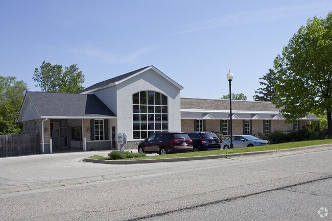

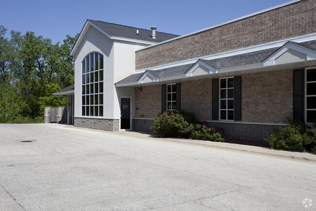
Property Detail
490 E Belvidere Rd
06-35-200-005
PT SW NE BEG AT X OF CEN LN OLD PLANK RD& W LN E TO WLY ROW LN OF RR,NW654,SW 101 TO W LN,S471 TO POB SECTION 35 TOWN SHIP 45 RANGE 10
Commercialbuilding
Lake
AE The base floodplain where base flood elevations are provided. AE Zones are now used on new format FIRMs instead of A1-A30 Zones.
Illinois
2023
2.66 AC
2024
Far North
861105
Chicago
11,395 SF
Chicago-Naperville-Elgin, IL-IN
NEARBY LISTINGS FOR SALE OR LEASE
DEMOGRAPHICS near 490 E Belvidere Rd
1 mile
3 mile
5 mile
2025 Total Population
6,775
47,143
138,402
2030 Population
6,795
47,528
139,102
Pop Growth 2025-2030
+ 0.30%
+ 0.82%
+ 0.51%
Average Age
40
40
40
2025 Total Households
2,679
17,480
49,102
HH Growth 2025-2030
+ 0.19%
+ 0.83%
+ 0.50%
Median Household Inc
$104,805
$101,294
$107,854
Avg Household Size
2.50
2.70
2.80
2025 Avg HH Vehicles
2.00
2.00
2.00
Median Home Value
$298,368
$279,328
$289,029
Median Year Built
1991
1991
1991
Nearby Places
Map Layers
Map Styles
 Street
 Aerial
Layers
 Traffic
 Biking
Places
Listings with unknown addresses are not visible on the map
- Restaurants
- Banks
- Shops
- Fitness
- Groceries
PUBLIC TRANSPORTATION
COMMUTER RAIL
Grayslake Station (MD-N) (Milwaukee District North Line - Northeast Illinois Regional Commuter Railroad (Metra))
Drive
Walk
Distance
Grayslake Station (MD-N) (Milwaukee District North Line - Northeast Illinois Regional Commuter Railroad (Metra))
3 min
15 min
0.8 mi
Prairie Crossing Station (MD-North) (Milwaukee District North Line - Northeast Illinois Regional Commuter Railroad (Metra))
Drive
Walk
Distance
Prairie Crossing Station (MD-North) (Milwaukee District North Line - Northeast Illinois Regional Commuter Railroad (Metra))
3 min
1.5 mi
AIRPORT
Chicago O'Hare International
Drive
Walk
Distance
Chicago O'Hare International
67 min
37.6 mi
Freight Ports
Port Milwaukee
Drive
Walk
Distance
Port Milwaukee
65 min
53.1 mi
Nearby Properties
Address
Land Use
TOTAL SIZE
Lot Size
Zoning
Address
Land Use
TOTAL SIZE
Lot Size
Zoning
1,401,971 SF
85.78 AC
Address
Land Use
TOTAL SIZE
Lot Size
Zoning
596,712 SF
35.56 AC
Address
Land Use
TOTAL SIZE
Lot Size
Zoning
2,993,760 SF
20.63 AC
Address
Land Use
TOTAL SIZE
Lot Size
Zoning
298,181 SF
20.41 AC
Address
Land Use
TOTAL SIZE
Lot Size
Zoning
177,993 SF
10 AC
Address
Land Use
TOTAL SIZE
Lot Size
Zoning
135,180 SF
22.05 AC
Address
Land Use
TOTAL SIZE
Lot Size
Zoning
217,620 SF
13.07 AC
Address
Land Use
TOTAL SIZE
Lot Size
Zoning
192,330 SF
10.23 AC
Address
Land Use
TOTAL SIZE
Lot Size
Zoning
175,833 SF
7.70 AC
Address
Land Use
TOTAL SIZE
Lot Size
Zoning
308,160 SF
7.43 AC
Address
Land Use
TOTAL SIZE
Lot Size
Zoning
282,999 SF
23.06 AC
Address
Land Use
TOTAL SIZE
Lot Size
Zoning
428,703 SF
24.63 AC
Address
Land Use
TOTAL SIZE
Lot Size
Zoning
71,320 SF
26.33 AC
Address
Land Use
TOTAL SIZE
Lot Size
Zoning
Address
Land Use
TOTAL SIZE
Lot Size
Zoning
95,180 SF
12.40 AC
Address
Land Use
TOTAL SIZE
Lot Size
Zoning
100,123 SF
12.63 AC
Address
Land Use
TOTAL SIZE
Lot Size
Zoning
89,754 SF
8.64 AC
Address
Land Use
TOTAL SIZE
Lot Size
Zoning
142,290 SF
10.56 AC
Address
Land Use
TOTAL SIZE
Lot Size
Zoning
6.04 AC
Address
Land Use
TOTAL SIZE
Lot Size
Zoning
129,075 SF
8.79 AC
Address
Land Use
TOTAL SIZE
Lot Size
Zoning
132,256 SF
18.59 AC
Address
Land Use
TOTAL SIZE
Lot Size
Zoning
79,136 SF
30.10 AC
Address
Land Use
TOTAL SIZE
Lot Size
Zoning
71,064 SF
29.20 AC
Address
Land Use
TOTAL SIZE
Lot Size
Zoning
92,245 SF
5.89 AC
Address
Land Use
TOTAL SIZE
Lot Size
Zoning
70,256 SF
33.85 AC
Address
Land Use
TOTAL SIZE
Lot Size
Zoning
3.72 AC
Address
Land Use
TOTAL SIZE
Lot Size
Zoning
2.88 AC
Address
Land Use
TOTAL SIZE
Lot Size
Zoning
519,710 SF
16.32 AC
Address
Land Use
TOTAL SIZE
Lot Size
Zoning
17,079 SF
3.02 AC
Address
Land Use
TOTAL SIZE
Lot Size
Zoning
421,146 SF
4.79 AC
The World's #1 Commercial Real Estate Marketplace
Connect with us
© 2026 CoStar Group
The information above has been obtained from sources believed reliable. While we do not doubt its accuracy we have not verified it and make no guarantee, warranty or representation about it. It is your responsibility to independently confirm its accuracy and completeness. Any projections, opinions, assumptions, or estimates used are for example only and do not represent the current or future performance of the property. The value of this transaction to you depends on tax and other factors which should be evaluated by your tax, financial, and legal advisors. You and your advisors should conduct a careful, independent investigation of the property to determine to your satisfaction the suitability of the property for your needs.