Property Record
490 E Wright Ave, Shepherd, MI 48883


Property Detail
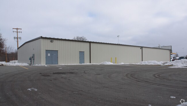
490 E Wright Ave
03-016-10-006-01
COM ON N LINE OF SEC 16 T13N R3W COE TWP 838.36 FT N 89D 25M 38S W FROM N 1/4 COR OF SEC 16 TH S 00D 02M 45S W 441.56 FT TH N
Commercialnec
Isabella
B and X Area of moderate flood hazard, usually the area between the limits of the 100-year and 500-year floods.
Michigan
2023
1.41 AC
2025
Other Market Areas
000900
Mount Pleasant, MI
NEARBY LISTINGS FOR SALE OR LEASE
-
-
View all Shepherd listings for sale on LoopNet.com
DEMOGRAPHICS near 490 E Wright Ave
1 mile
3 mile
5 mile
2025 Total Population
1,637
2,643
6,335
2030 Population
1,620
2,619
6,362
Pop Growth 2025-2030
(1.04%)
(0.91%)
+ 0.43%
Average Age
41
41
38
2025 Total Households
690
1,077
2,591
HH Growth 2025-2030
(0.87%)
(0.84%)
+ 0.50%
Median Household Inc
$78,757
$74,687
$60,167
Avg Household Size
2.40
2.50
2.40
2025 Avg HH Vehicles
2.00
2.00
2.00
Median Home Value
$169,421
$172,751
$169,688
Median Year Built
1965
1969
1984
Nearby Places
Map Layers
Map Styles
 Street
 Aerial
Layers
 Traffic
 Biking
Places
Listings with unknown addresses are not visible on the map
- Restaurants
- Banks
- Shops
- Fitness
- Groceries
PUBLIC TRANSPORTATION
AIRPORT
MBS International
Drive
Walk
Distance
MBS International
63 min
41.0 mi
Nearby Properties
Address
Land Use
TOTAL SIZE
Lot Size
Zoning
Address
Land Use
TOTAL SIZE
Lot Size
Zoning
153.03 AC
Address
Land Use
TOTAL SIZE
Lot Size
Zoning
2.75 AC
Address
Land Use
TOTAL SIZE
Lot Size
Zoning
Address
Land Use
TOTAL SIZE
Lot Size
Zoning
17.63 AC
Address
Land Use
TOTAL SIZE
Lot Size
Zoning
Address
Land Use
TOTAL SIZE
Lot Size
Zoning
144.26 AC
Address
Land Use
TOTAL SIZE
Lot Size
Zoning
Address
Land Use
TOTAL SIZE
Lot Size
Zoning
Address
Land Use
TOTAL SIZE
Lot Size
Zoning
2.30 AC
Address
Land Use
TOTAL SIZE
Lot Size
Zoning
Address
Land Use
TOTAL SIZE
Lot Size
Zoning
155.72 AC
Address
Land Use
TOTAL SIZE
Lot Size
Zoning
135.90 AC
Address
Land Use
TOTAL SIZE
Lot Size
Zoning
Address
Land Use
TOTAL SIZE
Lot Size
Zoning
138.09 AC
Address
Land Use
TOTAL SIZE
Lot Size
Zoning
149.30 AC
Address
Land Use
TOTAL SIZE
Lot Size
Zoning
Address
Land Use
TOTAL SIZE
Lot Size
Zoning
121.18 AC
Address
Land Use
TOTAL SIZE
Lot Size
Zoning
Address
Land Use
TOTAL SIZE
Lot Size
Zoning
104.75 AC
Address
Land Use
TOTAL SIZE
Lot Size
Zoning
125.50 AC
Address
Land Use
TOTAL SIZE
Lot Size
Zoning
125.63 AC
Address
Land Use
TOTAL SIZE
Lot Size
Zoning
120 AC
Address
Land Use
TOTAL SIZE
Lot Size
Zoning
120 AC
Address
Land Use
TOTAL SIZE
Lot Size
Zoning
Address
Land Use
TOTAL SIZE
Lot Size
Zoning
3.41 AC
Address
Land Use
TOTAL SIZE
Lot Size
Zoning
120 AC
Address
Land Use
TOTAL SIZE
Lot Size
Zoning
Address
Land Use
TOTAL SIZE
Lot Size
Zoning
100 AC
Address
Land Use
TOTAL SIZE
Lot Size
Zoning
112.40 AC
Address
Land Use
TOTAL SIZE
Lot Size
Zoning
77.90 AC
The World's #1 Commercial Real Estate Marketplace
Connect with us
© 2026 CoStar Group
The information above has been obtained from sources believed reliable. While we do not doubt its accuracy we have not verified it and make no guarantee, warranty or representation about it. It is your responsibility to independently confirm its accuracy and completeness. Any projections, opinions, assumptions, or estimates used are for example only and do not represent the current or future performance of the property. The value of this transaction to you depends on tax and other factors which should be evaluated by your tax, financial, and legal advisors. You and your advisors should conduct a careful, independent investigation of the property to determine to your satisfaction the suitability of the property for your needs.