No Photo
Property Record
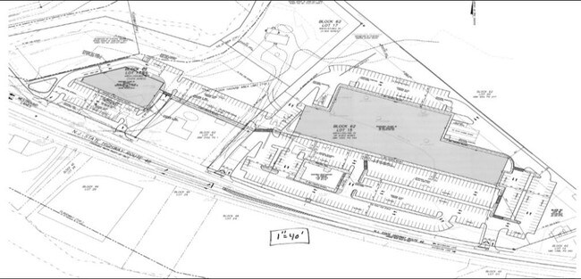
490 Us Highway 46, Belvidere, NJ 07823

NEARBY LISTINGS FOR SALE OR LEASE
Property Detail
490 Us Highway 46
23-00062-0000-00017
Warren
Storemultistory
New Jersey
AE
15
34041C0208E
1.56 AC
2024
Warren County
2025
Northern New Jersey
031601
Allentown-Bethlehem-Easton, PA-NJ
1,188 SF
DEMOGRAPHICS near 490 Us Highway 46
1 Mile
3 Mile
5 Mile
2024 Total Population
412
7,081
15,346
2029 Population
421
7,219
15,613
Pop Growth 2024-2029
+ 2.18%
+ 1.95%
+ 1.74%
Average Age
46
48
47
2024 Total Households
158
3,084
6,485
HH Growth 2024-2029
+ 1.90%
+ 2.11%
+ 1.87%
Median Household Inc
$91,874
$72,613
$76,634
Avg Household Size
2.60
2.30
2.30
2024 Avg HH Vehicles
3.00
2.00
2.00
Median Home Value
$414,773
$266,730
$277,910
Median Year Built
1965
1972
1974
Nearby Places
- Restaurants
- Banks
- Shops
- Fitness
- Groceries
PUBLIC TRANSPORTATION
AIRPORT
Lehigh Valley International
DRIVE
WALK
Distance
Lehigh Valley International
48 min
28.3 mi
Freight Ports
New York Container Terminal
DRIVE
WALK
Distance
New York Container Terminal
84 min
65.1 mi
SALE & LEASE HISTORY
LISTING DATE
SALE/LEASE

Sep 24, 2016
For Sale
Nearby Properties
Address
Land Use
TOTAL SIZE
Lot Size
Zoning
Address
Land Use
TOTAL SIZE
Lot Size
Zoning
7,745 SF
12.50 AC
R100
Address
Land Use
TOTAL SIZE
Lot Size
Zoning
17,074 SF
60.46 AC
LM
Address
Land Use
TOTAL SIZE
Lot Size
Zoning
11.69 AC
I
Address
Land Use
TOTAL SIZE
Lot Size
Zoning
800 SF
3.73 AC
Address
Land Use
TOTAL SIZE
Lot Size
Zoning
0.58 AC
CH-P
Address
Land Use
TOTAL SIZE
Lot Size
Zoning
7.17 AC
Address
Land Use
TOTAL SIZE
Lot Size
Zoning
65.27 AC
Address
Land Use
TOTAL SIZE
Lot Size
Zoning
9,692 SF
3.26 AC
RM
Address
Land Use
TOTAL SIZE
Lot Size
Zoning
7,500 SF
4 AC
LM
Address
Land Use
TOTAL SIZE
Lot Size
Zoning
3.44 AC
CH-P
Address
Land Use
TOTAL SIZE
Lot Size
Zoning
Address
Land Use
TOTAL SIZE
Lot Size
Zoning
11.52 AC
Address
Land Use
TOTAL SIZE
Lot Size
Zoning
13,250 SF
11.41 AC
R2
Address
Land Use
TOTAL SIZE
Lot Size
Zoning
Address
Land Use
TOTAL SIZE
Lot Size
Zoning
3.16 AC
R80
Address
Land Use
TOTAL SIZE
Lot Size
Zoning
217.87 AC
Address
Land Use
TOTAL SIZE
Lot Size
Zoning
864 SF
2.70 AC
LM
Address
Land Use
TOTAL SIZE
Lot Size
Zoning
5,696 SF
2.56 AC
Address
Land Use
TOTAL SIZE
Lot Size
Zoning
55.52 AC
LI
Address
Land Use
TOTAL SIZE
Lot Size
Zoning
11,616 SF
1.12 AC
R50
Address
Land Use
TOTAL SIZE
Lot Size
Zoning
2,472 SF
0.44 AC
CH-P
Address
Land Use
TOTAL SIZE
Lot Size
Zoning
2,932 SF
0.65 AC
CH-P
Address
Land Use
TOTAL SIZE
Lot Size
Zoning
Address
Land Use
TOTAL SIZE
Lot Size
Zoning
2,268 SF
1.38 AC
R50
Address
Land Use
TOTAL SIZE
Lot Size
Zoning
7,544 SF
0.58 AC
CH-P
Address
Land Use
TOTAL SIZE
Lot Size
Zoning
1,800 SF
9.75 AC
Address
Land Use
TOTAL SIZE
Lot Size
Zoning
46.04 AC
Address
Land Use
TOTAL SIZE
Lot Size
Zoning
Address
Land Use
TOTAL SIZE
Lot Size
Zoning
2,800 SF
3.88 AC
LM
Address
Land Use
TOTAL SIZE
Lot Size
Zoning
7,064 SF
1.81 AC
LMSC
The World's #1 Commercial Real Estate Marketplace
Connect with us
© 2025 CoStar Group
The information above has been obtained from sources believed reliable. While we do not doubt its accuracy we have not verified it and make no guarantee, warranty or representation about it. It is your responsibility to independently confirm its accuracy and completeness. Any projections, opinions, assumptions, or estimates used are for example only and do not represent the current or future performance of the property. The value of this transaction to you depends on tax and other factors which should be evaluated by your tax, financial, and legal advisors. You and your advisors should conduct a careful, independent investigation of the property to determine to your satisfaction the suitability of the property for your needs.