Property Record
490 Sw Highway 351, Cross City, FL 32628
NEARBY LISTINGS FOR SALE OR LEASE
-
-
View all Cross City listings for lease on LoopNet.com
Property Detail
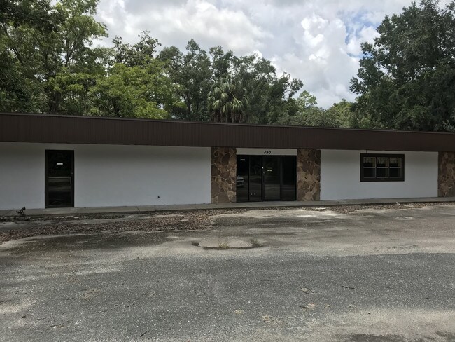
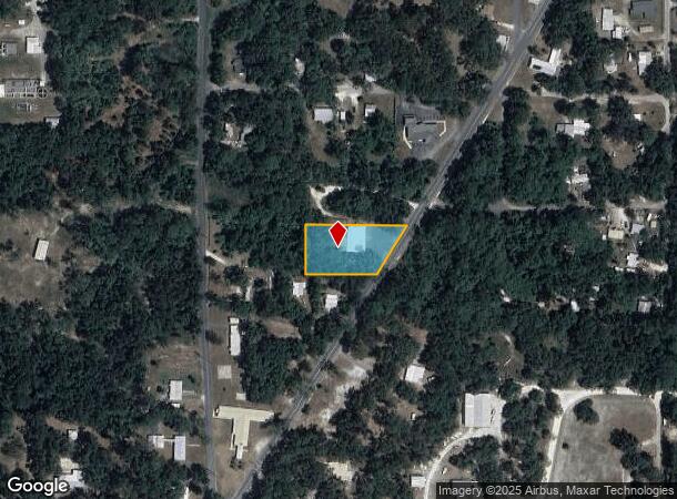
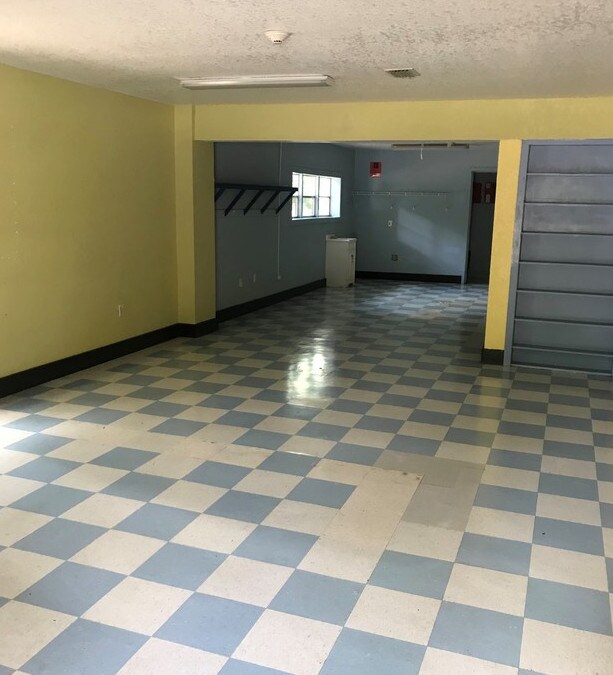
490 Sw Highway 351
09-10-12-2362-000-90010
Parker Annex To The Town Of Cross City
Officebuilding
9 10 12 LOTS 1 2 & E1/2 LOT 3 BLK 9 ALL OF BLK 10 ALSO THAT PORTION OF PARKER ST LYING BETWEEN BLK 9 & 10 PARKER ANNEX ORB 74 P 488-490 ORB 76 P 599 & 644 ORB 82 P 95 ORB 93 P 607 ORB 196 P 87 ORB 236 P 79 ORB 528 P 456 ORB 575 P 684 ORB 593 P 130 OR
AE
Dixie
12029C0169D
Florida
2025
1,3
2025
0.91 AC
970101
Florida Central North Area
4,966 SF
Other Market Areas
DEMOGRAPHICS near 490 Sw Highway 351
1 Mile
3 Mile
5 Mile
2024 Total Population
2,332
4,210
5,138
2029 Population
2,361
4,260
5,217
Pop Growth 2024-2029
+ 1.24%
+ 1.19%
+ 1.54%
Average Age
42
42
42
2024 Total Households
651
1,092
1,381
HH Growth 2024-2029
+ 1.23%
+ 1.19%
+ 1.59%
Median Household Inc
$44,210
$41,693
$42,741
Avg Household Size
2.50
2.50
2.50
2024 Avg HH Vehicles
2.00
2.00
2.00
Median Home Value
$79,316
$80,853
$85,210
Median Year Built
1981
1981
1983
Nearby Places
Map Layers
Map Styles
 Street
 Aerial
- Restaurants
- Banks
- Shops
- Fitness
- Groceries
SALE & LEASE HISTORY
LISTING DATE
SALE/LEASE

Sep 23, 2021
For Lease
Aug 20, 2019
For Sale
Nearby Properties
Address
Land Use
TOTAL SIZE
Lot Size
Zoning
Address
Land Use
TOTAL SIZE
Lot Size
Zoning
161,580 SF
36.05 AC
A-5
Address
Land Use
TOTAL SIZE
Lot Size
Zoning
112,432 SF
23.79 AC
A-2
Address
Land Use
TOTAL SIZE
Lot Size
Zoning
100,000 SF
40 AC
M-1
Address
Land Use
TOTAL SIZE
Lot Size
Zoning
78,342 SF
135.81 AC
A-5
Address
Land Use
TOTAL SIZE
Lot Size
Zoning
52,256 SF
13.39 AC
I-1
Address
Land Use
TOTAL SIZE
Lot Size
Zoning
22,940 SF
4.09 AC
C-2
Address
Land Use
TOTAL SIZE
Lot Size
Zoning
113,602 SF
30 AC
M-1
Address
Land Use
TOTAL SIZE
Lot Size
Zoning
22,680 SF
1.17 AC
GOVT
Address
Land Use
TOTAL SIZE
Lot Size
Zoning
11,112 SF
3 AC
C-2
Address
Land Use
TOTAL SIZE
Lot Size
Zoning
17,761 SF
1.04 AC
C-2
Address
Land Use
TOTAL SIZE
Lot Size
Zoning
11,800 SF
2.76 AC
C-1
Address
Land Use
TOTAL SIZE
Lot Size
Zoning
62,082 SF
4.17 AC
C-1
Address
Land Use
TOTAL SIZE
Lot Size
Zoning
3,600 SF
64.96 AC
M-1
Address
Land Use
TOTAL SIZE
Lot Size
Zoning
32,207 SF
4.93 AC
R-3
Address
Land Use
TOTAL SIZE
Lot Size
Zoning
103,142 SF
16 AC
C-1
Address
Land Use
TOTAL SIZE
Lot Size
Zoning
Address
Land Use
TOTAL SIZE
Lot Size
Zoning
12,840 SF
1.44 AC
C-2
Address
Land Use
TOTAL SIZE
Lot Size
Zoning
10,000 SF
37.43 AC
Address
Land Use
TOTAL SIZE
Lot Size
Zoning
13,206 SF
2.27 AC
R-1
Address
Land Use
TOTAL SIZE
Lot Size
Zoning
5,902 SF
32.50 AC
MH-2
Address
Land Use
TOTAL SIZE
Lot Size
Zoning
5,880 SF
4.41 AC
A-5
Address
Land Use
TOTAL SIZE
Lot Size
Zoning
13,604 SF
2.80 AC
Address
Land Use
TOTAL SIZE
Lot Size
Zoning
11,996 SF
1.42 AC
R-1
Address
Land Use
TOTAL SIZE
Lot Size
Zoning
2,786 SF
1.52 AC
C-1
Address
Land Use
TOTAL SIZE
Lot Size
Zoning
Address
Land Use
TOTAL SIZE
Lot Size
Zoning
6,228 SF
8.62 AC
A-1
Address
Land Use
TOTAL SIZE
Lot Size
Zoning
8,168 SF
2.03 AC
Address
Land Use
TOTAL SIZE
Lot Size
Zoning
13,328 SF
3.14 AC
R-1
Address
Land Use
TOTAL SIZE
Lot Size
Zoning
3,388 SF
0.88 AC
C-2
Address
Land Use
TOTAL SIZE
Lot Size
Zoning
12,168 SF
1.97 AC
C-2
The World's #1 Commercial Real Estate Marketplace
Connect with us
© 2025 CoStar Group
The information above has been obtained from sources believed reliable. While we do not doubt its accuracy we have not verified it and make no guarantee, warranty or representation about it. It is your responsibility to independently confirm its accuracy and completeness. Any projections, opinions, assumptions, or estimates used are for example only and do not represent the current or future performance of the property. The value of this transaction to you depends on tax and other factors which should be evaluated by your tax, financial, and legal advisors. You and your advisors should conduct a careful, independent investigation of the property to determine to your satisfaction the suitability of the property for your needs.