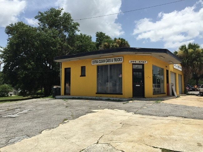
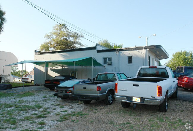
Property Record
490 W Highway 50, Clermont, FL 34711
NEARBY LISTINGS FOR SALE OR LEASE
Property Detail
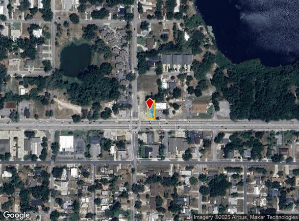
490 W Highway 50
Orlando-Kissimmee-Sanford, FL
Clermont
24-22-25-0100-045-01800
CLERMONT LOT 18 BLK 45 PB 8 PG 17 ORB 5181 PG 1031 ORB 5478 PG 1931
Commercialacreage
Lake
X
Florida
12069C0570E
18
2024
0.15 AC
2026
Lake County
031312
Orlando
1,456 SF
DEMOGRAPHICS near 490 W Highway 50
1 Mile
3 Mile
5 Mile
2024 Total Population
5,840
40,797
99,600
2029 Population
6,725
47,361
116,564
Pop Growth 2024-2029
+ 15.15%
+ 16.09%
+ 17.03%
Average Age
41
40
42
2024 Total Households
2,322
15,022
36,735
HH Growth 2024-2029
+ 15.07%
+ 15.82%
+ 16.79%
Median Household Inc
$64,275
$80,280
$81,828
Avg Household Size
2.40
2.70
2.70
2024 Avg HH Vehicles
2.00
2.00
2.00
Median Home Value
$312,963
$308,271
$316,710
Median Year Built
1975
2001
2003
Nearby Places
Map Layers
Map Styles
 Street
 Aerial
- Restaurants
- Banks
- Shops
- Fitness
- Groceries
PUBLIC TRANSPORTATION
AIRPORT
Orlando International
DRIVE
WALK
Distance
Orlando International
46 min
33.8 mi
SALE & LEASE HISTORY
LISTING DATE
SALE/LEASE

Sep 24, 2016
For Sale
Nearby Properties
Address
Land Use
TOTAL SIZE
Lot Size
Zoning
Address
Land Use
TOTAL SIZE
Lot Size
Zoning
403,970 SF
30.99 AC
PUD
Address
Land Use
TOTAL SIZE
Lot Size
Zoning
285,581 SF
19.34 AC
CFD
Address
Land Use
TOTAL SIZE
Lot Size
Zoning
299,214 SF
25.01 AC
PUD
Address
Land Use
TOTAL SIZE
Lot Size
Zoning
321,012 SF
22.55 AC
PUD
Address
Land Use
TOTAL SIZE
Lot Size
Zoning
2,000 SF
35.96 AC
PUD
Address
Land Use
TOTAL SIZE
Lot Size
Zoning
269,594 SF
25.23 AC
PUD
Address
Land Use
TOTAL SIZE
Lot Size
Zoning
179,290 SF
23.79 AC
Address
Land Use
TOTAL SIZE
Lot Size
Zoning
212,649 SF
4.20 AC
Address
Land Use
TOTAL SIZE
Lot Size
Zoning
192,907 SF
16.43 AC
PUD
Address
Land Use
TOTAL SIZE
Lot Size
Zoning
273,592 SF
91.55 AC
R6
Address
Land Use
TOTAL SIZE
Lot Size
Zoning
204,472 SF
43.52 AC
Address
Land Use
TOTAL SIZE
Lot Size
Zoning
Address
Land Use
TOTAL SIZE
Lot Size
Zoning
52,986 SF
18.27 AC
Address
Land Use
TOTAL SIZE
Lot Size
Zoning
2,000 SF
30.62 AC
CFD
Address
Land Use
TOTAL SIZE
Lot Size
Zoning
124,634 SF
18.57 AC
Address
Land Use
TOTAL SIZE
Lot Size
Zoning
142,824 SF
9.90 AC
C2
Address
Land Use
TOTAL SIZE
Lot Size
Zoning
126,067 SF
9.34 AC
Address
Land Use
TOTAL SIZE
Lot Size
Zoning
62,794 SF
2.31 AC
Address
Land Use
TOTAL SIZE
Lot Size
Zoning
203,762 SF
18.28 AC
R1
Address
Land Use
TOTAL SIZE
Lot Size
Zoning
227,034 SF
29.20 AC
Address
Land Use
TOTAL SIZE
Lot Size
Zoning
95,182 SF
12.34 AC
PUD
Address
Land Use
TOTAL SIZE
Lot Size
Zoning
102,086 SF
5.32 AC
Address
Land Use
TOTAL SIZE
Lot Size
Zoning
158,351 SF
19.10 AC
C2
Address
Land Use
TOTAL SIZE
Lot Size
Zoning
87,951 SF
5.88 AC
Address
Land Use
TOTAL SIZE
Lot Size
Zoning
80,774 SF
6.61 AC
Address
Land Use
TOTAL SIZE
Lot Size
Zoning
74,375 SF
6.69 AC
Address
Land Use
TOTAL SIZE
Lot Size
Zoning
90,469 SF
5.99 AC
PUD
Address
Land Use
TOTAL SIZE
Lot Size
Zoning
61,515 SF
9.92 AC
R6
Address
Land Use
TOTAL SIZE
Lot Size
Zoning
99,348 SF
34.10 AC
R1A
Address
Land Use
TOTAL SIZE
Lot Size
Zoning
51,196 SF
2.22 AC
C2
The World's #1 Commercial Real Estate Marketplace
Connect with us
© 2025 CoStar Group
The information above has been obtained from sources believed reliable. While we do not doubt its accuracy we have not verified it and make no guarantee, warranty or representation about it. It is your responsibility to independently confirm its accuracy and completeness. Any projections, opinions, assumptions, or estimates used are for example only and do not represent the current or future performance of the property. The value of this transaction to you depends on tax and other factors which should be evaluated by your tax, financial, and legal advisors. You and your advisors should conduct a careful, independent investigation of the property to determine to your satisfaction the suitability of the property for your needs.