Property Record
4900 Frontage Rd S, Lakeland, FL 33815

Save to a Folder
{{folder.Name}}
{{folder.ListingIds.length}} Properties
{{folder.ListingIds.length}} Property
Create a New Folder
Property Detail
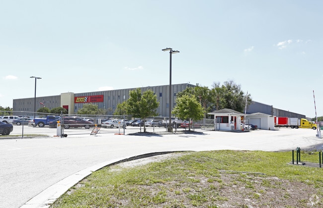
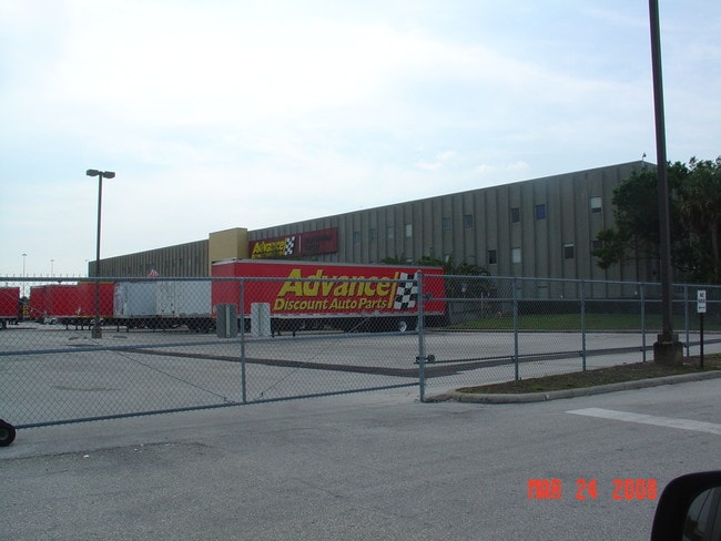
4900 Frontage Rd S
23-28-19-087500-000025
WEBSTER & OMOHUNDRO SUB PB 3 PG 81 LOT 2 E 600 FT OF W 1181 FT OF SW1/4 OF NE1/4 LESS R/W FOR SR 570 AS DESC IN OR 3601-442 & COMM INTR OF E LINE OF E 600 FT OF W 1181 FT OF SW1/4 OF NE1/4 & S LINE OF NE1/4 RUN E ALONG SAID S LINE 185 FT N 974.52 FT
Warehouse
Polk
GI
Florida
A Areas with a 1% annual chance of flooding and a 26% chance of flooding over the life of a 30-year mortgage.
2
2025
33.79 AC
2025
Polk County
012004
Tampa/St Petersburg
566,274 SF
Lakeland-Winter Haven, FL
NEARBY LISTINGS FOR SALE OR LEASE
DEMOGRAPHICS near 4900 Frontage Rd S
1 mile
3 mile
5 mile
2025 Total Population
1,089
16,009
77,768
2030 Population
1,249
18,181
88,220
Pop Growth 2025-2030
+ 14.69%
+ 13.57%
+ 13.44%
Average Age
40
41
41
2025 Total Households
440
6,112
30,127
HH Growth 2025-2030
+ 15.00%
+ 14.02%
+ 13.90%
Median Household Inc
$70,806
$74,746
$61,449
Avg Household Size
2.50
2.60
2.50
2025 Avg HH Vehicles
1.00
2.00
2.00
Median Home Value
$304,545
$315,211
$241,744
Median Year Built
1983
1989
1988
Nearby Places
Map Layers
Map Styles
 Street
 Aerial
Layers
 Traffic
 Biking
Places
Listings with unknown addresses are not visible on the map
- Restaurants
- Banks
- Shops
- Fitness
- Groceries
PUBLIC TRANSPORTATION
COMMUTER RAIL
Lakeland (Silver Star - Amtrak)
Drive
Walk
Distance
Lakeland (Silver Star - Amtrak)
11 min
6.2 mi
Freight Ports
Port of Tampa Bay
Drive
Walk
Distance
Port of Tampa Bay
39 min
29.1 mi
Nearby Properties
Address
Land Use
TOTAL SIZE
Lot Size
Zoning
Address
Land Use
TOTAL SIZE
Lot Size
Zoning
2,095,234 SF
102.45 AC
PUD
Address
Land Use
TOTAL SIZE
Lot Size
Zoning
1,055,503 SF
97.03 AC
PD
Address
Land Use
TOTAL SIZE
Lot Size
Zoning
1,210,880 SF
405.82 AC
PUD
Address
Land Use
TOTAL SIZE
Lot Size
Zoning
1,494,080 SF
116.77 AC
Address
Land Use
TOTAL SIZE
Lot Size
Zoning
518,028 SF
195.69 AC
Address
Land Use
TOTAL SIZE
Lot Size
Zoning
711,568 SF
42.87 AC
PD
Address
Land Use
TOTAL SIZE
Lot Size
Zoning
805,336 SF
52.50 AC
PD
Address
Land Use
TOTAL SIZE
Lot Size
Zoning
779,760 SF
67.03 AC
PD
Address
Land Use
TOTAL SIZE
Lot Size
Zoning
705,615 SF
33.05 AC
Address
Land Use
TOTAL SIZE
Lot Size
Zoning
595,473 SF
47.29 AC
Address
Land Use
TOTAL SIZE
Lot Size
Zoning
711,568 SF
43.33 AC
PD
Address
Land Use
TOTAL SIZE
Lot Size
Zoning
723,962 SF
47.49 AC
PD
Address
Land Use
TOTAL SIZE
Lot Size
Zoning
508,310 SF
37.85 AC
M-1A
Address
Land Use
TOTAL SIZE
Lot Size
Zoning
655,123 SF
45.28 AC
Address
Land Use
TOTAL SIZE
Lot Size
Zoning
1,004,426 SF
93.42 AC
C4
Address
Land Use
TOTAL SIZE
Lot Size
Zoning
520,806 SF
25.62 AC
Address
Land Use
TOTAL SIZE
Lot Size
Zoning
505,506 SF
50.60 AC
PD
Address
Land Use
TOTAL SIZE
Lot Size
Zoning
492,960 SF
22.09 AC
Address
Land Use
TOTAL SIZE
Lot Size
Zoning
602,125 SF
43.97 AC
Address
Land Use
TOTAL SIZE
Lot Size
Zoning
599,280 SF
35.27 AC
GI
Address
Land Use
TOTAL SIZE
Lot Size
Zoning
417,890 SF
14.59 AC
Address
Land Use
TOTAL SIZE
Lot Size
Zoning
528,067 SF
37 AC
I2
Address
Land Use
TOTAL SIZE
Lot Size
Zoning
568,801 SF
37.13 AC
C4
Address
Land Use
TOTAL SIZE
Lot Size
Zoning
220,510 SF
37.56 AC
PD
Address
Land Use
TOTAL SIZE
Lot Size
Zoning
333,718 SF
28.99 AC
M-1
Address
Land Use
TOTAL SIZE
Lot Size
Zoning
349,920 SF
22.21 AC
Address
Land Use
TOTAL SIZE
Lot Size
Zoning
300,411 SF
18.77 AC
PD
Address
Land Use
TOTAL SIZE
Lot Size
Zoning
172,176 SF
8.93 AC
RE2
Address
Land Use
TOTAL SIZE
Lot Size
Zoning
441,480 SF
24.28 AC
The World's #1 Commercial Real Estate Marketplace
Connect with us
© 2026 CoStar Group
The information above has been obtained from sources believed reliable. While we do not doubt its accuracy we have not verified it and make no guarantee, warranty or representation about it. It is your responsibility to independently confirm its accuracy and completeness. Any projections, opinions, assumptions, or estimates used are for example only and do not represent the current or future performance of the property. The value of this transaction to you depends on tax and other factors which should be evaluated by your tax, financial, and legal advisors. You and your advisors should conduct a careful, independent investigation of the property to determine to your satisfaction the suitability of the property for your needs.