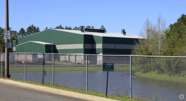
Property Record
4900 Gum Rd, Tallahassee, FL 32304


NEARBY LISTINGS FOR SALE OR LEASE
Property Detail
4900 Gum Rd
21-29-20-611-000.0
Unplatted Land
Countyproperty
29 1N 1W IN SW 1/4 TR 15 & 16 PALMER OR 1084/1160 1100/2290 2360/2002 PROPOSED TRANSFER STATION
AE
Leon
12073C0278F
Florida
2025
15.05 AC
2025
Southwest Leon County
002304
Tallahassee
59,105 SF
Tallahassee, FL
DEMOGRAPHICS near 4900 Gum Rd
1 Mile
3 Mile
5 Mile
2024 Total Population
3,900
47,677
111,602
2029 Population
4,198
49,689
116,716
Pop Growth 2024-2029
+ 7.64%
+ 4.22%
+ 4.58%
Average Age
33
31
32
2024 Total Households
1,405
20,244
45,916
HH Growth 2024-2029
+ 7.90%
+ 4.00%
+ 4.72%
Median Household Inc
$34,356
$35,276
$37,929
Avg Household Size
2.20
2.20
2.20
2024 Avg HH Vehicles
2.00
2.00
2.00
Median Home Value
$89,938
$139,095
$159,573
Median Year Built
1998
1988
1985
Nearby Places
Map Layers
Map Styles
 Street
 Aerial
- Restaurants
- Banks
- Shops
- Fitness
- Groceries
PUBLIC TRANSPORTATION
AIRPORT
Tallahassee International
DRIVE
WALK
Distance
Tallahassee International
10 min
4.3 mi
Nearby Properties
Address
Land Use
TOTAL SIZE
Lot Size
Zoning
Address
Land Use
TOTAL SIZE
Lot Size
Zoning
1,604,893 SF
175.71 AC
MR1
Address
Land Use
TOTAL SIZE
Lot Size
Zoning
959,505 SF
32.03 AC
M1
Address
Land Use
TOTAL SIZE
Lot Size
Zoning
664,514 SF
2.49 AC
UT
Address
Land Use
TOTAL SIZE
Lot Size
Zoning
758,762 SF
20.82 AC
UT
Address
Land Use
TOTAL SIZE
Lot Size
Zoning
719,149 SF
40.73 AC
MR1
Address
Land Use
TOTAL SIZE
Lot Size
Zoning
445,676 SF
23.50 AC
PUD
Address
Land Use
TOTAL SIZE
Lot Size
Zoning
721,205 SF
6.19 AC
UT
Address
Land Use
TOTAL SIZE
Lot Size
Zoning
556,751 SF
20.60 AC
CP
Address
Land Use
TOTAL SIZE
Lot Size
Zoning
859,666 SF
20.17 AC
MR1
Address
Land Use
TOTAL SIZE
Lot Size
Zoning
392,437 SF
10 AC
UT
Address
Land Use
TOTAL SIZE
Lot Size
Zoning
607,000 SF
37.55 AC
PUD
Address
Land Use
TOTAL SIZE
Lot Size
Zoning
828,694 SF
25.98 AC
MR1
Address
Land Use
TOTAL SIZE
Lot Size
Zoning
739,671 SF
20.04 AC
MR1
Address
Land Use
TOTAL SIZE
Lot Size
Zoning
660,721 SF
30.95 AC
Address
Land Use
TOTAL SIZE
Lot Size
Zoning
168,448 SF
47.73 AC
I
Address
Land Use
TOTAL SIZE
Lot Size
Zoning
711,296 SF
17.86 AC
PUD
Address
Land Use
TOTAL SIZE
Lot Size
Zoning
127,486 SF
8.23 AC
M1
Address
Land Use
TOTAL SIZE
Lot Size
Zoning
196,915 SF
3.33 AC
UT
Address
Land Use
TOTAL SIZE
Lot Size
Zoning
153,404 SF
12.05 AC
M1
Address
Land Use
TOTAL SIZE
Lot Size
Zoning
463,831 SF
44.63 AC
M1
Address
Land Use
TOTAL SIZE
Lot Size
Zoning
236,679 SF
32.60 AC
MR1
Address
Land Use
TOTAL SIZE
Lot Size
Zoning
588,955 SF
36.20 AC
R3
Address
Land Use
TOTAL SIZE
Lot Size
Zoning
456,228 SF
27.14 AC
UT
Address
Land Use
TOTAL SIZE
Lot Size
Zoning
39,330 SF
2.90 AC
PUD
Address
Land Use
TOTAL SIZE
Lot Size
Zoning
301,930 SF
12.28 AC
UT
Address
Land Use
TOTAL SIZE
Lot Size
Zoning
570,525 SF
18.89 AC
MR1
Address
Land Use
TOTAL SIZE
Lot Size
Zoning
123,020 SF
9.45 AC
M1
Address
Land Use
TOTAL SIZE
Lot Size
Zoning
1,792 SF
231.63 AC
M1
Address
Land Use
TOTAL SIZE
Lot Size
Zoning
365,297 SF
9.50 AC
MR1
Address
Land Use
TOTAL SIZE
Lot Size
Zoning
274,674 SF
3.63 AC
UT
The World's #1 Commercial Real Estate Marketplace
Connect with us
© 2026 CoStar Group
The information above has been obtained from sources believed reliable. While we do not doubt its accuracy we have not verified it and make no guarantee, warranty or representation about it. It is your responsibility to independently confirm its accuracy and completeness. Any projections, opinions, assumptions, or estimates used are for example only and do not represent the current or future performance of the property. The value of this transaction to you depends on tax and other factors which should be evaluated by your tax, financial, and legal advisors. You and your advisors should conduct a careful, independent investigation of the property to determine to your satisfaction the suitability of the property for your needs.