Property Record
4900 Memco Ln, Caledonia, WI 53404
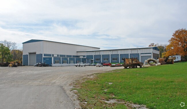

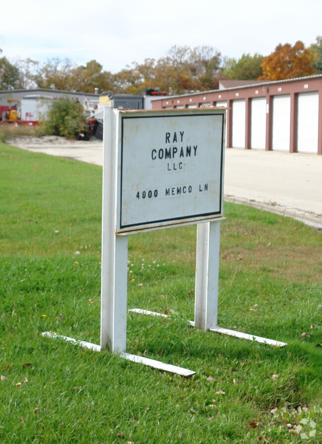
Property Detail
4900 Memco Ln
Racine-Mount Pleasant, WI
PT NE1/4-CERTIFIED SURVEY MAP #1019-PARCEL #2 REC IN V3P53-55 & S75'PARCEL #1 IN V1653P131 ASSESSED BY STATE **TOTAL ACRES**
104-042330008002
Racine
Industrialgeneral
Wisconsin
AE The base floodplain where base flood elevations are provided. AE Zones are now used on new format FIRMs instead of A1-A30 Zones.
5.47 AC
2025
Racine East
2025
Milwaukee/Madison
001507
NEARBY LISTINGS FOR SALE OR LEASE
DEMOGRAPHICS near 4900 Memco Ln
1 mile
3 mile
5 mile
2025 Total Population
3,543
42,875
95,058
2030 Population
3,537
43,087
95,791
Pop Growth 2025-2030
(0.17%)
+ 0.49%
+ 0.77%
Average Age
42
42
40
2025 Total Households
1,418
17,394
38,587
HH Growth 2025-2030
(0.21%)
+ 0.47%
+ 0.79%
Median Household Inc
$69,735
$76,121
$68,647
Avg Household Size
2.40
2.40
2.40
2025 Avg HH Vehicles
2.00
2.00
2.00
Median Home Value
$256,265
$253,535
$227,499
Median Year Built
1972
1969
1963
Nearby Places
Map Layers
Map Styles
 Street
 Aerial
Layers
 Traffic
 Biking
Places
Listings with unknown addresses are not visible on the map
- Restaurants
- Banks
- Shops
- Fitness
- Groceries
PUBLIC TRANSPORTATION
COMMUTER RAIL
Sturtevant Amtrak Station (Hiawatha Service - Amtrak)
Drive
Walk
Distance
Sturtevant Amtrak Station (Hiawatha Service - Amtrak)
17 min
9.4 mi
AIRPORT
General Mitchell International
Drive
Walk
Distance
General Mitchell International
28 min
15.7 mi
Freight Ports
Port Milwaukee
Drive
Walk
Distance
Port Milwaukee
34 min
21.7 mi
SALE & LEASE HISTORY
LISTING DATE
SALE/LEASE

Sep 25, 2016
For Lease
Sep 23, 2016
For Sale
Mar 29, 2017
For Sale
Nearby Properties
Address
Land Use
TOTAL SIZE
Lot Size
Zoning
Address
Land Use
TOTAL SIZE
Lot Size
Zoning
24.48 AC
Address
Land Use
TOTAL SIZE
Lot Size
Zoning
94.35 AC
Address
Land Use
TOTAL SIZE
Lot Size
Zoning
9.18 AC
Address
Land Use
TOTAL SIZE
Lot Size
Zoning
Address
Land Use
TOTAL SIZE
Lot Size
Zoning
8.06 AC
Address
Land Use
TOTAL SIZE
Lot Size
Zoning
12.10 AC
I2
Address
Land Use
TOTAL SIZE
Lot Size
Zoning
10.50 AC
Address
Land Use
TOTAL SIZE
Lot Size
Zoning
91,381 SF
6.62 AC
B2
Address
Land Use
TOTAL SIZE
Lot Size
Zoning
122,640 SF
8.27 AC
R4
Address
Land Use
TOTAL SIZE
Lot Size
Zoning
5.53 AC
R4
Address
Land Use
TOTAL SIZE
Lot Size
Zoning
6.77 AC
I2IP
Address
Land Use
TOTAL SIZE
Lot Size
Zoning
93,000 SF
3.58 AC
R4
Address
Land Use
TOTAL SIZE
Lot Size
Zoning
148.72 AC
Address
Land Use
TOTAL SIZE
Lot Size
Zoning
148.72 AC
Address
Land Use
TOTAL SIZE
Lot Size
Zoning
4,239 SF
349.70 AC
I2
Address
Land Use
TOTAL SIZE
Lot Size
Zoning
Address
Land Use
TOTAL SIZE
Lot Size
Zoning
21.22 AC
Address
Land Use
TOTAL SIZE
Lot Size
Zoning
6.27 AC
I2IP
Address
Land Use
TOTAL SIZE
Lot Size
Zoning
2.72 AC
Address
Land Use
TOTAL SIZE
Lot Size
Zoning
676 SF
6.02 AC
Address
Land Use
TOTAL SIZE
Lot Size
Zoning
5.62 AC
Address
Land Use
TOTAL SIZE
Lot Size
Zoning
4.20 AC
Address
Land Use
TOTAL SIZE
Lot Size
Zoning
5,477 SF
3.11 AC
R4
Address
Land Use
TOTAL SIZE
Lot Size
Zoning
20,340 SF
1.73 AC
R5
Address
Land Use
TOTAL SIZE
Lot Size
Zoning
1.37 AC
Address
Land Use
TOTAL SIZE
Lot Size
Zoning
Address
Land Use
TOTAL SIZE
Lot Size
Zoning
11.33 AC
Address
Land Use
TOTAL SIZE
Lot Size
Zoning
40,328 SF
28.68 AC
I2
Address
Land Use
TOTAL SIZE
Lot Size
Zoning
29,833 SF
0.98 AC
R5
Address
Land Use
TOTAL SIZE
Lot Size
Zoning
1.58 AC
The World's #1 Commercial Real Estate Marketplace
Connect with us
© 2026 CoStar Group
The information above has been obtained from sources believed reliable. While we do not doubt its accuracy we have not verified it and make no guarantee, warranty or representation about it. It is your responsibility to independently confirm its accuracy and completeness. Any projections, opinions, assumptions, or estimates used are for example only and do not represent the current or future performance of the property. The value of this transaction to you depends on tax and other factors which should be evaluated by your tax, financial, and legal advisors. You and your advisors should conduct a careful, independent investigation of the property to determine to your satisfaction the suitability of the property for your needs.