Property Record
4900 Union Rd, Paso Robles, CA 93446
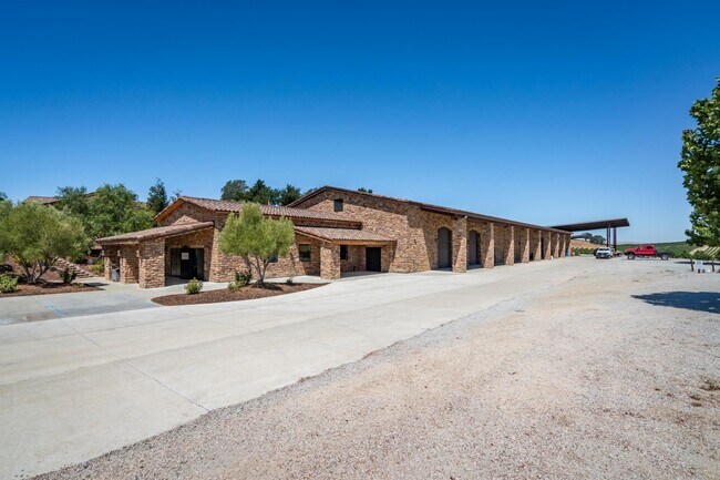


Property Detail
4900 Union Rd
015-053-009
PM 37-28 PAR B
Agriculturalland
San Luis Obispo
AG
California
B and X Area of moderate flood hazard, usually the area between the limits of the 100-year and 500-year floods.
82.10 AC
2024
North 101 Corridor
2025
San Luis Obispo/Paso Robles
010302
San Luis Obispo-Paso Robles, CA
NEARBY LISTINGS FOR SALE OR LEASE
DEMOGRAPHICS near 4900 Union Rd
1 mile
3 mile
5 mile
2025 Total Population
57
5,532
33,568
2030 Population
56
5,464
33,203
Pop Growth 2025-2030
(1.75%)
(1.23%)
(1.09%)
Average Age
44
43
40
2025 Total Households
21
2,077
12,174
HH Growth 2025-2030
(4.76%)
(1.40%)
(1.29%)
Median Household Inc
$199,999
$98,606
$93,979
Avg Household Size
2.40
2.60
2.70
2025 Avg HH Vehicles
3.00
2.00
2.00
Median Home Value
$812,499
$665,849
$719,756
Median Year Built
1986
1989
1988
Nearby Places
Map Layers
Map Styles
 Street
 Aerial
Transit
 Traffic
 Biking
Places
Listings with unknown addresses are not visible on the map
- Restaurants
- Banks
- Shops
- Fitness
- Groceries
PUBLIC TRANSPORTATION
COMMUTER RAIL
Paso Robles Amtrak Station (Coast Starlight - Amtrak)
Drive
Walk
Distance
Paso Robles Amtrak Station (Coast Starlight - Amtrak)
12 min
5.8 mi
AIRPORT
San Luis County Regional
Drive
Walk
Distance
San Luis County Regional
55 min
40.1 mi
Freight Ports
The Port of Hueneme
Drive
Walk
Distance
The Port of Hueneme
212 min
167.1 mi
SALE & LEASE HISTORY
LISTING DATE
SALE/LEASE

Aug 15, 2023
For Sale
Nearby Properties
Address
Land Use
TOTAL SIZE
Lot Size
Zoning
Address
Land Use
TOTAL SIZE
Lot Size
Zoning
115,054 SF
18.78 AC
PM
Address
Land Use
TOTAL SIZE
Lot Size
Zoning
77,710 SF
44 AC
AG
Address
Land Use
TOTAL SIZE
Lot Size
Zoning
24.74 AC
AG
Address
Land Use
TOTAL SIZE
Lot Size
Zoning
34.76 AC
Address
Land Use
TOTAL SIZE
Lot Size
Zoning
Address
Land Use
TOTAL SIZE
Lot Size
Zoning
3.01 AC
Address
Land Use
TOTAL SIZE
Lot Size
Zoning
14,995 SF
10.74 AC
Address
Land Use
TOTAL SIZE
Lot Size
Zoning
14.75 AC
Address
Land Use
TOTAL SIZE
Lot Size
Zoning
1,386 SF
315 AC
AG
Address
Land Use
TOTAL SIZE
Lot Size
Zoning
Address
Land Use
TOTAL SIZE
Lot Size
Zoning
1,584 SF
255.80 AC
AG
Address
Land Use
TOTAL SIZE
Lot Size
Zoning
3,650 SF
17.40 AC
R1
Address
Land Use
TOTAL SIZE
Lot Size
Zoning
31,458 SF
3.99 AC
PM
Address
Land Use
TOTAL SIZE
Lot Size
Zoning
6,025 SF
224.27 AC
POS
Address
Land Use
TOTAL SIZE
Lot Size
Zoning
201.46 AC
Address
Land Use
TOTAL SIZE
Lot Size
Zoning
28,374 SF
5.19 AC
PM
Address
Land Use
TOTAL SIZE
Lot Size
Zoning
57,434 SF
4.18 AC
R4
Address
Land Use
TOTAL SIZE
Lot Size
Zoning
4.90 AC
C3
Address
Land Use
TOTAL SIZE
Lot Size
Zoning
172.19 AC
AG
Address
Land Use
TOTAL SIZE
Lot Size
Zoning
29,800 SF
11.48 AC
C3
Address
Land Use
TOTAL SIZE
Lot Size
Zoning
1,440 SF
67.22 AC
RA
Address
Land Use
TOTAL SIZE
Lot Size
Zoning
9.80 AC
Address
Land Use
TOTAL SIZE
Lot Size
Zoning
3.81 AC
C3
Address
Land Use
TOTAL SIZE
Lot Size
Zoning
12,639 SF
8.26 AC
C2
Address
Land Use
TOTAL SIZE
Lot Size
Zoning
141 AC
PF
Address
Land Use
TOTAL SIZE
Lot Size
Zoning
1,008 SF
224.50 AC
POS
Address
Land Use
TOTAL SIZE
Lot Size
Zoning
159 AC
AG
Address
Land Use
TOTAL SIZE
Lot Size
Zoning
15,000 SF
2.25 AC
PM
Address
Land Use
TOTAL SIZE
Lot Size
Zoning
42,566 SF
2.64 AC
PM
The World's #1 Commercial Real Estate Marketplace
Connect with us
© 2026 CoStar Group
The information above has been obtained from sources believed reliable. While we do not doubt its accuracy we have not verified it and make no guarantee, warranty or representation about it. It is your responsibility to independently confirm its accuracy and completeness. Any projections, opinions, assumptions, or estimates used are for example only and do not represent the current or future performance of the property. The value of this transaction to you depends on tax and other factors which should be evaluated by your tax, financial, and legal advisors. You and your advisors should conduct a careful, independent investigation of the property to determine to your satisfaction the suitability of the property for your needs.