Property Record
4901 Langley Rd, Houston, TX 77093
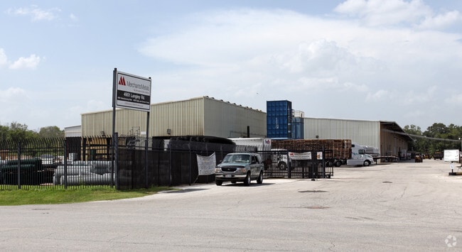
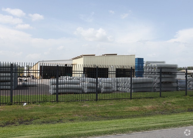
Property Detail
4901 Langley Rd
0450760000002
TRS 2 & 2A ABST 772 M TERRELL
Outdoorrecreationbeachmountaindesert
HARRIS
AE The base floodplain where base flood elevations are provided. AE Zones are now used on new format FIRMs instead of A1-A30 Zones.
Texas
2024
32.46 AC
2025
Northeast Hwy 90
231700
Houston
164,377 SF
Houston-Pasadena-The Woodlands, TX
NEARBY LISTINGS FOR SALE OR LEASE
DEMOGRAPHICS near 4901 Langley Rd
1 mile
3 mile
5 mile
2025 Total Population
10,111
111,351
256,362
2030 Population
10,739
118,901
274,023
Pop Growth 2025-2030
+ 6.21%
+ 6.78%
+ 6.89%
Average Age
36
36
36
2025 Total Households
2,969
33,543
79,166
HH Growth 2025-2030
+ 6.50%
+ 7.06%
+ 7.15%
Median Household Inc
$45,466
$43,864
$43,485
Avg Household Size
3.30
3.20
3.10
2025 Avg HH Vehicles
2.00
2.00
2.00
Median Home Value
$123,395
$144,517
$160,879
Median Year Built
1965
1967
1968
Nearby Places
Map Layers
Map Styles
 Street
 Aerial
Transit
 Traffic
 Biking
Places
Listings with unknown addresses are not visible on the map
- Restaurants
- Banks
- Shops
- Fitness
- Groceries
PUBLIC TRANSPORTATION
COMMUTER RAIL
Drive
Walk
Distance
18 min
9.9 mi
AIRPORT
George Bush Intcntl/Houston
Drive
Walk
Distance
George Bush Intcntl/Houston
18 min
10.4 mi
William P Hobby
Drive
Walk
Distance
William P Hobby
36 min
20.9 mi
Freight Ports
Port of Houston
Drive
Walk
Distance
Port of Houston
24 min
12.9 mi
Nearby Properties
Address
Land Use
TOTAL SIZE
Lot Size
Zoning
Address
Land Use
TOTAL SIZE
Lot Size
Zoning
139,252 SF
4.55 AC
Address
Land Use
TOTAL SIZE
Lot Size
Zoning
132,902 SF
6.12 AC
Address
Land Use
TOTAL SIZE
Lot Size
Zoning
91,623 SF
9.09 AC
Address
Land Use
TOTAL SIZE
Lot Size
Zoning
200,186 SF
13.20 AC
Address
Land Use
TOTAL SIZE
Lot Size
Zoning
261,236 SF
11.57 AC
Address
Land Use
TOTAL SIZE
Lot Size
Zoning
81,067 SF
35.13 AC
Address
Land Use
TOTAL SIZE
Lot Size
Zoning
219,230 SF
9.92 AC
Address
Land Use
TOTAL SIZE
Lot Size
Zoning
148,981 SF
6.53 AC
Address
Land Use
TOTAL SIZE
Lot Size
Zoning
230,024 SF
15.34 AC
Address
Land Use
TOTAL SIZE
Lot Size
Zoning
112,212 SF
10.51 AC
Address
Land Use
TOTAL SIZE
Lot Size
Zoning
130,309 SF
13.28 AC
Address
Land Use
TOTAL SIZE
Lot Size
Zoning
102,214 SF
11.26 AC
Address
Land Use
TOTAL SIZE
Lot Size
Zoning
352,503 SF
20.41 AC
Address
Land Use
TOTAL SIZE
Lot Size
Zoning
102,252 SF
5.93 AC
Address
Land Use
TOTAL SIZE
Lot Size
Zoning
210,869 SF
8.43 AC
Address
Land Use
TOTAL SIZE
Lot Size
Zoning
149,910 SF
6.57 AC
Address
Land Use
TOTAL SIZE
Lot Size
Zoning
136,996 SF
29.18 AC
Address
Land Use
TOTAL SIZE
Lot Size
Zoning
129,204 SF
7.03 AC
Address
Land Use
TOTAL SIZE
Lot Size
Zoning
288,992 SF
6.56 AC
Address
Land Use
TOTAL SIZE
Lot Size
Zoning
120,288 SF
9.30 AC
Address
Land Use
TOTAL SIZE
Lot Size
Zoning
88,462 SF
6.93 AC
Address
Land Use
TOTAL SIZE
Lot Size
Zoning
68,140 SF
8.49 AC
Address
Land Use
TOTAL SIZE
Lot Size
Zoning
148,266 SF
9.16 AC
Address
Land Use
TOTAL SIZE
Lot Size
Zoning
132,508 SF
5.78 AC
Address
Land Use
TOTAL SIZE
Lot Size
Zoning
111,892 SF
6.51 AC
Address
Land Use
TOTAL SIZE
Lot Size
Zoning
81,225 SF
5.03 AC
Address
Land Use
TOTAL SIZE
Lot Size
Zoning
104,553 SF
11.28 AC
Address
Land Use
TOTAL SIZE
Lot Size
Zoning
142,170 SF
6.99 AC
Address
Land Use
TOTAL SIZE
Lot Size
Zoning
1,920 SF
19.61 AC
The World's #1 Commercial Real Estate Marketplace
Connect with us
© 2026 CoStar Group
The information above has been obtained from sources believed reliable. While we do not doubt its accuracy we have not verified it and make no guarantee, warranty or representation about it. It is your responsibility to independently confirm its accuracy and completeness. Any projections, opinions, assumptions, or estimates used are for example only and do not represent the current or future performance of the property. The value of this transaction to you depends on tax and other factors which should be evaluated by your tax, financial, and legal advisors. You and your advisors should conduct a careful, independent investigation of the property to determine to your satisfaction the suitability of the property for your needs.