Property Record
4901 Weedpatch Hwy, Bakersfield, CA 93307

Property Detail
4901 Weedpatch Hwy
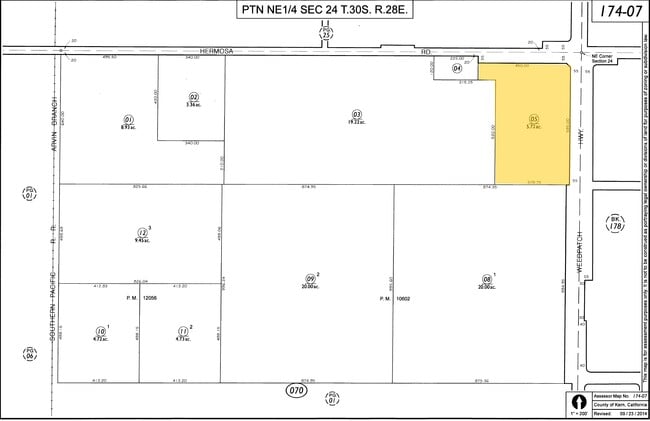
174-070-05-00-4
SECTION 24 , TOWNSHIP 30 , RANGE 28 , QUARTER
Commercialnec
Kern
A1
California
B and X Area of moderate flood hazard, usually the area between the limits of the 100-year and 500-year floods.
5.72 AC
2024
Southeast Bakersfield
2025
Bakersfield
002401
Bakersfield-Delano, CA
NEARBY LISTINGS FOR SALE OR LEASE
-
-
View all Bakersfield listings for sale on LoopNet.com
DEMOGRAPHICS near 4901 Weedpatch Hwy
1 mile
3 mile
5 mile
2025 Total Population
1,257
9,455
80,747
2030 Population
1,281
9,707
81,627
Pop Growth 2025-2030
+ 1.91%
+ 2.67%
+ 1.09%
Average Age
35
34
33
2025 Total Households
336
2,421
21,100
HH Growth 2025-2030
+ 1.79%
+ 2.52%
+ 1.01%
Median Household Inc
$50,208
$65,168
$51,775
Avg Household Size
3.60
3.80
3.70
2025 Avg HH Vehicles
2.00
2.00
2.00
Median Home Value
$342,857
$360,492
$264,598
Median Year Built
1979
1984
1976
Nearby Places
Map Layers
Map Styles
 Street
 Aerial
Layers
 Traffic
 Biking
Places
Listings with unknown addresses are not visible on the map
- Restaurants
- Banks
- Shops
- Fitness
- Groceries
PUBLIC TRANSPORTATION
COMMUTER RAIL
Drive
Walk
Distance
16 min
9.1 mi
AIRPORT
Meadows Field
Drive
Walk
Distance
Meadows Field
27 min
17.1 mi
SALE & LEASE HISTORY
LISTING DATE
SALE/LEASE

Nov 02, 2018
For Sale
Nearby Properties
Address
Land Use
TOTAL SIZE
Lot Size
Zoning
Address
Land Use
TOTAL SIZE
Lot Size
Zoning
38.14 AC
M-3
Address
Land Use
TOTAL SIZE
Lot Size
Zoning
3,600 SF
18 AC
AG
Address
Land Use
TOTAL SIZE
Lot Size
Zoning
196.78 AC
A
Address
Land Use
TOTAL SIZE
Lot Size
Zoning
44,779 SF
2.17 AC
M2
Address
Land Use
TOTAL SIZE
Lot Size
Zoning
47,592 SF
35.87 AC
M2
Address
Land Use
TOTAL SIZE
Lot Size
Zoning
5.63 AC
C2
Address
Land Use
TOTAL SIZE
Lot Size
Zoning
83.70 AC
A
Address
Land Use
TOTAL SIZE
Lot Size
Zoning
17,217 SF
1.52 AC
C2
Address
Land Use
TOTAL SIZE
Lot Size
Zoning
83.70 AC
A
Address
Land Use
TOTAL SIZE
Lot Size
Zoning
Address
Land Use
TOTAL SIZE
Lot Size
Zoning
72.55 AC
A
Address
Land Use
TOTAL SIZE
Lot Size
Zoning
246.66 AC
A
Address
Land Use
TOTAL SIZE
Lot Size
Zoning
30,000 SF
12.56 AC
M-1
Address
Land Use
TOTAL SIZE
Lot Size
Zoning
160.43 AC
A
Address
Land Use
TOTAL SIZE
Lot Size
Zoning
78,550 SF
6.99 AC
M1
Address
Land Use
TOTAL SIZE
Lot Size
Zoning
84,324 SF
6.99 AC
M1
Address
Land Use
TOTAL SIZE
Lot Size
Zoning
153.69 AC
A
Address
Land Use
TOTAL SIZE
Lot Size
Zoning
2,682 SF
1.04 AC
C-2 FPS
Address
Land Use
TOTAL SIZE
Lot Size
Zoning
29,900 SF
3.61 AC
M-2
Address
Land Use
TOTAL SIZE
Lot Size
Zoning
7,594 SF
79.09 AC
A
Address
Land Use
TOTAL SIZE
Lot Size
Zoning
9,100 SF
0.94 AC
C-2
Address
Land Use
TOTAL SIZE
Lot Size
Zoning
3,600 SF
4.61 AC
C2
Address
Land Use
TOTAL SIZE
Lot Size
Zoning
27,962 SF
1.73 AC
C-2
Address
Land Use
TOTAL SIZE
Lot Size
Zoning
36.64 AC
A
Address
Land Use
TOTAL SIZE
Lot Size
Zoning
2,450 SF
0.69 AC
C2
Address
Land Use
TOTAL SIZE
Lot Size
Zoning
18.43 AC
A
Address
Land Use
TOTAL SIZE
Lot Size
Zoning
3,358 SF
2.62 AC
C2
Address
Land Use
TOTAL SIZE
Lot Size
Zoning
0.65 AC
C-2
The World's #1 Commercial Real Estate Marketplace
Connect with us
© 2026 CoStar Group
The information above has been obtained from sources believed reliable. While we do not doubt its accuracy we have not verified it and make no guarantee, warranty or representation about it. It is your responsibility to independently confirm its accuracy and completeness. Any projections, opinions, assumptions, or estimates used are for example only and do not represent the current or future performance of the property. The value of this transaction to you depends on tax and other factors which should be evaluated by your tax, financial, and legal advisors. You and your advisors should conduct a careful, independent investigation of the property to determine to your satisfaction the suitability of the property for your needs.