Property Record
4902 S 1900 W, Roy, UT 84067
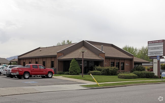
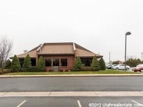

Property Detail
4902 S 1900 W
08-419-0003
UNIT 3, ROY DENTAL ASSOCIATION CONDOMINIUM, ROY CITY, WEBER COUNTY, UTAH.
Medicalbuilding
Weber
B and X Area of moderate flood hazard, usually the area between the limits of the 100-year and 500-year floods.
Utah
2025
0.08 AC
2025
Davis/Weber Counties
210701
Salt Lake City
1,974 SF
Ogden, UT
NEARBY LISTINGS FOR SALE OR LEASE
DEMOGRAPHICS near 4902 S 1900 W
1 mile
3 mile
5 mile
2025 Total Population
12,004
80,961
204,887
2030 Population
12,293
83,311
213,381
Pop Growth 2025-2030
+ 2.41%
+ 2.90%
+ 4.15%
Average Age
36
36
35
2025 Total Households
4,287
27,303
68,592
HH Growth 2025-2030
+ 2.59%
+ 3.13%
+ 4.32%
Median Household Inc
$77,496
$90,053
$89,021
Avg Household Size
2.80
2.90
2.90
2025 Avg HH Vehicles
2.00
2.00
2.00
Median Home Value
$379,317
$398,139
$428,500
Median Year Built
1972
1986
1989
Nearby Places
Map Layers
Map Styles
 Street
 Aerial
Layers
 Traffic
 Biking
Places
Listings with unknown addresses are not visible on the map
- Restaurants
- Banks
- Shops
- Fitness
- Groceries
PUBLIC TRANSPORTATION
COMMUTER RAIL
Roy (FrontRunner North - Utah Transit Authority (UTA))
Drive
Walk
Distance
Roy (FrontRunner North - Utah Transit Authority (UTA))
5 min
2.0 mi
Ogden (FrontRunner North - Utah Transit Authority (UTA))
Drive
Walk
Distance
Ogden (FrontRunner North - Utah Transit Authority (UTA))
10 min
5.6 mi
AIRPORT
Salt Lake City International
Drive
Walk
Distance
Salt Lake City International
42 min
34.6 mi
SALE & LEASE HISTORY
LISTING DATE
SALE/LEASE

Jul 31, 2020
For Lease
Apr 05, 2023
For Lease
Nearby Properties
Address
Land Use
TOTAL SIZE
Lot Size
Zoning
Address
Land Use
TOTAL SIZE
Lot Size
Zoning
2,657 SF
16.26 AC
Address
Land Use
TOTAL SIZE
Lot Size
Zoning
3,743 SF
8.80 AC
Address
Land Use
TOTAL SIZE
Lot Size
Zoning
200,509 SF
12.75 AC
Address
Land Use
TOTAL SIZE
Lot Size
Zoning
35,219 SF
58.98 AC
Address
Land Use
TOTAL SIZE
Lot Size
Zoning
7,492 SF
8.96 AC
Address
Land Use
TOTAL SIZE
Lot Size
Zoning
83,038 SF
7.54 AC
Address
Land Use
TOTAL SIZE
Lot Size
Zoning
71,940 SF
11 AC
Address
Land Use
TOTAL SIZE
Lot Size
Zoning
98,660 SF
3.18 AC
Address
Land Use
TOTAL SIZE
Lot Size
Zoning
8,580 SF
6.40 AC
Address
Land Use
TOTAL SIZE
Lot Size
Zoning
115,094 SF
13.88 AC
Address
Land Use
TOTAL SIZE
Lot Size
Zoning
225,497 SF
20.33 AC
Address
Land Use
TOTAL SIZE
Lot Size
Zoning
255,596 SF
15.98 AC
Address
Land Use
TOTAL SIZE
Lot Size
Zoning
23,932 SF
5.53 AC
Address
Land Use
TOTAL SIZE
Lot Size
Zoning
2,140 SF
6.19 AC
Address
Land Use
TOTAL SIZE
Lot Size
Zoning
10,440 SF
4.24 AC
Address
Land Use
TOTAL SIZE
Lot Size
Zoning
139,574 SF
9.30 AC
Address
Land Use
TOTAL SIZE
Lot Size
Zoning
292,364 SF
24.15 AC
Address
Land Use
TOTAL SIZE
Lot Size
Zoning
1,440 SF
7.72 AC
Address
Land Use
TOTAL SIZE
Lot Size
Zoning
17,220 SF
218.11 AC
Address
Land Use
TOTAL SIZE
Lot Size
Zoning
48,290 SF
7.95 AC
The World's #1 Commercial Real Estate Marketplace
Connect with us
© 2026 CoStar Group
The information above has been obtained from sources believed reliable. While we do not doubt its accuracy we have not verified it and make no guarantee, warranty or representation about it. It is your responsibility to independently confirm its accuracy and completeness. Any projections, opinions, assumptions, or estimates used are for example only and do not represent the current or future performance of the property. The value of this transaction to you depends on tax and other factors which should be evaluated by your tax, financial, and legal advisors. You and your advisors should conduct a careful, independent investigation of the property to determine to your satisfaction the suitability of the property for your needs.