Property Record
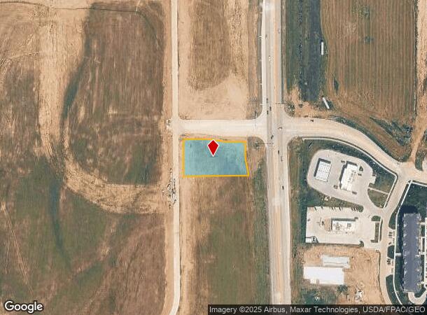
4903 S 205 St, Elkhorn, NE 68022
NEARBY LISTINGS FOR SALE OR LEASE
Property Detail
4903 S 205 St
Omaha/Council Bluffs
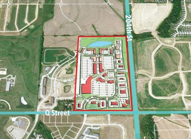
Kensington Park
Omaha-Council Bluffs, NE-IA
KENSINGTON PARK LOT 10 BLOCK 0 LOT 10 .916 AC
3485-1022-14
Douglas
Commercialnec
Nebraska
2024
10
2025
0.92 AC
007506
Southwest Omaha
DEMOGRAPHICS near 4903 S 205 St
1 Mile
3 Mile
5 Mile
2024 Total Population
5,055
47,482
126,143
2029 Population
5,121
49,118
130,209
Pop Growth 2024-2029
+ 1.31%
+ 3.45%
+ 3.22%
Average Age
34
36
38
2024 Total Households
1,604
15,388
44,107
HH Growth 2024-2029
+ 1.31%
+ 3.33%
+ 3.03%
Median Household Inc
$118,162
$139,317
$123,925
Avg Household Size
3.10
3.10
2.80
2024 Avg HH Vehicles
2.00
2.00
2.00
Median Home Value
$322,426
$348,392
$312,083
Median Year Built
2010
2007
2002
Nearby Places
Map Layers
Map Styles
 Street
 Aerial
- Restaurants
- Banks
- Shops
- Fitness
- Groceries
PUBLIC TRANSPORTATION
AIRPORT
Eppley Airfield
DRIVE
WALK
Distance
Eppley Airfield
39 min
22.7 mi
Lincoln
DRIVE
WALK
Distance
Lincoln
51 min
43.1 mi
Nearby Properties
Address
Land Use
TOTAL SIZE
Lot Size
Zoning
Address
Land Use
TOTAL SIZE
Lot Size
Zoning
349,722 SF
25.22 AC
R6
Address
Land Use
TOTAL SIZE
Lot Size
Zoning
391,191 SF
87.18 AC
GI
Address
Land Use
TOTAL SIZE
Lot Size
Zoning
394,017 SF
11.62 AC
Address
Land Use
TOTAL SIZE
Lot Size
Zoning
277,073 SF
16.78 AC
Address
Land Use
TOTAL SIZE
Lot Size
Zoning
299,172 SF
13.80 AC
R7
Address
Land Use
TOTAL SIZE
Lot Size
Zoning
165,950 SF
11.57 AC
MH
Address
Land Use
TOTAL SIZE
Lot Size
Zoning
240,630 SF
5.38 AC
Address
Land Use
TOTAL SIZE
Lot Size
Zoning
257,106 SF
21.44 AC
R6
Address
Land Use
TOTAL SIZE
Lot Size
Zoning
222,090 SF
7.74 AC
R6
Address
Land Use
TOTAL SIZE
Lot Size
Zoning
193,490 SF
9.35 AC
Address
Land Use
TOTAL SIZE
Lot Size
Zoning
182,501 SF
9.53 AC
Address
Land Use
TOTAL SIZE
Lot Size
Zoning
28,444 SF
0.85 AC
Address
Land Use
TOTAL SIZE
Lot Size
Zoning
387,400 SF
6.13 AC
Address
Land Use
TOTAL SIZE
Lot Size
Zoning
52,791 SF
8.09 AC
Address
Land Use
TOTAL SIZE
Lot Size
Zoning
209,767 SF
21.17 AC
MU
Address
Land Use
TOTAL SIZE
Lot Size
Zoning
137,181 SF
16.36 AC
MU
Address
Land Use
TOTAL SIZE
Lot Size
Zoning
34,209 SF
3.02 AC
Address
Land Use
TOTAL SIZE
Lot Size
Zoning
134,709 SF
2.32 AC
MU
Address
Land Use
TOTAL SIZE
Lot Size
Zoning
138,942 SF
2.86 AC
Address
Land Use
TOTAL SIZE
Lot Size
Zoning
59,022 SF
4.86 AC
Address
Land Use
TOTAL SIZE
Lot Size
Zoning
173,600 SF
16.36 AC
MU
Address
Land Use
TOTAL SIZE
Lot Size
Zoning
32,049 SF
5.70 AC
Address
Land Use
TOTAL SIZE
Lot Size
Zoning
37,700 SF
3.85 AC
Address
Land Use
TOTAL SIZE
Lot Size
Zoning
107,577 SF
4.24 AC
Address
Land Use
TOTAL SIZE
Lot Size
Zoning
72,485 SF
1.75 AC
Address
Land Use
TOTAL SIZE
Lot Size
Zoning
83,022 SF
2.72 AC
MU
Address
Land Use
TOTAL SIZE
Lot Size
Zoning
34,718 SF
3.49 AC
MU
Address
Land Use
TOTAL SIZE
Lot Size
Zoning
44,790 SF
3.68 AC
Address
Land Use
TOTAL SIZE
Lot Size
Zoning
39,264 SF
1.67 AC
RG35
Address
Land Use
TOTAL SIZE
Lot Size
Zoning
9,083 SF
2.56 AC
The World's #1 Commercial Real Estate Marketplace
Connect with us
© 2025 CoStar Group
The information above has been obtained from sources believed reliable. While we do not doubt its accuracy we have not verified it and make no guarantee, warranty or representation about it. It is your responsibility to independently confirm its accuracy and completeness. Any projections, opinions, assumptions, or estimates used are for example only and do not represent the current or future performance of the property. The value of this transaction to you depends on tax and other factors which should be evaluated by your tax, financial, and legal advisors. You and your advisors should conduct a careful, independent investigation of the property to determine to your satisfaction the suitability of the property for your needs.