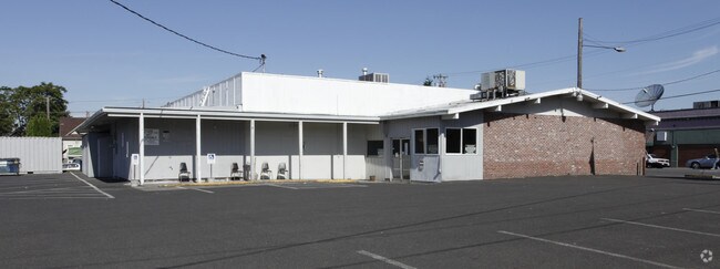
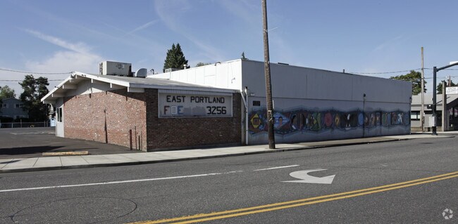
Property Record
4904 Se Hawthorne Blvd, Portland, OR 97215

Property Detail
4904 Se Hawthorne Blvd
R177076
HAWTHORNE PL, BLOCK 2, LOT 2-6 TL 6500
Commercialnec
Multnomah
CM2
Oregon
B and X Area of moderate flood hazard, usually the area between the limits of the 100-year and 500-year floods.
2-6
2025
0.53 AC
2025
Mall 205
001400
Portland
7,481 SF
Portland-Vancouver-Hillsboro, OR-WA
NEARBY LISTINGS FOR SALE OR LEASE
DEMOGRAPHICS near 4904 Se Hawthorne Blvd
1 mile
3 mile
5 mile
2025 Total Population
27,165
207,409
508,903
2030 Population
26,692
204,354
504,304
Pop Growth 2025-2030
(1.74%)
(1.47%)
(0.90%)
Average Age
41
41
41
2025 Total Households
12,189
92,305
225,039
HH Growth 2025-2030
(1.98%)
(1.62%)
(0.98%)
Median Household Inc
$113,861
$93,093
$86,608
Avg Household Size
2.10
2.10
2.10
2025 Avg HH Vehicles
1.00
1.00
1.00
Median Home Value
$723,630
$657,894
$608,035
Median Year Built
1948
1952
1963
Nearby Places
Map Layers
Map Styles
 Street
 Aerial
Layers
 Traffic
 Biking
Places
Listings with unknown addresses are not visible on the map
- Restaurants
- Banks
- Shops
- Fitness
- Groceries
PUBLIC TRANSPORTATION
COMMUTER RAIL
Portland (Amtrak Cascades - Amtrak, Coast Starlight - Amtrak, Empire Builder - Amtrak)
Drive
Walk
Distance
Portland (Amtrak Cascades - Amtrak, Coast Starlight - Amtrak, Empire Builder - Amtrak)
14 min
4.3 mi
AIRPORT
Portland International
Drive
Walk
Distance
Portland International
19 min
9.6 mi
Freight Ports
Port of Portland
Drive
Walk
Distance
Port of Portland
16 min
8.2 mi
Nearby Properties
Address
Land Use
TOTAL SIZE
Lot Size
Zoning
Address
Land Use
TOTAL SIZE
Lot Size
Zoning
627,500 SF
16.60 AC
CX
Address
Land Use
TOTAL SIZE
Lot Size
Zoning
822,867 SF
103.39 AC
CI1
Address
Land Use
TOTAL SIZE
Lot Size
Zoning
1.09 AC
EX
Address
Land Use
TOTAL SIZE
Lot Size
Zoning
2.24 AC
CX
Address
Land Use
TOTAL SIZE
Lot Size
Zoning
417,324 SF
0.68 AC
CX
Address
Land Use
TOTAL SIZE
Lot Size
Zoning
1,024 SF
15.92 AC
OS
Address
Land Use
TOTAL SIZE
Lot Size
Zoning
178,785 SF
10.20 AC
R5
Address
Land Use
TOTAL SIZE
Lot Size
Zoning
296,039 SF
11.70 AC
R5
Address
Land Use
TOTAL SIZE
Lot Size
Zoning
7.78 AC
EX
Address
Land Use
TOTAL SIZE
Lot Size
Zoning
183,664 SF
8.96 AC
R5
Address
Land Use
TOTAL SIZE
Lot Size
Zoning
280,069 SF
18.31 AC
IR
Address
Land Use
TOTAL SIZE
Lot Size
Zoning
247,520 SF
7.74 AC
CX
Address
Land Use
TOTAL SIZE
Lot Size
Zoning
473,746 SF
1.68 AC
Address
Land Use
TOTAL SIZE
Lot Size
Zoning
2,218,439 SF
21.88 AC
CX
Address
Land Use
TOTAL SIZE
Lot Size
Zoning
147,334 SF
10.92 AC
IG1
Address
Land Use
TOTAL SIZE
Lot Size
Zoning
360,053 SF
0.71 AC
EXD
Address
Land Use
TOTAL SIZE
Lot Size
Zoning
250,280 SF
23.86 AC
IR
Address
Land Use
TOTAL SIZE
Lot Size
Zoning
31,878 SF
15.95 AC
IG2
Address
Land Use
TOTAL SIZE
Lot Size
Zoning
54,676 SF
190.32 AC
OS
Address
Land Use
TOTAL SIZE
Lot Size
Zoning
198,107 SF
4.03 AC
R2.5
Address
Land Use
TOTAL SIZE
Lot Size
Zoning
42,839,055 SF
19.25 AC
CI1
Address
Land Use
TOTAL SIZE
Lot Size
Zoning
320,732 SF
1.14 AC
CX
Address
Land Use
TOTAL SIZE
Lot Size
Zoning
152,575 SF
5.32 AC
EG1
Address
Land Use
TOTAL SIZE
Lot Size
Zoning
453,461 SF
1.16 AC
CX
Address
Land Use
TOTAL SIZE
Lot Size
Zoning
317,656 SF
21.94 AC
CX
Address
Land Use
TOTAL SIZE
Lot Size
Zoning
440,000 SF
1.80 AC
CX
Address
Land Use
TOTAL SIZE
Lot Size
Zoning
785,000 SF
4 AC
NULL
Address
Land Use
TOTAL SIZE
Lot Size
Zoning
44,644 SF
2.18 AC
R2
Address
Land Use
TOTAL SIZE
Lot Size
Zoning
64,673 SF
NULL
Address
Land Use
TOTAL SIZE
Lot Size
Zoning
100,217 SF
1.99 AC
R5
The World's #1 Commercial Real Estate Marketplace
Connect with us
© 2026 CoStar Group
The information above has been obtained from sources believed reliable. While we do not doubt its accuracy we have not verified it and make no guarantee, warranty or representation about it. It is your responsibility to independently confirm its accuracy and completeness. Any projections, opinions, assumptions, or estimates used are for example only and do not represent the current or future performance of the property. The value of this transaction to you depends on tax and other factors which should be evaluated by your tax, financial, and legal advisors. You and your advisors should conduct a careful, independent investigation of the property to determine to your satisfaction the suitability of the property for your needs.