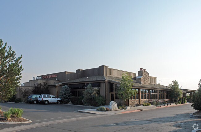
Property Record
4905 S Virginia St, Reno, NV 89502


NEARBY LISTINGS FOR SALE OR LEASE
Property Detail
4905 S Virginia St
Reno, NV
_Unspecified
024-054-04
PM 3779 LT 2
Commercialnec
Washoe
X
Nevada
32031C3231G
2
2025
2.10 AC
2026
Meadowood
001005
Reno/Sparks
13,241 SF
DEMOGRAPHICS near 4905 S Virginia St
1 Mile
3 Mile
5 Mile
2024 Total Population
16,141
83,340
200,734
2029 Population
16,993
87,692
211,350
Pop Growth 2024-2029
+ 5.28%
+ 5.22%
+ 5.29%
Average Age
38
40
40
2024 Total Households
6,530
36,307
85,756
HH Growth 2024-2029
+ 5.42%
+ 5.36%
+ 5.40%
Median Household Inc
$56,968
$64,046
$62,570
Avg Household Size
2.40
2.20
2.20
2024 Avg HH Vehicles
2.00
2.00
2.00
Median Home Value
$405,309
$469,821
$482,281
Median Year Built
1977
1977
1980
Nearby Places
Map Layers
Map Styles
 Street
 Aerial
- Restaurants
- Banks
- Shops
- Fitness
- Groceries
PUBLIC TRANSPORTATION
AIRPORT
Reno/Tahoe International
DRIVE
WALK
Distance
Reno/Tahoe International
6 min
2.2 mi
Freight Ports
Port of Richmond
DRIVE
WALK
Distance
Port of Richmond
1 min
176.4 mi
Nearby Properties
Address
Land Use
TOTAL SIZE
Lot Size
Zoning
Address
Land Use
TOTAL SIZE
Lot Size
Zoning
1,638,272 SF
17.11 AC
MU
Address
Land Use
TOTAL SIZE
Lot Size
Zoning
762,384 SF
1,131.28 AC
MA
Address
Land Use
TOTAL SIZE
Lot Size
Zoning
799,762 SF
13.30 AC
MU
Address
Land Use
TOTAL SIZE
Lot Size
Zoning
390,743 SF
22.20 AC
IC
Address
Land Use
TOTAL SIZE
Lot Size
Zoning
1,051,043 SF
78.81 AC
PD
Address
Land Use
TOTAL SIZE
Lot Size
Zoning
425,118 SF
30.37 AC
IC
Address
Land Use
TOTAL SIZE
Lot Size
Zoning
759,161 SF
37.37 AC
MU
Address
Land Use
TOTAL SIZE
Lot Size
Zoning
893,055 SF
52.71 AC
MA
Address
Land Use
TOTAL SIZE
Lot Size
Zoning
451,635 SF
15 AC
PD
Address
Land Use
TOTAL SIZE
Lot Size
Zoning
497,928 SF
3.52 AC
MU
Address
Land Use
TOTAL SIZE
Lot Size
Zoning
645,699 SF
4.53 AC
MU
Address
Land Use
TOTAL SIZE
Lot Size
Zoning
421,744 SF
12.07 AC
MS
Address
Land Use
TOTAL SIZE
Lot Size
Zoning
500,079 SF
45.66 AC
SPD
Address
Land Use
TOTAL SIZE
Lot Size
Zoning
335,490 SF
19.54 AC
PD
Address
Land Use
TOTAL SIZE
Lot Size
Zoning
342,019 SF
23.32 AC
MF14
Address
Land Use
TOTAL SIZE
Lot Size
Zoning
109,936 SF
1.80 AC
MD-RD
Address
Land Use
TOTAL SIZE
Lot Size
Zoning
366,641 SF
37.91 AC
MA
Address
Land Use
TOTAL SIZE
Lot Size
Zoning
231,329 SF
8.37 AC
GC
Address
Land Use
TOTAL SIZE
Lot Size
Zoning
591,000 SF
5.46 AC
MU
Address
Land Use
TOTAL SIZE
Lot Size
Zoning
322,180 SF
2.87 AC
MU
Address
Land Use
TOTAL SIZE
Lot Size
Zoning
149,324 SF
4.34 AC
PD
Address
Land Use
TOTAL SIZE
Lot Size
Zoning
159,803 SF
0.60 AC
MD-RD
Address
Land Use
TOTAL SIZE
Lot Size
Zoning
253,751 SF
1.02 AC
MD-RD
Address
Land Use
TOTAL SIZE
Lot Size
Zoning
270,950 SF
14.86 AC
IC
Address
Land Use
TOTAL SIZE
Lot Size
Zoning
170,507 SF
17.24 AC
GC
Address
Land Use
TOTAL SIZE
Lot Size
Zoning
80,970 SF
5.28 AC
MS
Address
Land Use
TOTAL SIZE
Lot Size
Zoning
181,296 SF
2.65 AC
MU
Address
Land Use
TOTAL SIZE
Lot Size
Zoning
117,360 SF
1.75 AC
MU
Address
Land Use
TOTAL SIZE
Lot Size
Zoning
146,586 SF
2.94 AC
IC
Address
Land Use
TOTAL SIZE
Lot Size
Zoning
381,852 SF
18.60 AC
GC
The World's #1 Commercial Real Estate Marketplace
Connect with us
© 2026 CoStar Group
The information above has been obtained from sources believed reliable. While we do not doubt its accuracy we have not verified it and make no guarantee, warranty or representation about it. It is your responsibility to independently confirm its accuracy and completeness. Any projections, opinions, assumptions, or estimates used are for example only and do not represent the current or future performance of the property. The value of this transaction to you depends on tax and other factors which should be evaluated by your tax, financial, and legal advisors. You and your advisors should conduct a careful, independent investigation of the property to determine to your satisfaction the suitability of the property for your needs.