Property Record
4909 E Upriver Dr, Spokane, WA 99217
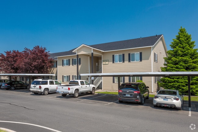
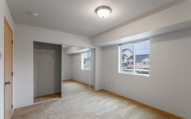
Property Detail
4909 E Upriver Dr
35112.9073
22-25-43, A PARCEL OF LAND SITUATE IN THE SOUTHEAST QUARTER OF THE NORTHWEST QUARTER AND THE NORTHEAST QUARTER OF THE SOUTHWEST QUARTER BEING ALL OF TRACT D PER SHORT PLAT 1266-01; EXCEPTING TRACT 3 THE FOLLOWING DESCRIBED PARCEL: THE TRUE POINT OF B
Apartment
SPOKANE
HDR
Washington
B and X Area of moderate flood hazard, usually the area between the limits of the 100-year and 500-year floods.
d
2025
3.15 AC
2025
Minnehaha
011302
Spokane
73,392 SF
Spokane-Spokane Valley, WA
NEARBY LISTINGS FOR SALE OR LEASE
DEMOGRAPHICS near 4909 E Upriver Dr
1 mile
3 mile
5 mile
2025 Total Population
5,084
74,903
219,444
2030 Population
5,157
76,139
223,016
Pop Growth 2025-2030
+ 1.44%
+ 1.65%
+ 1.63%
Average Age
37
39
40
2025 Total Households
2,034
28,978
90,883
HH Growth 2025-2030
+ 1.47%
+ 1.66%
+ 1.76%
Median Household Inc
$75,245
$62,114
$62,682
Avg Household Size
2.50
2.40
2.30
2025 Avg HH Vehicles
2.00
2.00
2.00
Median Home Value
$330,952
$327,961
$358,390
Median Year Built
1983
1962
1969
Nearby Places
Map Layers
Map Styles
 Street
 Aerial
Transit
 Traffic
 Biking
Places
Listings with unknown addresses are not visible on the map
- Restaurants
- Banks
- Shops
- Fitness
- Groceries
PUBLIC TRANSPORTATION
COMMUTER RAIL
Spokane (Empire Builder - Amtrak)
Drive
Walk
Distance
Spokane (Empire Builder - Amtrak)
16 min
5.6 mi
AIRPORT
Spokane International
Drive
Walk
Distance
Spokane International
24 min
12.3 mi
Freight Ports
Port of Everett
Drive
Walk
Distance
Port of Everett
351 min
307.9 mi
Nearby Properties
Address
Land Use
TOTAL SIZE
Lot Size
Zoning
Address
Land Use
TOTAL SIZE
Lot Size
Zoning
917,113 SF
100.67 AC
LI
Address
Land Use
TOTAL SIZE
Lot Size
Zoning
427,054 SF
16.60 AC
LI
Address
Land Use
TOTAL SIZE
Lot Size
Zoning
386,885 SF
22.81 AC
RSF
Address
Land Use
TOTAL SIZE
Lot Size
Zoning
251,542 SF
5.78 AC
DTG
Address
Land Use
TOTAL SIZE
Lot Size
Zoning
310,606 SF
27.56 AC
RMF
Address
Land Use
TOTAL SIZE
Lot Size
Zoning
180,822 SF
16.11 AC
CC1
Address
Land Use
TOTAL SIZE
Lot Size
Zoning
355,192 SF
35.83 AC
I-2
Address
Land Use
TOTAL SIZE
Lot Size
Zoning
379,678 SF
20.64 AC
LI
Address
Land Use
TOTAL SIZE
Lot Size
Zoning
290,380 SF
2.11 AC
CA3
Address
Land Use
TOTAL SIZE
Lot Size
Zoning
378,750 SF
17.38 AC
R-2
Address
Land Use
TOTAL SIZE
Lot Size
Zoning
91,310 SF
2.34 AC
Address
Land Use
TOTAL SIZE
Lot Size
Zoning
108,237 SF
3.48 AC
LI
Address
Land Use
TOTAL SIZE
Lot Size
Zoning
58,522 SF
19.91 AC
HI
Address
Land Use
TOTAL SIZE
Lot Size
Zoning
134,806 SF
7.79 AC
RMF
Address
Land Use
TOTAL SIZE
Lot Size
Zoning
41,890 SF
2.11 AC
OR
Address
Land Use
TOTAL SIZE
Lot Size
Zoning
95,030 SF
3.51 AC
CC1
Address
Land Use
TOTAL SIZE
Lot Size
Zoning
160,810 SF
25.18 AC
RMF
Address
Land Use
TOTAL SIZE
Lot Size
Zoning
96,424 SF
9.04 AC
I-1
Address
Land Use
TOTAL SIZE
Lot Size
Zoning
107,442 SF
5.57 AC
MF-2
Address
Land Use
TOTAL SIZE
Lot Size
Zoning
133,043 SF
1.85 AC
CC1
Address
Land Use
TOTAL SIZE
Lot Size
Zoning
59,441 SF
2.04 AC
GC
Address
Land Use
TOTAL SIZE
Lot Size
Zoning
134,104 SF
5.89 AC
HDR
Address
Land Use
TOTAL SIZE
Lot Size
Zoning
150,812 SF
17.49 AC
RC
Address
Land Use
TOTAL SIZE
Lot Size
Zoning
107,539 SF
7.54 AC
RMF
Address
Land Use
TOTAL SIZE
Lot Size
Zoning
102,441 SF
8.38 AC
Address
Land Use
TOTAL SIZE
Lot Size
Zoning
118,818 SF
7.96 AC
HDR
Address
Land Use
TOTAL SIZE
Lot Size
Zoning
138,078 SF
8.44 AC
HI
Address
Land Use
TOTAL SIZE
Lot Size
Zoning
60,484 SF
2.38 AC
LI
Address
Land Use
TOTAL SIZE
Lot Size
Zoning
91,811 SF
6.02 AC
LI
Address
Land Use
TOTAL SIZE
Lot Size
Zoning
71,803 SF
2.34 AC
RMF
The World's #1 Commercial Real Estate Marketplace
Connect with us
© 2026 CoStar Group
The information above has been obtained from sources believed reliable. While we do not doubt its accuracy we have not verified it and make no guarantee, warranty or representation about it. It is your responsibility to independently confirm its accuracy and completeness. Any projections, opinions, assumptions, or estimates used are for example only and do not represent the current or future performance of the property. The value of this transaction to you depends on tax and other factors which should be evaluated by your tax, financial, and legal advisors. You and your advisors should conduct a careful, independent investigation of the property to determine to your satisfaction the suitability of the property for your needs.