Property Record
491 Richmond Dr, Millbrae, CA 94030


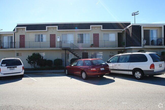
Property Detail
491 Richmond Dr
San Francisco-San Mateo-Redwood City, CA
LOT 1 BLK 3 SILVA RANCH SUB NO 1 RSM 60/2 3
021-433-010
San Mateo
Multifamilydwelling
California
B and X Area of moderate flood hazard, usually the area between the limits of the 100-year and 500-year floods.
1
2024
0.20 AC
2025
Millbrae
604800
San Francisco
8,684 SF
NEARBY LISTINGS FOR SALE OR LEASE
DEMOGRAPHICS near 491 Richmond Dr
1 mile
3 mile
5 mile
2025 Total Population
22,912
80,955
211,741
2030 Population
23,097
81,502
213,108
Pop Growth 2025-2030
+ 0.81%
+ 0.68%
+ 0.65%
Average Age
44
43
43
2025 Total Households
8,095
29,640
75,693
HH Growth 2025-2030
+ 0.68%
+ 0.65%
+ 0.63%
Median Household Inc
$152,333
$147,841
$143,508
Avg Household Size
2.70
2.60
2.70
2025 Avg HH Vehicles
2.00
2.00
2.00
Median Home Value
$1,132,915
$1,105,573
$1,095,757
Median Year Built
1960
1959
1963
Nearby Places
Map Layers
Map Styles
 Street
 Aerial
Layers
 Traffic
 Biking
Places
Listings with unknown addresses are not visible on the map
- Restaurants
- Banks
- Shops
- Fitness
- Groceries
PUBLIC TRANSPORTATION
COMMUTER RAIL
Drive
Walk
Distance
4 min
1.3 mi
Drive
Walk
Distance
6 min
2.8 mi
AIRPORT
San Francisco International
Drive
Walk
Distance
San Francisco International
9 min
3.7 mi
Metro Oakland International
Drive
Walk
Distance
Metro Oakland International
42 min
31.4 mi
Norman Y Mineta San Jose International
Drive
Walk
Distance
Norman Y Mineta San Jose International
42 min
32.8 mi
Nearby Properties
Address
Land Use
TOTAL SIZE
Lot Size
Zoning
Address
Land Use
TOTAL SIZE
Lot Size
Zoning
6.67 AC
PD0000
Address
Land Use
TOTAL SIZE
Lot Size
Zoning
10,000 SF
0.48 AC
ML00M1
Address
Land Use
TOTAL SIZE
Lot Size
Zoning
634,000 SF
8.62 AC
M10000
Address
Land Use
TOTAL SIZE
Lot Size
Zoning
198,375 SF
5.52 AC
PD0000
Address
Land Use
TOTAL SIZE
Lot Size
Zoning
5.02 AC
Address
Land Use
TOTAL SIZE
Lot Size
Zoning
19,657 SF
0.69 AC
Address
Land Use
TOTAL SIZE
Lot Size
Zoning
2.83 AC
Address
Land Use
TOTAL SIZE
Lot Size
Zoning
547,306 SF
3.93 AC
Address
Land Use
TOTAL SIZE
Lot Size
Zoning
55,000 SF
1.64 AC
ML00M1
Address
Land Use
TOTAL SIZE
Lot Size
Zoning
403,363 SF
11.26 AC
PD0000
Address
Land Use
TOTAL SIZE
Lot Size
Zoning
85,500 SF
2.20 AC
Address
Land Use
TOTAL SIZE
Lot Size
Zoning
2.57 AC
Address
Land Use
TOTAL SIZE
Lot Size
Zoning
Address
Land Use
TOTAL SIZE
Lot Size
Zoning
270,980 SF
3.33 AC
Address
Land Use
TOTAL SIZE
Lot Size
Zoning
589,128 SF
11.23 AC
Address
Land Use
TOTAL SIZE
Lot Size
Zoning
453,076 SF
25.10 AC
Address
Land Use
TOTAL SIZE
Lot Size
Zoning
86,000 SF
4.90 AC
PD0000
Address
Land Use
TOTAL SIZE
Lot Size
Zoning
11.46 AC
Address
Land Use
TOTAL SIZE
Lot Size
Zoning
426,540 SF
9.36 AC
C40000
Address
Land Use
TOTAL SIZE
Lot Size
Zoning
Address
Land Use
TOTAL SIZE
Lot Size
Zoning
294,000 SF
6.34 AC
PD0000
Address
Land Use
TOTAL SIZE
Lot Size
Zoning
144,591 SF
6.06 AC
CO0000
Address
Land Use
TOTAL SIZE
Lot Size
Zoning
105,710 SF
3.49 AC
Address
Land Use
TOTAL SIZE
Lot Size
Zoning
15.33 AC
Address
Land Use
TOTAL SIZE
Lot Size
Zoning
20.86 AC
Address
Land Use
TOTAL SIZE
Lot Size
Zoning
2,025 SF
2.28 AC
Address
Land Use
TOTAL SIZE
Lot Size
Zoning
338,057 SF
5.06 AC
Address
Land Use
TOTAL SIZE
Lot Size
Zoning
231,306 SF
3.68 AC
Address
Land Use
TOTAL SIZE
Lot Size
Zoning
32,625 SF
1.70 AC
CL00C1
Address
Land Use
TOTAL SIZE
Lot Size
Zoning
220,000 SF
9.80 AC
PD0000
The World's #1 Commercial Real Estate Marketplace
Connect with us
© 2026 CoStar Group
The information above has been obtained from sources believed reliable. While we do not doubt its accuracy we have not verified it and make no guarantee, warranty or representation about it. It is your responsibility to independently confirm its accuracy and completeness. Any projections, opinions, assumptions, or estimates used are for example only and do not represent the current or future performance of the property. The value of this transaction to you depends on tax and other factors which should be evaluated by your tax, financial, and legal advisors. You and your advisors should conduct a careful, independent investigation of the property to determine to your satisfaction the suitability of the property for your needs.