Property Record
491 S Main St, Cedar City, UT 84720


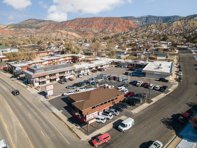
Property Detail
491 S Main St
Other Market Areas
S 44.5 FT LOT 12, BLK 7, THORLEY WILLIAMS FRETWELL DALLEY SUBDIVISION; ALSO ALL LOT 13, BLK 7, THORLEY WILLIAMS FRETWELL DALLEY SUBDIVISION; ALSO COM AT NW COR LOT 14, BLK 7 SD SUBD; SELY ALG LOT LN TO NE COR SD LOT 14; SWLY TO PT ON W LN SD LOT 14 W
Cedar City, UT
Iron
B-1005-0000-0000
Utah
Commercialnec
12,13
2025
1.03 AC
2025
Cedar City & St George
110602
NEARBY LISTINGS FOR SALE OR LEASE
DEMOGRAPHICS near 491 S Main St
1 mile
3 mile
5 mile
2025 Total Population
10,216
31,908
46,361
2030 Population
11,171
35,322
51,520
Pop Growth 2025-2030
+ 9.35%
+ 10.70%
+ 11.13%
Average Age
32
34
34
2025 Total Households
3,479
10,986
15,570
HH Growth 2025-2030
+ 9.69%
+ 11.00%
+ 11.42%
Median Household Inc
$59,983
$67,696
$71,708
Avg Household Size
2.60
2.70
2.80
2025 Avg HH Vehicles
2.00
2.00
2.00
Median Home Value
$340,409
$401,901
$421,618
Median Year Built
1984
1995
1998
Nearby Places
Map Layers
Map Styles
 Street
 Aerial
Layers
 Traffic
 Biking
Places
Listings with unknown addresses are not visible on the map
- Restaurants
- Banks
- Shops
- Fitness
- Groceries
SALE & LEASE HISTORY
LISTING DATE
SALE/LEASE

Sep 24, 2016
For Sale
Mar 06, 2024
For Lease
Aug 23, 2024
For Lease
Apr 05, 2017
For Sale
Nearby Properties
Address
Land Use
TOTAL SIZE
Lot Size
Zoning
Address
Land Use
TOTAL SIZE
Lot Size
Zoning
14.77 AC
Address
Land Use
TOTAL SIZE
Lot Size
Zoning
13.92 AC
Address
Land Use
TOTAL SIZE
Lot Size
Zoning
11.68 AC
Address
Land Use
TOTAL SIZE
Lot Size
Zoning
Address
Land Use
TOTAL SIZE
Lot Size
Zoning
Address
Land Use
TOTAL SIZE
Lot Size
Zoning
5.47 AC
Address
Land Use
TOTAL SIZE
Lot Size
Zoning
Address
Land Use
TOTAL SIZE
Lot Size
Zoning
Address
Land Use
TOTAL SIZE
Lot Size
Zoning
5.99 AC
Address
Land Use
TOTAL SIZE
Lot Size
Zoning
Address
Land Use
TOTAL SIZE
Lot Size
Zoning
Address
Land Use
TOTAL SIZE
Lot Size
Zoning
8.39 AC
Address
Land Use
TOTAL SIZE
Lot Size
Zoning
0.59 AC
Address
Land Use
TOTAL SIZE
Lot Size
Zoning
Address
Land Use
TOTAL SIZE
Lot Size
Zoning
3.49 AC
Address
Land Use
TOTAL SIZE
Lot Size
Zoning
576 SF
0.16 AC
Address
Land Use
TOTAL SIZE
Lot Size
Zoning
Address
Land Use
TOTAL SIZE
Lot Size
Zoning
Address
Land Use
TOTAL SIZE
Lot Size
Zoning
The World's #1 Commercial Real Estate Marketplace
Connect with us
© 2026 CoStar Group
The information above has been obtained from sources believed reliable. While we do not doubt its accuracy we have not verified it and make no guarantee, warranty or representation about it. It is your responsibility to independently confirm its accuracy and completeness. Any projections, opinions, assumptions, or estimates used are for example only and do not represent the current or future performance of the property. The value of this transaction to you depends on tax and other factors which should be evaluated by your tax, financial, and legal advisors. You and your advisors should conduct a careful, independent investigation of the property to determine to your satisfaction the suitability of the property for your needs.