Property Record
491 Wingo Rd, Byhalia, MS 38611

Save to a Folder
{{folder.Name}}
{{folder.ListingIds.length}} Properties
{{folder.ListingIds.length}} Property
Create a New Folder
Property Detail
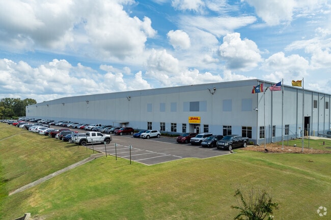
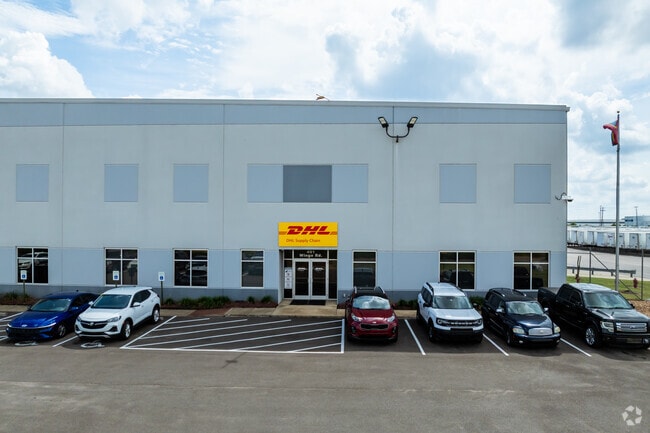
491 Wingo Rd
188-28-00200
N W PT N W 1/4 DEED BK 000 PAGE 0
Warehouse
MARSHALL
B and X Area of moderate flood hazard, usually the area between the limits of the 100-year and 500-year floods.
Mississippi
2025
44.90 AC
2025
Marshall County
950201
Memphis
700,200 SF
Memphis, TN-MS-AR
NEARBY LISTINGS FOR SALE OR LEASE
DEMOGRAPHICS near 491 Wingo Rd
1 mile
3 mile
5 mile
2025 Total Population
60
2,944
11,920
2030 Population
63
3,021
12,041
Pop Growth 2025-2030
+ 5.00%
+ 2.62%
+ 1.02%
Average Age
40
44
42
2025 Total Households
23
1,164
4,383
HH Growth 2025-2030
+ 4.35%
+ 2.66%
+ 1.12%
Median Household Inc
$62,143
$63,422
$86,123
Avg Household Size
2.50
2.50
2.70
2025 Avg HH Vehicles
2.00
2.00
2.00
Median Home Value
$158,333
$245,886
$405,102
Median Year Built
1995
1993
1994
Nearby Places
Map Layers
Map Styles
 Street
 Aerial
Layers
 Traffic
 Biking
Places
Listings with unknown addresses are not visible on the map
- Restaurants
- Banks
- Shops
- Fitness
- Groceries
PUBLIC TRANSPORTATION
AIRPORT
Memphis International
Drive
Walk
Distance
Memphis International
39 min
27.2 mi
Freight Ports
Port of Shreveport
Drive
Walk
Distance
Port of Shreveport
443 min
399.5 mi
Nearby Properties
Address
Land Use
TOTAL SIZE
Lot Size
Zoning
Address
Land Use
TOTAL SIZE
Lot Size
Zoning
707,940 SF
49 AC
Address
Land Use
TOTAL SIZE
Lot Size
Zoning
963,300 SF
52.78 AC
B3
Address
Land Use
TOTAL SIZE
Lot Size
Zoning
630,028 SF
40.74 AC
B3
Address
Land Use
TOTAL SIZE
Lot Size
Zoning
986,000 SF
64.70 AC
Address
Land Use
TOTAL SIZE
Lot Size
Zoning
615,600 SF
39.80 AC
Address
Land Use
TOTAL SIZE
Lot Size
Zoning
26,640 SF
6.27 AC
B2
Address
Land Use
TOTAL SIZE
Lot Size
Zoning
27,200 SF
5.23 AC
B2
Address
Land Use
TOTAL SIZE
Lot Size
Zoning
5,000 SF
3.77 AC
Address
Land Use
TOTAL SIZE
Lot Size
Zoning
27,500 SF
2.92 AC
M3
Address
Land Use
TOTAL SIZE
Lot Size
Zoning
14,484 SF
7.84 AC
M3
Address
Land Use
TOTAL SIZE
Lot Size
Zoning
1,800 SF
48.75 AC
Address
Land Use
TOTAL SIZE
Lot Size
Zoning
8,889 SF
3.92 AC
M3
Address
Land Use
TOTAL SIZE
Lot Size
Zoning
42 AC
CA
Address
Land Use
TOTAL SIZE
Lot Size
Zoning
85.56 AC
CA
Address
Land Use
TOTAL SIZE
Lot Size
Zoning
9,962 SF
3 AC
B2
Address
Land Use
TOTAL SIZE
Lot Size
Zoning
13,864 SF
3.59 AC
M3
Address
Land Use
TOTAL SIZE
Lot Size
Zoning
10.26 AC
B2
Address
Land Use
TOTAL SIZE
Lot Size
Zoning
135.40 AC
CA
Address
Land Use
TOTAL SIZE
Lot Size
Zoning
7,840 SF
2.64 AC
M3
The World's #1 Commercial Real Estate Marketplace
Connect with us
© 2026 CoStar Group
The information above has been obtained from sources believed reliable. While we do not doubt its accuracy we have not verified it and make no guarantee, warranty or representation about it. It is your responsibility to independently confirm its accuracy and completeness. Any projections, opinions, assumptions, or estimates used are for example only and do not represent the current or future performance of the property. The value of this transaction to you depends on tax and other factors which should be evaluated by your tax, financial, and legal advisors. You and your advisors should conduct a careful, independent investigation of the property to determine to your satisfaction the suitability of the property for your needs.