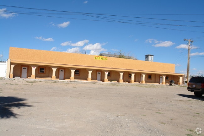
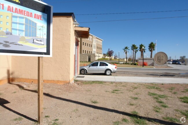
Property Record
4911 Alameda Ave, El Paso, TX 79905
NEARBY LISTINGS FOR SALE OR LEASE
Property Detail
4911 Alameda Ave
El Paso, TX
Val Verde
V088-999-0030-4500
3 VAL VERDE 5 TO 44 & E 65 FT OF 1 & 2 & 20 FT ALLEY (217405.92 SQ FT)
Governmentalpublicusegeneral
El Paso
0
Texas
2025
4.99 AC
003000
East
237,300 SF
El Paso
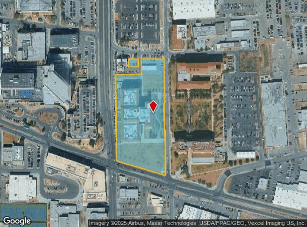
DEMOGRAPHICS near 4911 Alameda Ave
1 Mile
3 Mile
5 Mile
2024 Total Population
12,771
81,186
172,458
2029 Population
12,938
82,519
175,483
Pop Growth 2024-2029
+ 1.31%
+ 1.64%
+ 1.75%
Average Age
41
39
38
2024 Total Households
4,706
29,527
65,222
HH Growth 2024-2029
+ 1.21%
+ 1.53%
+ 1.79%
Median Household Inc
$26,004
$29,497
$34,683
Avg Household Size
2.60
2.50
2.50
2024 Avg HH Vehicles
1.00
2.00
2.00
Median Home Value
$102,728
$113,216
$133,667
Median Year Built
1957
1956
1961
Nearby Places
Map Layers
Map Styles
 Street
 Aerial
- Restaurants
- Banks
- Shops
- Fitness
- Groceries
PUBLIC TRANSPORTATION
AIRPORT
El Paso International
DRIVE
WALK
Distance
El Paso International
22 min
10.8 mi
Freight Ports
Port of Corpus Christi
DRIVE
WALK
Distance
Port of Corpus Christi
678 min
692.1 mi
Nearby Properties
Address
Land Use
TOTAL SIZE
Lot Size
Zoning
Address
Land Use
TOTAL SIZE
Lot Size
Zoning
75,601 SF
495.64 AC
M3
Address
Land Use
TOTAL SIZE
Lot Size
Zoning
315,094 SF
2.22 AC
M1S
Address
Land Use
TOTAL SIZE
Lot Size
Zoning
561,866 SF
27.25 AC
C4
Address
Land Use
TOTAL SIZE
Lot Size
Zoning
230,968 SF
10.69 AC
C4
Address
Land Use
TOTAL SIZE
Lot Size
Zoning
1 SF
214 AC
M3
Address
Land Use
TOTAL SIZE
Lot Size
Zoning
343,190 SF
31.84 AC
C4
Address
Land Use
TOTAL SIZE
Lot Size
Zoning
313,532 SF
5.73 AC
C1S
Address
Land Use
TOTAL SIZE
Lot Size
Zoning
107.76 AC
C4
Address
Land Use
TOTAL SIZE
Lot Size
Zoning
374,839 SF
33.29 AC
C3S
Address
Land Use
TOTAL SIZE
Lot Size
Zoning
213,351 SF
12 AC
C3S
Address
Land Use
TOTAL SIZE
Lot Size
Zoning
271,746 SF
1.93 AC
C4
Address
Land Use
TOTAL SIZE
Lot Size
Zoning
190,770 SF
8.70 AC
C4S
Address
Land Use
TOTAL SIZE
Lot Size
Zoning
210,541 SF
2.45 AC
C3S
Address
Land Use
TOTAL SIZE
Lot Size
Zoning
74,907 SF
8.07 AC
C4
Address
Land Use
TOTAL SIZE
Lot Size
Zoning
142,532 SF
13.32 AC
C3S
Address
Land Use
TOTAL SIZE
Lot Size
Zoning
142,858 SF
0.17 AC
R3H
Address
Land Use
TOTAL SIZE
Lot Size
Zoning
97,809 SF
20.31 AC
C3S
Address
Land Use
TOTAL SIZE
Lot Size
Zoning
114,289 SF
3.03 AC
R5
Address
Land Use
TOTAL SIZE
Lot Size
Zoning
185,087 SF
10.27 AC
A3S
Address
Land Use
TOTAL SIZE
Lot Size
Zoning
197,902 SF
30 AC
R4
Address
Land Use
TOTAL SIZE
Lot Size
Zoning
174,369 SF
6.47 AC
C4
Address
Land Use
TOTAL SIZE
Lot Size
Zoning
105,970 SF
7.45 AC
C4
Address
Land Use
TOTAL SIZE
Lot Size
Zoning
55,208 SF
5.34 AC
SD
Address
Land Use
TOTAL SIZE
Lot Size
Zoning
138,825 SF
23.17 AC
R3
Address
Land Use
TOTAL SIZE
Lot Size
Zoning
195,358 SF
13.53 AC
R5
Address
Land Use
TOTAL SIZE
Lot Size
Zoning
137,378 SF
10.05 AC
C3S
Address
Land Use
TOTAL SIZE
Lot Size
Zoning
83,251 SF
2.43 AC
M1
Address
Land Use
TOTAL SIZE
Lot Size
Zoning
74,244 SF
1.55 AC
C4
Address
Land Use
TOTAL SIZE
Lot Size
Zoning
92,100 SF
5.23 AC
C1
The World's #1 Commercial Real Estate Marketplace
Connect with us
© 2026 CoStar Group
The information above has been obtained from sources believed reliable. While we do not doubt its accuracy we have not verified it and make no guarantee, warranty or representation about it. It is your responsibility to independently confirm its accuracy and completeness. Any projections, opinions, assumptions, or estimates used are for example only and do not represent the current or future performance of the property. The value of this transaction to you depends on tax and other factors which should be evaluated by your tax, financial, and legal advisors. You and your advisors should conduct a careful, independent investigation of the property to determine to your satisfaction the suitability of the property for your needs.