Property Record
4911 Menchaca Rd, Austin, TX 78745
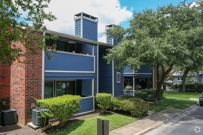


Property Detail
4911 Menchaca Rd
Austin-Round Rock-San Marcos, TX
Stony Creek Addn
315682
5.920 ACR OF LOT 1 STONY CREEK ADDN
Multifamilydwelling
Travis
AE
Texas
48453C0585H
1
2025
5.92 AC
2025
South Manchaca
002002
Austin
78,458 SF
NEARBY LISTINGS FOR SALE OR LEASE
DEMOGRAPHICS near 4911 Menchaca Rd
1 mile
3 mile
5 mile
2024 Total Population
14,657
126,519
325,187
2029 Population
15,897
137,311
353,039
Pop Growth 2024-2029
+ 8.46%
+ 8.53%
+ 8.56%
Average Age
41
38
37
2024 Total Households
6,725
60,062
150,492
HH Growth 2024-2029
+ 9.20%
+ 9.24%
+ 9.44%
Median Household Inc
$80,879
$77,173
$82,868
Avg Household Size
2.00
2.00
2.10
2024 Avg HH Vehicles
2.00
2.00
2.00
Median Home Value
$455,618
$477,245
$479,492
Median Year Built
1976
1986
1994
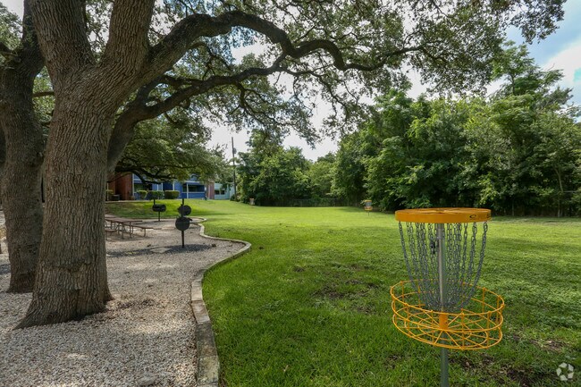
Nearby Places
Map Layers
Map Styles
 Street
 Aerial
Transit
 Traffic
 Biking
Places
Listings with unknown addresses are not visible on the map
- Restaurants
- Banks
- Shops
- Fitness
- Groceries
PUBLIC TRANSPORTATION
COMMUTER RAIL
Austin (Texas Eagle - Amtrak)
Drive
Walk
Distance
Austin (Texas Eagle - Amtrak)
10 min
4.5 mi
AIRPORT
Austin-Bergstrom International
Drive
Walk
Distance
Austin-Bergstrom International
22 min
10.9 mi
Freight Ports
Calhoun Port
Drive
Walk
Distance
Calhoun Port
187 min
154.4 mi
Nearby Properties
Address
Land Use
TOTAL SIZE
Lot Size
Zoning
Address
Land Use
TOTAL SIZE
Lot Size
Zoning
Address
Land Use
TOTAL SIZE
Lot Size
Zoning
881,940 SF
80.11 AC
Address
Land Use
TOTAL SIZE
Lot Size
Zoning
8,213 SF
36.95 AC
Address
Land Use
TOTAL SIZE
Lot Size
Zoning
442,023 SF
8.97 AC
Address
Land Use
TOTAL SIZE
Lot Size
Zoning
368,349 SF
17.13 AC
Address
Land Use
TOTAL SIZE
Lot Size
Zoning
456,650 SF
15 AC
Address
Land Use
TOTAL SIZE
Lot Size
Zoning
551,881 SF
34.85 AC
Address
Land Use
TOTAL SIZE
Lot Size
Zoning
413,880 SF
30.21 AC
Address
Land Use
TOTAL SIZE
Lot Size
Zoning
316,847 SF
10.35 AC
Address
Land Use
TOTAL SIZE
Lot Size
Zoning
342,956 SF
6.15 AC
Address
Land Use
TOTAL SIZE
Lot Size
Zoning
539,533 SF
26.50 AC
Address
Land Use
TOTAL SIZE
Lot Size
Zoning
398,436 SF
30.81 AC
Address
Land Use
TOTAL SIZE
Lot Size
Zoning
432,404 SF
37.29 AC
Address
Land Use
TOTAL SIZE
Lot Size
Zoning
386,952 SF
6.77 AC
Address
Land Use
TOTAL SIZE
Lot Size
Zoning
401,771 SF
59.77 AC
Address
Land Use
TOTAL SIZE
Lot Size
Zoning
324,860 SF
8.36 AC
Address
Land Use
TOTAL SIZE
Lot Size
Zoning
425,720 SF
28.49 AC
Address
Land Use
TOTAL SIZE
Lot Size
Zoning
263,050 SF
4.04 AC
Address
Land Use
TOTAL SIZE
Lot Size
Zoning
256,182 SF
3.63 AC
Address
Land Use
TOTAL SIZE
Lot Size
Zoning
281,588 SF
6.29 AC
Address
Land Use
TOTAL SIZE
Lot Size
Zoning
258,637 SF
3.03 AC
Address
Land Use
TOTAL SIZE
Lot Size
Zoning
270,600 SF
3.90 AC
Address
Land Use
TOTAL SIZE
Lot Size
Zoning
319,275 SF
7.66 AC
Address
Land Use
TOTAL SIZE
Lot Size
Zoning
404,812 SF
31.32 AC
Address
Land Use
TOTAL SIZE
Lot Size
Zoning
366,275 SF
39.95 AC
Address
Land Use
TOTAL SIZE
Lot Size
Zoning
372,125 SF
26.22 AC
Address
Land Use
TOTAL SIZE
Lot Size
Zoning
9.80 AC
Address
Land Use
TOTAL SIZE
Lot Size
Zoning
290,107 SF
18.62 AC
Address
Land Use
TOTAL SIZE
Lot Size
Zoning
239,000 SF
2.62 AC
Address
Land Use
TOTAL SIZE
Lot Size
Zoning
301,446 SF
17.31 AC
The World's #1 Commercial Real Estate Marketplace
Connect with us
© 2026 CoStar Group
The information above has been obtained from sources believed reliable. While we do not doubt its accuracy we have not verified it and make no guarantee, warranty or representation about it. It is your responsibility to independently confirm its accuracy and completeness. Any projections, opinions, assumptions, or estimates used are for example only and do not represent the current or future performance of the property. The value of this transaction to you depends on tax and other factors which should be evaluated by your tax, financial, and legal advisors. You and your advisors should conduct a careful, independent investigation of the property to determine to your satisfaction the suitability of the property for your needs.