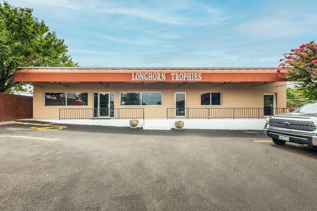
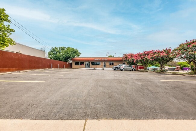
Property Record
4912 Burnet Rd, Austin, TX 78756

Property Detail
4912 Burnet Rd
Austin-Round Rock-San Marcos, TX
LOT B FLEMING ED SUBD
224722
Travis
Storemultistory
Texas
B and X Area of moderate flood hazard, usually the area between the limits of the 100-year and 500-year floods.
b
2025
0.24 AC
2025
Central
000206
Austin
4,550 SF
NEARBY LISTINGS FOR SALE OR LEASE
DEMOGRAPHICS near 4912 Burnet Rd
1 mile
3 mile
5 mile
2025 Total Population
18,753
168,823
372,677
2030 Population
19,764
177,387
391,548
Pop Growth 2025-2030
+ 5.39%
+ 5.07%
+ 5.06%
Average Age
38
35
37
2025 Total Households
10,034
76,088
166,764
HH Growth 2025-2030
+ 5.81%
+ 6.00%
+ 5.94%
Median Household Inc
$96,998
$82,455
$91,918
Avg Household Size
1.80
2.00
2.10
2025 Avg HH Vehicles
2.00
1.00
2.00
Median Home Value
$827,632
$839,266
$798,289
Median Year Built
1984
1983
1987
Nearby Places
Map Layers
Map Styles
 Street
 Aerial
Transit
 Traffic
 Biking
Places
Listings with unknown addresses are not visible on the map
- Restaurants
- Banks
- Shops
- Fitness
- Groceries
PUBLIC TRANSPORTATION
COMMUTER RAIL
Austin (Texas Eagle - Amtrak)
Drive
Walk
Distance
Austin (Texas Eagle - Amtrak)
10 min
5.9 mi
AIRPORT
Austin-Bergstrom International
Drive
Walk
Distance
Austin-Bergstrom International
27 min
14.3 mi
Freight Ports
Calhoun Port
Drive
Walk
Distance
Calhoun Port
192 min
157.8 mi
SALE & LEASE HISTORY
LISTING DATE
SALE/LEASE

Jul 15, 2021
For Sale
Jul 13, 2021
For Sale
Nearby Properties
Address
Land Use
TOTAL SIZE
Lot Size
Zoning
Address
Land Use
TOTAL SIZE
Lot Size
Zoning
29,594 SF
155.62 AC
Address
Land Use
TOTAL SIZE
Lot Size
Zoning
28.39 AC
Address
Land Use
TOTAL SIZE
Lot Size
Zoning
Address
Land Use
TOTAL SIZE
Lot Size
Zoning
28.62 AC
Address
Land Use
TOTAL SIZE
Lot Size
Zoning
27.17 AC
Address
Land Use
TOTAL SIZE
Lot Size
Zoning
30.96 AC
Address
Land Use
TOTAL SIZE
Lot Size
Zoning
18.52 AC
Address
Land Use
TOTAL SIZE
Lot Size
Zoning
74.69 AC
Address
Land Use
TOTAL SIZE
Lot Size
Zoning
548,399 SF
23.82 AC
Address
Land Use
TOTAL SIZE
Lot Size
Zoning
623,000 SF
11.78 AC
Address
Land Use
TOTAL SIZE
Lot Size
Zoning
21 AC
Address
Land Use
TOTAL SIZE
Lot Size
Zoning
614,532 SF
66.07 AC
Address
Land Use
TOTAL SIZE
Lot Size
Zoning
552,000 SF
1.21 AC
Address
Land Use
TOTAL SIZE
Lot Size
Zoning
Address
Land Use
TOTAL SIZE
Lot Size
Zoning
1,234 SF
96.75 AC
Address
Land Use
TOTAL SIZE
Lot Size
Zoning
95.86 AC
Address
Land Use
TOTAL SIZE
Lot Size
Zoning
11.61 AC
Address
Land Use
TOTAL SIZE
Lot Size
Zoning
263,226 SF
1.43 AC
Address
Land Use
TOTAL SIZE
Lot Size
Zoning
973,370 SF
11.26 AC
Address
Land Use
TOTAL SIZE
Lot Size
Zoning
22.14 AC
Address
Land Use
TOTAL SIZE
Lot Size
Zoning
11.11 AC
Address
Land Use
TOTAL SIZE
Lot Size
Zoning
328,340 SF
1.22 AC
Address
Land Use
TOTAL SIZE
Lot Size
Zoning
467,394 SF
1.56 AC
Address
Land Use
TOTAL SIZE
Lot Size
Zoning
14.55 AC
Address
Land Use
TOTAL SIZE
Lot Size
Zoning
394,423 SF
0.58 AC
Address
Land Use
TOTAL SIZE
Lot Size
Zoning
73.48 AC
Address
Land Use
TOTAL SIZE
Lot Size
Zoning
339,926 SF
1.34 AC
Address
Land Use
TOTAL SIZE
Lot Size
Zoning
510,500 SF
9.26 AC
Address
Land Use
TOTAL SIZE
Lot Size
Zoning
401,418 SF
4.77 AC
The World's #1 Commercial Real Estate Marketplace
Connect with us
© 2026 CoStar Group
The information above has been obtained from sources believed reliable. While we do not doubt its accuracy we have not verified it and make no guarantee, warranty or representation about it. It is your responsibility to independently confirm its accuracy and completeness. Any projections, opinions, assumptions, or estimates used are for example only and do not represent the current or future performance of the property. The value of this transaction to you depends on tax and other factors which should be evaluated by your tax, financial, and legal advisors. You and your advisors should conduct a careful, independent investigation of the property to determine to your satisfaction the suitability of the property for your needs.