Property Record
4913 Mason Rd, Union City, GA 30291
NEARBY LISTINGS FOR SALE OR LEASE
Property Detail
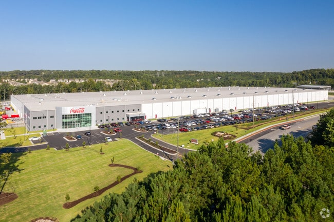
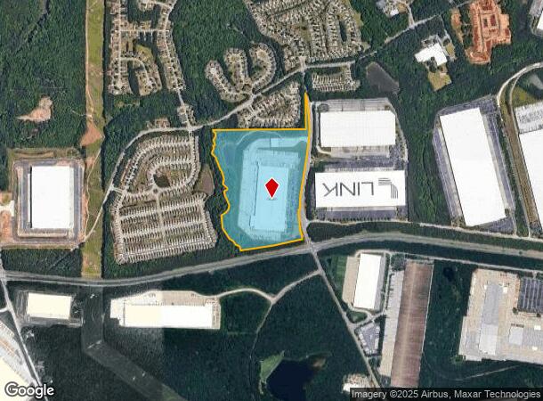
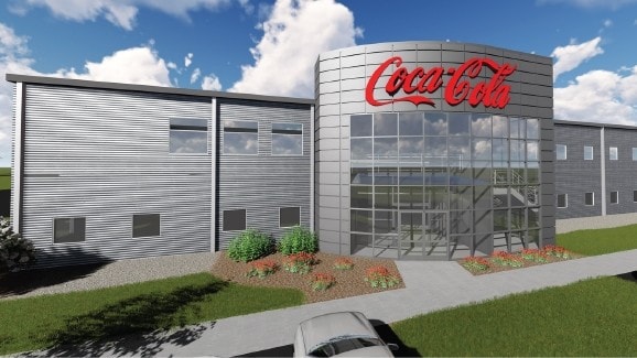
4913 Mason Rd
09F-3400-0133-004-7
Nathaniel Boyd & Lucy Boyd
Warehouse
Fulton
AE
Georgia
13121C0456F
2
2024
46.62 AC
2025
Airport/North Clayton
010524
Atlanta
426,244 SF
Atlanta-Sandy Springs-Roswell, GA
DEMOGRAPHICS near 4913 Mason Rd
1 Mile
3 Mile
5 Mile
2024 Total Population
3,058
40,221
124,378
2029 Population
3,133
41,738
128,724
Pop Growth 2024-2029
+ 2.45%
+ 3.77%
+ 3.49%
Average Age
36
37
37
2024 Total Households
1,148
14,529
46,930
HH Growth 2024-2029
+ 2.53%
+ 3.92%
+ 3.50%
Median Household Inc
$73,420
$71,965
$65,334
Avg Household Size
2.60
2.70
2.60
2024 Avg HH Vehicles
2.00
2.00
2.00
Median Home Value
$267,695
$234,388
$215,532
Median Year Built
2002
2002
1997
Nearby Places
Map Layers
Map Styles
 Street
 Aerial
- Restaurants
- Banks
- Shops
- Fitness
- Groceries
PUBLIC TRANSPORTATION
AIRPORT
Hartsfield - Jackson Atlanta International
DRIVE
WALK
Distance
Hartsfield - Jackson Atlanta International
17 min
10.3 mi
Freight Ports
Georgia Ports - Savannah
DRIVE
WALK
Distance
Georgia Ports - Savannah
279 min
247.6 mi
Nearby Properties
Address
Land Use
TOTAL SIZE
Lot Size
Zoning
Address
Land Use
TOTAL SIZE
Lot Size
Zoning
929,571 SF
65.66 AC
M1
Address
Land Use
TOTAL SIZE
Lot Size
Zoning
14.13 AC
TCMU
Address
Land Use
TOTAL SIZE
Lot Size
Zoning
11.10 AC
SUBC
Address
Land Use
TOTAL SIZE
Lot Size
Zoning
1,325,500 SF
101.81 AC
AG1
Address
Land Use
TOTAL SIZE
Lot Size
Zoning
78.33 AC
Address
Land Use
TOTAL SIZE
Lot Size
Zoning
1,052,500 SF
184.50 AC
AG1
Address
Land Use
TOTAL SIZE
Lot Size
Zoning
920,396 SF
62.40 AC
R3
Address
Land Use
TOTAL SIZE
Lot Size
Zoning
997,011 SF
68.07 AC
M1
Address
Land Use
TOTAL SIZE
Lot Size
Zoning
663,520 SF
62.96 AC
C1
Address
Land Use
TOTAL SIZE
Lot Size
Zoning
39.08 AC
SUBC
Address
Land Use
TOTAL SIZE
Lot Size
Zoning
768,288 SF
40.65 AC
M1
Address
Land Use
TOTAL SIZE
Lot Size
Zoning
619,194 SF
49.22 AC
R3
Address
Land Use
TOTAL SIZE
Lot Size
Zoning
327,250 SF
23.20 AC
R3
Address
Land Use
TOTAL SIZE
Lot Size
Zoning
773,776 SF
61.42 AC
M1
Address
Land Use
TOTAL SIZE
Lot Size
Zoning
669,152 SF
39.13 AC
M1C
Address
Land Use
TOTAL SIZE
Lot Size
Zoning
546,520 SF
31.54 AC
M1C
Address
Land Use
TOTAL SIZE
Lot Size
Zoning
628,193 SF
56.10 AC
M1
Address
Land Use
TOTAL SIZE
Lot Size
Zoning
499,950 SF
63.40 AC
AG1
Address
Land Use
TOTAL SIZE
Lot Size
Zoning
234,763 SF
22.43 AC
OI
Address
Land Use
TOTAL SIZE
Lot Size
Zoning
7.18 AC
R3
Address
Land Use
TOTAL SIZE
Lot Size
Zoning
31.58 AC
Address
Land Use
TOTAL SIZE
Lot Size
Zoning
281,032 SF
18.03 AC
M1
Address
Land Use
TOTAL SIZE
Lot Size
Zoning
2,404,061 SF
20.21 AC
RM
Address
Land Use
TOTAL SIZE
Lot Size
Zoning
388,450 SF
34.75 AC
C1C
Address
Land Use
TOTAL SIZE
Lot Size
Zoning
32.52 AC
C2
Address
Land Use
TOTAL SIZE
Lot Size
Zoning
24.53 AC
Address
Land Use
TOTAL SIZE
Lot Size
Zoning
508,696 SF
94.30 AC
M1C
Address
Land Use
TOTAL SIZE
Lot Size
Zoning
193,870 SF
14.49 AC
R1
Address
Land Use
TOTAL SIZE
Lot Size
Zoning
1,221 SF
10 AC
RM
The World's #1 Commercial Real Estate Marketplace
Connect with us
© 2026 CoStar Group
The information above has been obtained from sources believed reliable. While we do not doubt its accuracy we have not verified it and make no guarantee, warranty or representation about it. It is your responsibility to independently confirm its accuracy and completeness. Any projections, opinions, assumptions, or estimates used are for example only and do not represent the current or future performance of the property. The value of this transaction to you depends on tax and other factors which should be evaluated by your tax, financial, and legal advisors. You and your advisors should conduct a careful, independent investigation of the property to determine to your satisfaction the suitability of the property for your needs.