Property Record
4914 Ny Rt 365, Oneida, NY 13421
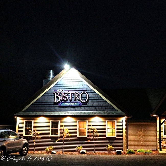

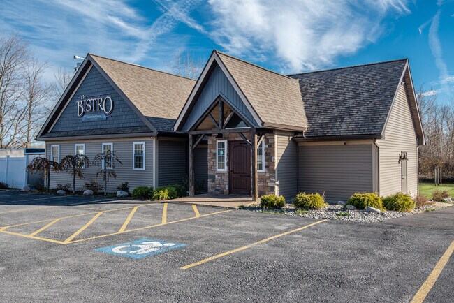
Property Detail
4914 Ny Rt 365
310-000-0003-018-000-0000
ONEIDA
Storebuilding
New York
01 - NOT Z
18.000
B and X Area of moderate flood hazard, usually the area between the limits of the 100-year and 500-year floods.
1.96 AC
2025
Outlying Oneida County
2024
Utica/Rome
030102
Utica-Rome, NY
3,044 SF
NEARBY LISTINGS FOR SALE OR LEASE
DEMOGRAPHICS near 4914 Ny Rt 365
1 mile
3 mile
5 mile
2025 Total Population
580
13,973
19,415
2030 Population
571
13,657
18,957
Pop Growth 2025-2030
(1.55%)
(2.26%)
(2.36%)
Average Age
44
43
43
2025 Total Households
235
6,055
8,276
HH Growth 2025-2030
(1.70%)
(2.39%)
(2.53%)
Median Household Inc
$74,999
$66,269
$68,097
Avg Household Size
2.40
2.30
2.30
2025 Avg HH Vehicles
2.00
2.00
2.00
Median Home Value
$204,412
$178,452
$183,461
Median Year Built
1964
1951
1954
Nearby Places
Map Layers
Map Styles
 Street
 Aerial
Transit
 Traffic
 Biking
Places
Listings with unknown addresses are not visible on the map
- Restaurants
- Banks
- Shops
- Fitness
- Groceries
PUBLIC TRANSPORTATION
AIRPORT
Syracuse Hancock International
Drive
Walk
Distance
Syracuse Hancock International
47 min
36.9 mi
Freight Ports
Albany, NY Port
Drive
Walk
Distance
Albany, NY Port
137 min
115.6 mi
SALE & LEASE HISTORY
LISTING DATE
SALE/LEASE

Nov 20, 2020
For Sale
Mar 06, 2020
For Sale
Jul 18, 2018
For Sale
Feb 07, 2019
For Sale
Nearby Properties
Address
Land Use
TOTAL SIZE
Lot Size
Zoning
Address
Land Use
TOTAL SIZE
Lot Size
Zoning
132,207 SF
4.14 AC
CS
Address
Land Use
TOTAL SIZE
Lot Size
Zoning
71,138 SF
14.10 AC
CS
Address
Land Use
TOTAL SIZE
Lot Size
Zoning
179,325 SF
131.08 AC
01 - NOT Z
Address
Land Use
TOTAL SIZE
Lot Size
Zoning
26,158 SF
19.28 AC
LI
Address
Land Use
TOTAL SIZE
Lot Size
Zoning
1.24 AC
01
Address
Land Use
TOTAL SIZE
Lot Size
Zoning
2,418 SF
55.37 AC
R1
Address
Land Use
TOTAL SIZE
Lot Size
Zoning
29,762 SF
6.75 AC
C
Address
Land Use
TOTAL SIZE
Lot Size
Zoning
Address
Land Use
TOTAL SIZE
Lot Size
Zoning
215,981 SF
12.90 AC
C
Address
Land Use
TOTAL SIZE
Lot Size
Zoning
49,029 SF
12 AC
CS
Address
Land Use
TOTAL SIZE
Lot Size
Zoning
19,251 SF
23.72 AC
LI
Address
Land Use
TOTAL SIZE
Lot Size
Zoning
21,150 SF
3.74 AC
Address
Land Use
TOTAL SIZE
Lot Size
Zoning
48,000 SF
4.58 AC
04 - FARM
Address
Land Use
TOTAL SIZE
Lot Size
Zoning
Address
Land Use
TOTAL SIZE
Lot Size
Zoning
61,969 SF
2.15 AC
C
Address
Land Use
TOTAL SIZE
Lot Size
Zoning
109,750 SF
12.98 AC
C
Address
Land Use
TOTAL SIZE
Lot Size
Zoning
64.66 AC
Address
Land Use
TOTAL SIZE
Lot Size
Zoning
82,953 SF
1.43 AC
C
Address
Land Use
TOTAL SIZE
Lot Size
Zoning
70,213 SF
6.93 AC
02 - SINGL
Address
Land Use
TOTAL SIZE
Lot Size
Zoning
56,914 SF
3.83 AC
C
Address
Land Use
TOTAL SIZE
Lot Size
Zoning
205,242 SF
46.75 AC
Address
Land Use
TOTAL SIZE
Lot Size
Zoning
205,242 SF
34.07 AC
Address
Land Use
TOTAL SIZE
Lot Size
Zoning
205,242 SF
46.75 AC
Address
Land Use
TOTAL SIZE
Lot Size
Zoning
17,600 SF
2.76 AC
R2
Address
Land Use
TOTAL SIZE
Lot Size
Zoning
4.66 AC
C
Address
Land Use
TOTAL SIZE
Lot Size
Zoning
29,848 SF
2.78 AC
C
Address
Land Use
TOTAL SIZE
Lot Size
Zoning
33,675 SF
6.50 AC
01 - NOT Z
Address
Land Use
TOTAL SIZE
Lot Size
Zoning
33,675 SF
6.50 AC
01 - NOT Z
Address
Land Use
TOTAL SIZE
Lot Size
Zoning
48.42 AC
Address
Land Use
TOTAL SIZE
Lot Size
Zoning
246,600 SF
48.42 AC
01 - NOT Z
The World's #1 Commercial Real Estate Marketplace
Connect with us
© 2026 CoStar Group
The information above has been obtained from sources believed reliable. While we do not doubt its accuracy we have not verified it and make no guarantee, warranty or representation about it. It is your responsibility to independently confirm its accuracy and completeness. Any projections, opinions, assumptions, or estimates used are for example only and do not represent the current or future performance of the property. The value of this transaction to you depends on tax and other factors which should be evaluated by your tax, financial, and legal advisors. You and your advisors should conduct a careful, independent investigation of the property to determine to your satisfaction the suitability of the property for your needs.