Property Record
4915 E Desert Inn Rd, Las Vegas, NV 89121
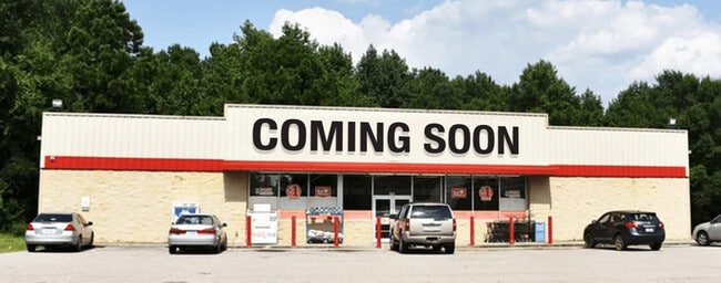


This Property Is For Sale
Current Lease Availabilities
NEARBY LISTINGS FOR SALE OR LEASE
Property Detail
4915 E Desert Inn Rd
Las Vegas-Henderson-Paradise, NV
Parcel Map File 119 Page 009
161-17-501-010
PARCEL MAP FILE 119 PAGE 9 LOT 1
Storebuilding
Clark
X
Nevada
32003C2190F
1
2025
0.91 AC
2025
East Las Vegas
001607
Las Vegas
10,000 SF
DEMOGRAPHICS near 4915 E Desert Inn Rd
1 Mile
3 Mile
5 Mile
2024 Total Population
30,399
203,836
469,682
2029 Population
32,310
217,302
501,976
Pop Growth 2024-2029
+ 6.29%
+ 6.61%
+ 6.88%
Average Age
39
39
38
2024 Total Households
11,904
72,391
173,659
HH Growth 2024-2029
+ 6.30%
+ 6.60%
+ 6.89%
Median Household Inc
$37,691
$46,526
$43,501
Avg Household Size
2.50
2.70
2.60
2024 Avg HH Vehicles
1.00
2.00
2.00
Median Home Value
$165,820
$256,004
$270,980
Median Year Built
1987
1985
1985
Nearby Places
Map Layers
Map Styles
 Street
 Aerial
- Restaurants
- Banks
- Shops
- Fitness
- Groceries
PUBLIC TRANSPORTATION
AIRPORT
Harry Reid International
DRIVE
WALK
Distance
Harry Reid International
15 min
8.3 mi
Boulder City Municipal
DRIVE
WALK
Distance
Boulder City Municipal
29 min
20.2 mi
Nearby Properties
Address
Land Use
TOTAL SIZE
Lot Size
Zoning
Address
Land Use
TOTAL SIZE
Lot Size
Zoning
265,609 SF
47.36 AC
H1
Address
Land Use
TOTAL SIZE
Lot Size
Zoning
3,356 SF
336.99 AC
RE
Address
Land Use
TOTAL SIZE
Lot Size
Zoning
345,133 SF
27.01 AC
H1
Address
Land Use
TOTAL SIZE
Lot Size
Zoning
20,727 SF
319.86 AC
PF
Address
Land Use
TOTAL SIZE
Lot Size
Zoning
280 AC
PF
Address
Land Use
TOTAL SIZE
Lot Size
Zoning
35.95 AC
PF
Address
Land Use
TOTAL SIZE
Lot Size
Zoning
38,764 SF
12.66 AC
H1
Address
Land Use
TOTAL SIZE
Lot Size
Zoning
137.65 AC
Address
Land Use
TOTAL SIZE
Lot Size
Zoning
4,460 SF
27.52 AC
Address
Land Use
TOTAL SIZE
Lot Size
Zoning
15.95 AC
PF
Address
Land Use
TOTAL SIZE
Lot Size
Zoning
9.37 AC
RE
Address
Land Use
TOTAL SIZE
Lot Size
Zoning
6,659 SF
6.05 AC
H1
Address
Land Use
TOTAL SIZE
Lot Size
Zoning
7,908 SF
24.13 AC
R4
Address
Land Use
TOTAL SIZE
Lot Size
Zoning
4.18 AC
PF
Address
Land Use
TOTAL SIZE
Lot Size
Zoning
223,422 SF
18.21 AC
R3
Address
Land Use
TOTAL SIZE
Lot Size
Zoning
9,044 SF
8.62 AC
Address
Land Use
TOTAL SIZE
Lot Size
Zoning
2,926 SF
19.73 AC
R3
Address
Land Use
TOTAL SIZE
Lot Size
Zoning
3,183 SF
18.35 AC
R3
Address
Land Use
TOTAL SIZE
Lot Size
Zoning
7,304 SF
12.58 AC
R4
Address
Land Use
TOTAL SIZE
Lot Size
Zoning
3,424 SF
14.53 AC
R3
Address
Land Use
TOTAL SIZE
Lot Size
Zoning
9.11 AC
PF
Address
Land Use
TOTAL SIZE
Lot Size
Zoning
40.07 AC
PF
Address
Land Use
TOTAL SIZE
Lot Size
Zoning
9,154 SF
8.94 AC
CV
Address
Land Use
TOTAL SIZE
Lot Size
Zoning
5,425 SF
14.38 AC
C:R-4
Address
Land Use
TOTAL SIZE
Lot Size
Zoning
2,927 SF
7.95 AC
C:R-4
Address
Land Use
TOTAL SIZE
Lot Size
Zoning
3,886 SF
14.26 AC
R4
Address
Land Use
TOTAL SIZE
Lot Size
Zoning
26,067 SF
20.09 AC
R4
Address
Land Use
TOTAL SIZE
Lot Size
Zoning
638 SF
3.08 AC
H2
Address
Land Use
TOTAL SIZE
Lot Size
Zoning
187,617 SF
21.71 AC
C2
Address
Land Use
TOTAL SIZE
Lot Size
Zoning
207,560 SF
10.36 AC
R4
The World's #1 Commercial Real Estate Marketplace
Connect with us
© 2025 CoStar Group
The information above has been obtained from sources believed reliable. While we do not doubt its accuracy we have not verified it and make no guarantee, warranty or representation about it. It is your responsibility to independently confirm its accuracy and completeness. Any projections, opinions, assumptions, or estimates used are for example only and do not represent the current or future performance of the property. The value of this transaction to you depends on tax and other factors which should be evaluated by your tax, financial, and legal advisors. You and your advisors should conduct a careful, independent investigation of the property to determine to your satisfaction the suitability of the property for your needs.