Property Record
4917 N 45Th St, Springdale, AR 72762

NEARBY LISTINGS FOR SALE OR LEASE
Property Detail
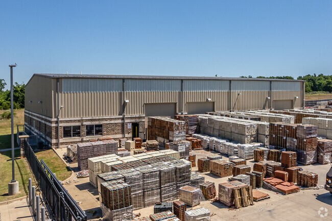
4917 N 45Th St
Fayetteville-Springdale-Rogers, AR-MO
Diesel Downs-Springdale
21-02348-000
LOT 3B, DIESEL DOWNS ADDITION TO THE CITY OF SPRINGDALE, BENTON COUNTY, ARKANSAS, AS PER RE-PLAT OF LOT 3 OF SAID SUBDIVISION FILED FOR RECORD AS INSTRUMENT NO. L201960602, IN THE OFFICE OF CIRCUIT CLERK AND EX-OFFICIO RECORDER OF BENTON COUNTY, ARKA
Officebuilding
Benton
X
Arkansas
05143C0060G
3b
2025
5.26 AC
2025
Greater Springdale
021315
Fayetteville/Springdale/Rogers
14,950 SF
DEMOGRAPHICS near 4917 N 45Th St
1 Mile
3 Mile
5 Mile
2024 Total Population
1,523
35,730
101,774
2029 Population
1,772
40,577
115,496
Pop Growth 2024-2029
+ 16.35%
+ 13.57%
+ 13.48%
Average Age
34
36
35
2024 Total Households
508
11,374
34,184
HH Growth 2024-2029
+ 16.54%
+ 13.81%
+ 13.86%
Median Household Inc
$114,172
$83,613
$79,227
Avg Household Size
3.00
3.00
2.90
2024 Avg HH Vehicles
2.00
2.00
2.00
Median Home Value
$257,228
$242,741
$256,437
Median Year Built
2003
1999
2000
Nearby Places
Map Layers
Map Styles
 Street
 Aerial
- Restaurants
- Banks
- Shops
- Fitness
- Groceries
PUBLIC TRANSPORTATION
AIRPORT
Northwest Arkansas Ntl
DRIVE
WALK
Distance
Northwest Arkansas Ntl
28 min
13.2 mi
Freight Ports
Tulsa Port of Inola
DRIVE
WALK
Distance
Tulsa Port of Inola
103 min
87.9 mi
Nearby Properties
Address
Land Use
TOTAL SIZE
Lot Size
Zoning
Address
Land Use
TOTAL SIZE
Lot Size
Zoning
367,076 SF
57.31 AC
Address
Land Use
TOTAL SIZE
Lot Size
Zoning
251,508 SF
30 AC
Address
Land Use
TOTAL SIZE
Lot Size
Zoning
132,494 SF
21.56 AC
Address
Land Use
TOTAL SIZE
Lot Size
Zoning
306,148 SF
48.89 AC
Address
Land Use
TOTAL SIZE
Lot Size
Zoning
196,657 SF
18.82 AC
Address
Land Use
TOTAL SIZE
Lot Size
Zoning
191,100 SF
10.03 AC
Address
Land Use
TOTAL SIZE
Lot Size
Zoning
75,610 SF
5.62 AC
Address
Land Use
TOTAL SIZE
Lot Size
Zoning
292,470 SF
17.27 AC
Address
Land Use
TOTAL SIZE
Lot Size
Zoning
348,916 SF
24.69 AC
Address
Land Use
TOTAL SIZE
Lot Size
Zoning
127,043 SF
6.82 AC
Address
Land Use
TOTAL SIZE
Lot Size
Zoning
12,882 SF
12.33 AC
Address
Land Use
TOTAL SIZE
Lot Size
Zoning
31,150 SF
3.74 AC
C1
Address
Land Use
TOTAL SIZE
Lot Size
Zoning
182,415 SF
68.93 AC
Address
Land Use
TOTAL SIZE
Lot Size
Zoning
182,415 SF
12.04 AC
Address
Land Use
TOTAL SIZE
Lot Size
Zoning
39,000 SF
16.38 AC
Address
Land Use
TOTAL SIZE
Lot Size
Zoning
73,711 SF
3.59 AC
Address
Land Use
TOTAL SIZE
Lot Size
Zoning
61,012 SF
18.96 AC
Address
Land Use
TOTAL SIZE
Lot Size
Zoning
147,762 SF
Address
Land Use
TOTAL SIZE
Lot Size
Zoning
123,740 SF
13.96 AC
Address
Land Use
TOTAL SIZE
Lot Size
Zoning
170,442 SF
12.62 AC
Address
Land Use
TOTAL SIZE
Lot Size
Zoning
160,570 SF
20.31 AC
Address
Land Use
TOTAL SIZE
Lot Size
Zoning
40,456 SF
14.17 AC
Address
Land Use
TOTAL SIZE
Lot Size
Zoning
65,200 SF
9.26 AC
Address
Land Use
TOTAL SIZE
Lot Size
Zoning
58,500 SF
3.45 AC
Address
Land Use
TOTAL SIZE
Lot Size
Zoning
150,076 SF
9.55 AC
Address
Land Use
TOTAL SIZE
Lot Size
Zoning
73,714 SF
2.48 AC
Address
Land Use
TOTAL SIZE
Lot Size
Zoning
51,376 SF
5.86 AC
Address
Land Use
TOTAL SIZE
Lot Size
Zoning
49,059 SF
2.42 AC
Address
Land Use
TOTAL SIZE
Lot Size
Zoning
49,800 SF
5.65 AC
Address
Land Use
TOTAL SIZE
Lot Size
Zoning
68,099 SF
17.38 AC
The World's #1 Commercial Real Estate Marketplace
Connect with us
© 2026 CoStar Group
The information above has been obtained from sources believed reliable. While we do not doubt its accuracy we have not verified it and make no guarantee, warranty or representation about it. It is your responsibility to independently confirm its accuracy and completeness. Any projections, opinions, assumptions, or estimates used are for example only and do not represent the current or future performance of the property. The value of this transaction to you depends on tax and other factors which should be evaluated by your tax, financial, and legal advisors. You and your advisors should conduct a careful, independent investigation of the property to determine to your satisfaction the suitability of the property for your needs.