Property Record
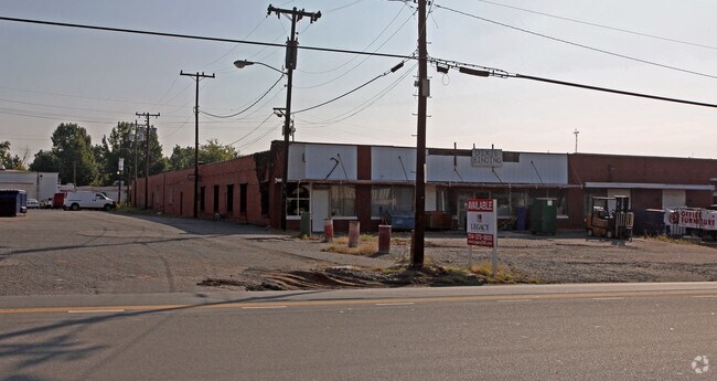
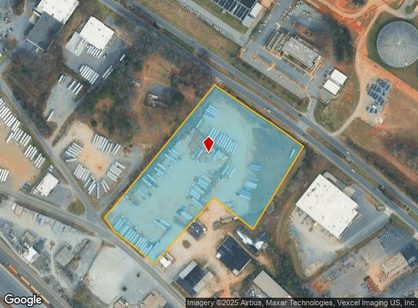
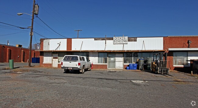
4918 Rozzelles Ferry Rd, Charlotte, NC 28216

NEARBY LISTINGS FOR SALE OR LEASE
Property Detail
4918 Rozzelles Ferry Rd
Charlotte-Concord-Gastonia, NC-SC
Johnny C Godley & Frank H Godl
039-071-12
L1A M52-236
Industrialgeneral
Mecklenburg
X
North Carolina
3710453500K
1a
2024
8.36 AC
2025
I-85/Beatties Ford Rd
004400
Charlotte
3,900 SF
DEMOGRAPHICS near 4918 Rozzelles Ferry Rd
1 Mile
3 Mile
5 Mile
2024 Total Population
4,880
67,850
193,769
2029 Population
5,159
72,169
207,112
Pop Growth 2024-2029
+ 5.72%
+ 6.37%
+ 6.89%
Average Age
37
37
36
2024 Total Households
1,777
25,142
82,078
HH Growth 2024-2029
+ 5.74%
+ 6.50%
+ 7.21%
Median Household Inc
$38,617
$47,500
$60,690
Avg Household Size
2.60
2.60
2.30
2024 Avg HH Vehicles
2.00
2.00
2.00
Median Home Value
$118,541
$181,709
$232,530
Median Year Built
1966
1983
1999
Nearby Places
- Restaurants
- Banks
- Shops
- Fitness
- Groceries
PUBLIC TRANSPORTATION
COMMUTER RAIL
Charlotte Amtrak Station (Carolinian - Amtrak, Crescent - Amtrak, Piedmont - Amtrak)
DRIVE
WALK
Distance
Charlotte Amtrak Station (Carolinian - Amtrak, Crescent - Amtrak, Piedmont - Amtrak)
10 min
5.7 mi
AIRPORT
Charlotte/Douglas International
DRIVE
WALK
Distance
Charlotte/Douglas International
18 min
9.3 mi
Concord-Padgett Regional
DRIVE
WALK
Distance
Concord-Padgett Regional
25 min
16.8 mi
Freight Ports
North Charleston Terminal
DRIVE
WALK
Distance
North Charleston Terminal
233 min
203.5 mi
Nearby Properties
Address
Land Use
TOTAL SIZE
Lot Size
Zoning
Address
Land Use
TOTAL SIZE
Lot Size
Zoning
621,107 SF
250.06 AC
I2
Address
Land Use
TOTAL SIZE
Lot Size
Zoning
375,318 SF
37.31 AC
B2
Address
Land Use
TOTAL SIZE
Lot Size
Zoning
308,793 SF
47.41 AC
R5
Address
Land Use
TOTAL SIZE
Lot Size
Zoning
311,541 SF
40.41 AC
INST
Address
Land Use
TOTAL SIZE
Lot Size
Zoning
58,666 SF
7.47 AC
Address
Land Use
TOTAL SIZE
Lot Size
Zoning
407,683 SF
37.23 AC
R22MF
Address
Land Use
TOTAL SIZE
Lot Size
Zoning
634,939 SF
42.26 AC
I1CD
Address
Land Use
TOTAL SIZE
Lot Size
Zoning
242,699 SF
20.50 AC
R17MF
Address
Land Use
TOTAL SIZE
Lot Size
Zoning
238,075 SF
9.52 AC
Address
Land Use
TOTAL SIZE
Lot Size
Zoning
536,042 SF
37.24 AC
R-22MF
Address
Land Use
TOTAL SIZE
Lot Size
Zoning
627,355 SF
45.41 AC
I2
Address
Land Use
TOTAL SIZE
Lot Size
Zoning
154,799 SF
6.09 AC
R12MF
Address
Land Use
TOTAL SIZE
Lot Size
Zoning
351,253 SF
27.85 AC
I-1(CD)
Address
Land Use
TOTAL SIZE
Lot Size
Zoning
152,910 SF
2.98 AC
MUDD-O
Address
Land Use
TOTAL SIZE
Lot Size
Zoning
229,084 SF
11.04 AC
Address
Land Use
TOTAL SIZE
Lot Size
Zoning
227,235 SF
44 AC
R12MF
Address
Land Use
TOTAL SIZE
Lot Size
Zoning
174,768 SF
9.28 AC
INST(CD)
Address
Land Use
TOTAL SIZE
Lot Size
Zoning
205,067 SF
9.94 AC
R5
Address
Land Use
TOTAL SIZE
Lot Size
Zoning
103,323 SF
12.89 AC
R-8
Address
Land Use
TOTAL SIZE
Lot Size
Zoning
346,795 SF
110.06 AC
I2
Address
Land Use
TOTAL SIZE
Lot Size
Zoning
15,869 SF
517.12 AC
R4
Address
Land Use
TOTAL SIZE
Lot Size
Zoning
2,967 SF
9.01 AC
R-17MF
Address
Land Use
TOTAL SIZE
Lot Size
Zoning
401,879 SF
20.57 AC
I-1
Address
Land Use
TOTAL SIZE
Lot Size
Zoning
237,032 SF
8.57 AC
I2
Address
Land Use
TOTAL SIZE
Lot Size
Zoning
361,253 SF
30.87 AC
I2
Address
Land Use
TOTAL SIZE
Lot Size
Zoning
79,972 SF
2.79 AC
R-22MF
Address
Land Use
TOTAL SIZE
Lot Size
Zoning
61,824 SF
10.19 AC
R-5
Address
Land Use
TOTAL SIZE
Lot Size
Zoning
269,210 SF
14.65 AC
I-1(CD)
Address
Land Use
TOTAL SIZE
Lot Size
Zoning
232,212 SF
10.96 AC
I-2
Address
Land Use
TOTAL SIZE
Lot Size
Zoning
135,576 SF
11.47 AC
B2
The World's #1 Commercial Real Estate Marketplace
Connect with us
© 2025 CoStar Group
The information above has been obtained from sources believed reliable. While we do not doubt its accuracy we have not verified it and make no guarantee, warranty or representation about it. It is your responsibility to independently confirm its accuracy and completeness. Any projections, opinions, assumptions, or estimates used are for example only and do not represent the current or future performance of the property. The value of this transaction to you depends on tax and other factors which should be evaluated by your tax, financial, and legal advisors. You and your advisors should conduct a careful, independent investigation of the property to determine to your satisfaction the suitability of the property for your needs.