Property Record
4919 Mount Pleasant St Nw, North Canton, OH 44720

NEARBY LISTINGS FOR SALE OR LEASE
Property Detail
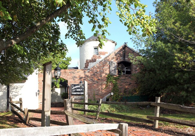
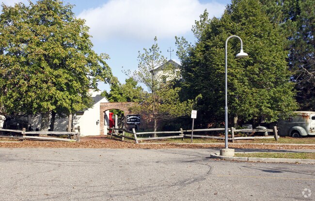
4919 Mount Pleasant St Nw
Akron, OH
Green Sec 36
28-09416
AKRON CANTON AIRPORT BLDG ON LEASED GROUND
Commercialnec
Summit
2024
Ohio
2025
0.38 AC
531407
Akron
74,308 SF
Cleveland
DEMOGRAPHICS near 4919 Mount Pleasant St Nw
1 Mile
3 Mile
5 Mile
2024 Total Population
107
30,927
88,203
2029 Population
106
30,699
87,376
Pop Growth 2024-2029
(0.93%)
(0.74%)
(0.94%)
Average Age
39
42
42
2024 Total Households
47
13,176
36,340
HH Growth 2024-2029
0.00%
(0.77%)
(0.93%)
Median Household Inc
$80,000
$81,767
$82,232
Avg Household Size
2.20
2.30
2.40
2024 Avg HH Vehicles
2.00
2.00
2.00
Median Home Value
$253,571
$231,553
$238,912
Median Year Built
1982
1981
1979
Nearby Places
Map Layers
Map Styles
 Street
 Aerial
- Restaurants
- Banks
- Shops
- Fitness
- Groceries
PUBLIC TRANSPORTATION
AIRPORT
Akron-Canton Regional
DRIVE
WALK
Distance
Akron-Canton Regional
4 min
1.3 mi
Nearby Properties
Address
Land Use
TOTAL SIZE
Lot Size
Zoning
Address
Land Use
TOTAL SIZE
Lot Size
Zoning
223,734 SF
1,140.33 AC
Address
Land Use
TOTAL SIZE
Lot Size
Zoning
475,122 SF
81.74 AC
Address
Land Use
TOTAL SIZE
Lot Size
Zoning
494,965 SF
15.48 AC
Address
Land Use
TOTAL SIZE
Lot Size
Zoning
103,786 SF
8.77 AC
Address
Land Use
TOTAL SIZE
Lot Size
Zoning
367,640 SF
35.46 AC
Address
Land Use
TOTAL SIZE
Lot Size
Zoning
296,562 SF
36.07 AC
Address
Land Use
TOTAL SIZE
Lot Size
Zoning
356,083 SF
32.10 AC
Address
Land Use
TOTAL SIZE
Lot Size
Zoning
415,636 SF
91.33 AC
Address
Land Use
TOTAL SIZE
Lot Size
Zoning
1,247.97 AC
Address
Land Use
TOTAL SIZE
Lot Size
Zoning
150,620 SF
18.25 AC
Address
Land Use
TOTAL SIZE
Lot Size
Zoning
106,867 SF
13.43 AC
Address
Land Use
TOTAL SIZE
Lot Size
Zoning
103,786 SF
8.51 AC
Address
Land Use
TOTAL SIZE
Lot Size
Zoning
Address
Land Use
TOTAL SIZE
Lot Size
Zoning
218,864 SF
11.84 AC
Address
Land Use
TOTAL SIZE
Lot Size
Zoning
160,650 SF
17.26 AC
Address
Land Use
TOTAL SIZE
Lot Size
Zoning
155,328 SF
22.08 AC
Address
Land Use
TOTAL SIZE
Lot Size
Zoning
255,406 SF
25.19 AC
Address
Land Use
TOTAL SIZE
Lot Size
Zoning
80,416 SF
81.53 AC
Address
Land Use
TOTAL SIZE
Lot Size
Zoning
50,062 SF
8.51 AC
Address
Land Use
TOTAL SIZE
Lot Size
Zoning
106,416 SF
18.99 AC
Address
Land Use
TOTAL SIZE
Lot Size
Zoning
129,322 SF
7 AC
Address
Land Use
TOTAL SIZE
Lot Size
Zoning
31.58 AC
Address
Land Use
TOTAL SIZE
Lot Size
Zoning
81,901 SF
7.14 AC
Address
Land Use
TOTAL SIZE
Lot Size
Zoning
71,426 SF
27.78 AC
Address
Land Use
TOTAL SIZE
Lot Size
Zoning
27.78 AC
Address
Land Use
TOTAL SIZE
Lot Size
Zoning
155,112 SF
8.55 AC
Address
Land Use
TOTAL SIZE
Lot Size
Zoning
67,597 SF
10.36 AC
Address
Land Use
TOTAL SIZE
Lot Size
Zoning
113,866 SF
10.68 AC
Address
Land Use
TOTAL SIZE
Lot Size
Zoning
121,154 SF
9.45 AC
Address
Land Use
TOTAL SIZE
Lot Size
Zoning
54,010 SF
10.64 AC
The World's #1 Commercial Real Estate Marketplace
Connect with us
© 2025 CoStar Group
The information above has been obtained from sources believed reliable. While we do not doubt its accuracy we have not verified it and make no guarantee, warranty or representation about it. It is your responsibility to independently confirm its accuracy and completeness. Any projections, opinions, assumptions, or estimates used are for example only and do not represent the current or future performance of the property. The value of this transaction to you depends on tax and other factors which should be evaluated by your tax, financial, and legal advisors. You and your advisors should conduct a careful, independent investigation of the property to determine to your satisfaction the suitability of the property for your needs.