Property Record
492 Drum Ave, Somerset, PA 15501
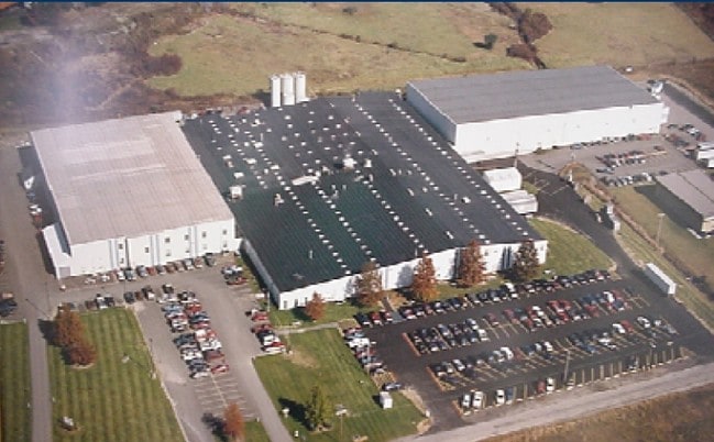

Property Detail
492 Drum Ave
Somerset, PA
2.981 A MULTI-INTEREST-PARENT-PARCEL GILMOUR MFG
410026080
Somerset
Industrialgeneral
Pennsylvania
B and X Area of moderate flood hazard, usually the area between the limits of the 100-year and 500-year floods.
9.65 AC
2026
Altoona/Johnstown
2026
Other Market Areas
020801
NEARBY LISTINGS FOR SALE OR LEASE
DEMOGRAPHICS near 492 Drum Ave
1 mile
3 mile
5 mile
2025 Total Population
1,262
12,026
17,258
2030 Population
1,241
11,751
16,847
Pop Growth 2025-2030
(1.66%)
(2.29%)
(2.38%)
Average Age
45
44
45
2025 Total Households
313
4,117
6,096
HH Growth 2025-2030
(1.28%)
(2.53%)
(2.61%)
Median Household Inc
$43,026
$42,601
$49,511
Avg Household Size
2.10
2.10
2.10
2025 Avg HH Vehicles
2.00
2.00
2.00
Median Home Value
$156,060
$152,458
$153,471
Median Year Built
1966
1963
1967
Nearby Places
Map Layers
Map Styles
 Street
 Aerial
Layers
 Traffic
 Biking
Places
Listings with unknown addresses are not visible on the map
- Restaurants
- Banks
- Shops
- Fitness
- Groceries
PUBLIC TRANSPORTATION
AIRPORT
Arnold Palmer Regional
Drive
Walk
Distance
Arnold Palmer Regional
60 min
36.2 mi
Freight Ports
Port of Baltimore
Drive
Walk
Distance
Port of Baltimore
215 min
184.7 mi
SALE & LEASE HISTORY
LISTING DATE
SALE/LEASE

Apr 05, 2018
For Lease
Nearby Properties
Address
Land Use
TOTAL SIZE
Lot Size
Zoning
Address
Land Use
TOTAL SIZE
Lot Size
Zoning
Address
Land Use
TOTAL SIZE
Lot Size
Zoning
113 SF
11.30 AC
Address
Land Use
TOTAL SIZE
Lot Size
Zoning
20,140 SF
15.87 AC
Address
Land Use
TOTAL SIZE
Lot Size
Zoning
111 SF
19.10 AC
Address
Land Use
TOTAL SIZE
Lot Size
Zoning
24.73 AC
Address
Land Use
TOTAL SIZE
Lot Size
Zoning
112 SF
23.51 AC
Address
Land Use
TOTAL SIZE
Lot Size
Zoning
25.17 AC
Address
Land Use
TOTAL SIZE
Lot Size
Zoning
1.63 AC
Address
Land Use
TOTAL SIZE
Lot Size
Zoning
20,140 SF
9.30 AC
Address
Land Use
TOTAL SIZE
Lot Size
Zoning
111 SF
51.67 AC
Address
Land Use
TOTAL SIZE
Lot Size
Zoning
212 SF
2.27 AC
Address
Land Use
TOTAL SIZE
Lot Size
Zoning
2.74 AC
Address
Land Use
TOTAL SIZE
Lot Size
Zoning
3.69 AC
Address
Land Use
TOTAL SIZE
Lot Size
Zoning
16.48 AC
Address
Land Use
TOTAL SIZE
Lot Size
Zoning
Address
Land Use
TOTAL SIZE
Lot Size
Zoning
20,112 SF
0.79 AC
Address
Land Use
TOTAL SIZE
Lot Size
Zoning
0.48 AC
Address
Land Use
TOTAL SIZE
Lot Size
Zoning
70,412 SF
0.17 AC
Address
Land Use
TOTAL SIZE
Lot Size
Zoning
10.75 AC
Address
Land Use
TOTAL SIZE
Lot Size
Zoning
Address
Land Use
TOTAL SIZE
Lot Size
Zoning
8.20 AC
Address
Land Use
TOTAL SIZE
Lot Size
Zoning
10.04 AC
Address
Land Use
TOTAL SIZE
Lot Size
Zoning
3.18 AC
Address
Land Use
TOTAL SIZE
Lot Size
Zoning
70,111 SF
5.61 AC
Address
Land Use
TOTAL SIZE
Lot Size
Zoning
27.21 AC
Address
Land Use
TOTAL SIZE
Lot Size
Zoning
213 SF
0.10 AC
Address
Land Use
TOTAL SIZE
Lot Size
Zoning
10.61 AC
Address
Land Use
TOTAL SIZE
Lot Size
Zoning
11.55 AC
Address
Land Use
TOTAL SIZE
Lot Size
Zoning
6.57 AC
The World's #1 Commercial Real Estate Marketplace
Connect with us
© 2026 CoStar Group
The information above has been obtained from sources believed reliable. While we do not doubt its accuracy we have not verified it and make no guarantee, warranty or representation about it. It is your responsibility to independently confirm its accuracy and completeness. Any projections, opinions, assumptions, or estimates used are for example only and do not represent the current or future performance of the property. The value of this transaction to you depends on tax and other factors which should be evaluated by your tax, financial, and legal advisors. You and your advisors should conduct a careful, independent investigation of the property to determine to your satisfaction the suitability of the property for your needs.