Property Record
492 State Route 57 W, Washington, NJ 07882
NEARBY LISTINGS FOR SALE OR LEASE
Property Detail
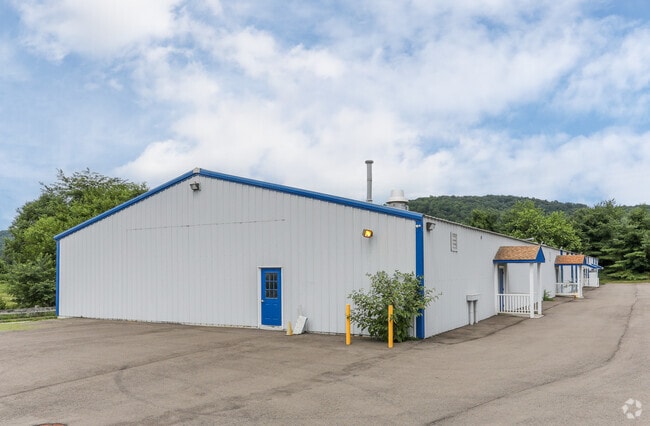
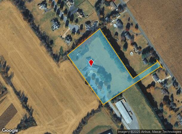
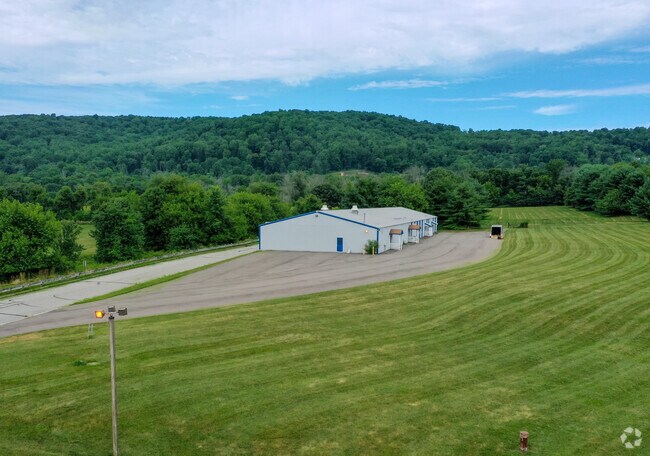
492 State Route 57 W
22-00015-0000-00010
FACILITY NAME: ADMIN OFFICE
Governmentalpublicusegeneral
Warren
X
New Jersey
34041C0307E
10
0
6.80 AC
2025
Warren County
031900
Northern New Jersey
9,849 SF
Allentown-Bethlehem-Easton, PA-NJ
DEMOGRAPHICS near 492 State Route 57 W
1 Mile
3 Mile
5 Mile
2024 Total Population
677
13,315
24,168
2029 Population
702
13,526
24,593
Pop Growth 2024-2029
+ 3.69%
+ 1.58%
+ 1.76%
Average Age
44
43
44
2024 Total Households
251
5,227
9,547
HH Growth 2024-2029
+ 3.98%
+ 1.51%
+ 1.73%
Median Household Inc
$104,829
$80,193
$84,011
Avg Household Size
2.70
2.50
2.50
2024 Avg HH Vehicles
2.00
2.00
2.00
Median Home Value
$310,526
$286,309
$311,721
Median Year Built
1971
1967
1971
Nearby Places
Map Layers
Map Styles
 Street
 Aerial
- Restaurants
- Banks
- Shops
- Fitness
- Groceries
PUBLIC TRANSPORTATION
AIRPORT
Lehigh Valley International
DRIVE
WALK
Distance
Lehigh Valley International
44 min
26.1 mi
Freight Ports
New York Container Terminal
DRIVE
WALK
Distance
New York Container Terminal
79 min
59.3 mi
Nearby Properties
Address
Land Use
TOTAL SIZE
Lot Size
Zoning
Address
Land Use
TOTAL SIZE
Lot Size
Zoning
Address
Land Use
TOTAL SIZE
Lot Size
Zoning
Address
Land Use
TOTAL SIZE
Lot Size
Zoning
77.78 AC
ED
Address
Land Use
TOTAL SIZE
Lot Size
Zoning
46.85 AC
R-40
Address
Land Use
TOTAL SIZE
Lot Size
Zoning
29.81 AC
HC
Address
Land Use
TOTAL SIZE
Lot Size
Zoning
Address
Land Use
TOTAL SIZE
Lot Size
Zoning
32.90 AC
PL
Address
Land Use
TOTAL SIZE
Lot Size
Zoning
17.20 AC
IP
Address
Land Use
TOTAL SIZE
Lot Size
Zoning
20.43 AC
R4
Address
Land Use
TOTAL SIZE
Lot Size
Zoning
6.24 AC
PVD
Address
Land Use
TOTAL SIZE
Lot Size
Zoning
Address
Land Use
TOTAL SIZE
Lot Size
Zoning
Address
Land Use
TOTAL SIZE
Lot Size
Zoning
Address
Land Use
TOTAL SIZE
Lot Size
Zoning
15.80 AC
I
Address
Land Use
TOTAL SIZE
Lot Size
Zoning
1,280 SF
240.85 AC
PVD
Address
Land Use
TOTAL SIZE
Lot Size
Zoning
1.87 AC
PVD
Address
Land Use
TOTAL SIZE
Lot Size
Zoning
5.50 AC
OR
Address
Land Use
TOTAL SIZE
Lot Size
Zoning
5.08 AC
HC
Address
Land Use
TOTAL SIZE
Lot Size
Zoning
9.50 AC
PL
Address
Land Use
TOTAL SIZE
Lot Size
Zoning
4.89 AC
R4
Address
Land Use
TOTAL SIZE
Lot Size
Zoning
4,082 SF
9.58 AC
R2
Address
Land Use
TOTAL SIZE
Lot Size
Zoning
11.77 AC
VR
Address
Land Use
TOTAL SIZE
Lot Size
Zoning
1.98 AC
PVD
Address
Land Use
TOTAL SIZE
Lot Size
Zoning
2,648 SF
4.97 AC
R-20
Address
Land Use
TOTAL SIZE
Lot Size
Zoning
1.70 AC
HC
Address
Land Use
TOTAL SIZE
Lot Size
Zoning
7.93 AC
R4
Address
Land Use
TOTAL SIZE
Lot Size
Zoning
7,500 SF
6.05 AC
HC
Address
Land Use
TOTAL SIZE
Lot Size
Zoning
2,010 SF
1.68 AC
B1
Address
Land Use
TOTAL SIZE
Lot Size
Zoning
5.52 AC
R4
Address
Land Use
TOTAL SIZE
Lot Size
Zoning
1.89 AC
HC
The World's #1 Commercial Real Estate Marketplace
Connect with us
© 2025 CoStar Group
The information above has been obtained from sources believed reliable. While we do not doubt its accuracy we have not verified it and make no guarantee, warranty or representation about it. It is your responsibility to independently confirm its accuracy and completeness. Any projections, opinions, assumptions, or estimates used are for example only and do not represent the current or future performance of the property. The value of this transaction to you depends on tax and other factors which should be evaluated by your tax, financial, and legal advisors. You and your advisors should conduct a careful, independent investigation of the property to determine to your satisfaction the suitability of the property for your needs.